
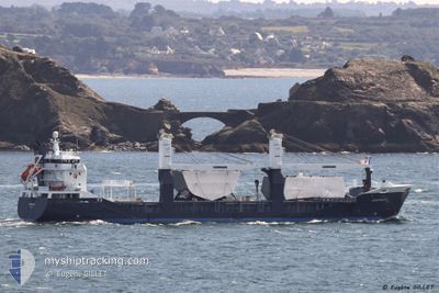
EENDRACHT
General Cargo
Current Trip
| Time Travelled | 3 days |
|---|---|
| Remaining Time | --- |
| Distance Travelled | 1276.63 nm |
| Remaining Distance | --- |
| AVG Speed | 14.5 Knop |
| MAX Speed | 19.2 Knop |
| AVG Wind | 11.9 knots |
| MAX Wind | 18.9 knots |
| MIN Temp | 7°C / 44.6°F |
| MAX Temp | 15°C / 59°F |
| Djupgående | 5.2 m |
| Position mottagen | 4 h, 3 m sen |
Current Position
| Longitud | -9.84607° |
|---|---|
| Latitude | 43.60575° |
| Status | Under way using engine |
| Fart | 16 Knop |
| Kurs | 208° |
| Område | North Atlantic Ocean |
| Station | T-AIS |
| Position mottagen | 4 h, 3 m sen |
Info
Information
The current position of EENDRACHT is in North Atlantic Ocean with coordinates 43.60575° / -9.84607° as reported on 2024-05-10 00:25 by AIS to our vessel tracker app. The vessel's current speed is 16 Knop and is heading at the port of CAPE TOWN. The estimated time of arrival as calculated by MyShipTracking vessel tracking app is 2024-05-24 06:00 LT
The vessel EENDRACHT (IMO: 9512783, MMSI: 244620052) is a General Cargo that was built in 2009 ( 15 År gammal ). It's sailing under the flag of [NL] Netherlands.
In this page you can find informations about the vessels current position, last detected port calls, and current voyage information. If the vessels is not in coverage by AIS you will find the latest position.
The current position of EENDRACHT is detected by our AIS receivers and we are not responsible for the reliability of the data. The last position was recorded while the vessel was in Coverage by the Ais receivers of our vessel tracking app.
The current draught of EENDRACHT as reported by AIS is 5.2 meters
Weather
| Temperature | 15.4°C / 59.72°F |
|---|---|
| Wind Speed | 9 knots |
| Direction | 18° NNE |
| Pressure | 1013.9 hPa |
| Humidity | 83.6 % |
| Cloud Coverage | 47 % |
Featured Company
Last Port Calls
| Port | Arrival | Departure | Time In Port |
|---|---|---|---|
| 2024-05-04 20:17 | 2024-05-06 12:40 | 1 d | |
| 2024-05-03 22:01 | 2024-05-04 03:39 | 5 h | |
| 2024-05-03 17:47 | 2024-05-03 17:51 | 3 m | |
| 2024-05-02 03:33 | 2024-05-02 10:29 | 6 h | |
| 2024-04-27 05:40 | 2024-04-30 09:18 | 3 d | |
| 2024-04-14 17:35 | 2024-04-18 11:14 | 3 d | |
| 2024-04-11 14:39 | 2024-04-12 11:30 | 20 h | |
| 2024-04-08 14:17 | 2024-04-08 18:29 | 4 h | |
| 2024-04-04 07:35 | 2024-04-04 18:10 | 10 h | |
| 2024-04-01 09:49 | 2024-04-01 20:55 | 11 h |
Most Visited Ports (Last year)
| Port | Arrivals | |
|---|---|---|
| 6 | ||
| 5 | ||
| 2 | ||
| 2 | ||
| 2 | ||
| 2 |
Last Trips
| Origin | Departure | Destination | Arrival | Distance | |
|---|---|---|---|---|---|
| 2024-05-04 05:39 | 2024-05-04 22:17 | 243.24 nm | |||
| 2024-05-03 19:51 | 2024-05-04 00:01 | 50.41 nm | |||
| 2024-05-02 12:29 | 2024-05-03 19:47 | 331.59 nm | |||
| 2024-04-30 11:18 | 2024-05-02 05:33 | 625.35 nm | |||
| 2024-04-18 13:14 | 2024-04-27 07:40 | 2236.36 nm | |||
| 2024-04-12 14:30 | 2024-04-14 19:35 | 820.22 nm | |||
| 2024-04-08 21:29 | 2024-04-11 17:39 | 868.69 nm | |||
| 2024-04-04 20:10 | 2024-04-08 17:17 | 1085.20 nm | |||
| 2024-04-01 22:55 | 2024-04-04 09:35 | 895.26 nm | |||
| 2024-03-12 22:51 | 2024-04-01 11:49 | 3816.79 nm |
Events
| Tid | Event | Detaljer | Position / Dest | Information |
|---|---|---|---|---|
| 2024-05-10 00:28 | Status ändrad | Default Under way using engine |
43.59338 / -9.85477
ZACPT
|
Fart: 16 kn Kurs: 208° |
| 2024-05-10 00:25 | UTANFÖR täckningsområde |
43.60575 / -9.84607
North Atlantic Ocean
ZACPT
|
Fart: 16 kn Kurs: 208° |
|
| 2024-05-10 00:16 | Status ändrad | Under way using engine Default |
43.64199 / -9.81949
ZACPT
|
Fart: 15.7 kn Kurs: 208° |
| 2024-05-10 00:10 | Status ändrad | Default Under way using engine |
43.66501 / -9.80227
ZACPT
|
Fart: 15.7 kn Kurs: 208.7° |
| 2024-05-09 23:59 | Status ändrad | Under way using engine Default |
43.70631 / -9.77119
ZACPT
|
Fart: 15.8 kn Kurs: 209° |
| 2024-05-09 23:51 | Status ändrad | Default Under way using engine |
43.73495 / -9.74949
ZACPT
|
Fart: 16.3 kn Kurs: 210.1° |
| 2024-05-09 23:16 | Status ändrad | Under way using engine Default |
43.87392 / -9.63810
ZACPT
|
Fart: 16 kn Kurs: 210° |
| 2024-05-09 22:43 | Status ändrad | Default Under way using engine |
43.99963 / -9.54230
ZACPT
|
Fart: 15.2 kn Kurs: 210.1° |
| 2024-05-09 22:34 | Status ändrad | Under way using engine Default |
44.03299 / -9.51547
ZACPT
|
Fart: 15.6 kn Kurs: 210° |
| 2024-05-09 22:34 | I täckningsområde |
44.03299 / -9.51547
North Atlantic Ocean
ZACPT
|
Fart: 15.6 kn Kurs: 209.7° |