
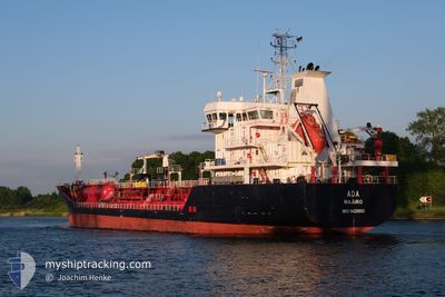
ADA
Oil/Chemical Tanker
Current Trip
| Time Travelled | 4 days |
|---|---|
| Remaining Time | --- |
| Distance Travelled | 521.73 nm |
| Remaining Distance | --- |
| AVG Speed | 9.6 Knop |
| MAX Speed | 12 Knop |
| AVG Wind | 5 knots |
| MAX Wind | 23 knots |
| MIN Temp | 8.8°C / 47.84°F |
| MAX Temp | 17.1°C / 62.78°F |
| Djupgående | 6.8 m |
| Position mottagen | 15 h, 38 m sen |
Current Position
| Longitud | --- |
|---|---|
| Latitude | --- |
| Status | Under way using engine |
| Fart | 11.5 Knop |
| Kurs | 4.8° |
| Område | Black Sea |
| Station | T-AIS |
| Position mottagen | 15 h, 38 m sen |
Info
Information
The current position of ADA is in Black Sea with coordinates 41.49848° / 29.23973° as reported on 2025-12-04 21:21 by AIS to our vessel tracker app. The vessel's current speed is 11.5 Knop
The vessel ADA (IMO: 9420693, MMSI: 538003122) is a Oil/Chemical Tanker that was built in 2008 ( 17 År gammal ). It's sailing under the flag of [MH] Marshall Is.
In this page you can find informations about the vessels current position, last detected port calls, and current voyage information. If the vessels is not in coverage by AIS you will find the latest position.
The current position of ADA is detected by our AIS receivers and we are not responsible for the reliability of the data. The last position was recorded while the vessel was in Coverage by the Ais receivers of our vessel tracking app.
The current draught of ADA as reported by AIS is 6.8 meters
Weather
| Temperature | 13°C / 55.4°F |
|---|---|
| Wind Speed | 23 knots |
| Direction | 86° E |
| Pressure | 1014.9 hPa |
| Humidity | 72.7 % |
| Cloud Coverage | 100 % |
Featured Company
Last Port Calls
| Port | Arrival | Departure | Time In Port |
|---|---|---|---|
| 2025-11-29 17:46 | 2025-11-30 20:24 | 1 d | |
| 2025-11-25 17:34 | 2025-11-27 14:16 | 1 d | |
| 2025-11-17 08:53 | 2025-11-18 17:12 | 1 d | |
| 2025-11-13 11:44 | 2025-11-14 20:36 | 1 d | |
| 2025-11-09 00:54 | 2025-11-09 01:09 | 15 m | |
| 2025-11-07 13:02 | 2025-11-07 13:30 | 27 m | |
| 2025-10-31 11:48 | 2025-11-02 07:36 | 1 d | |
| 2025-10-29 16:26 | 2025-10-30 20:34 | 1 d | |
| 2025-10-24 15:10 | 2025-10-26 08:26 | 1 d | |
| 2025-10-21 15:30 | 2025-10-22 14:18 | 22 h |
Most Visited Ports (Last year)
| Port | Arrivals | |
|---|---|---|
| 5 | ||
| 5 | ||
| 4 | ||
| 4 | ||
| 4 | ||
| 3 |
Last Trips
| Origin | Departure | Destination | Arrival | Distance | |
|---|---|---|---|---|---|
| 2025-11-27 14:16 | 2025-11-29 17:46 | 46.61 nm | |||
| 2025-11-18 17:12 | 2025-11-25 17:34 | 1537.40 nm | |||
| 2025-11-14 20:36 | 2025-11-17 08:53 | 178.60 nm | |||
| 2025-11-09 01:09 | 2025-11-13 11:44 | 303.13 nm | |||
| 2025-11-07 13:30 | 2025-11-09 00:54 | 6.96 nm | |||
| 2025-11-02 07:36 | 2025-11-07 13:02 | 364.67 nm | |||
| 2025-10-30 20:34 | 2025-10-31 11:48 | 167.97 nm | |||
| 2025-10-26 08:26 | 2025-10-29 16:26 | 457.66 nm | |||
| 2025-10-22 14:18 | 2025-10-24 15:10 | 427.67 nm | |||
| 2025-10-19 04:40 | 2025-10-21 15:30 | 252.90 nm |
Events
| Tid | Event | Detaljer | Position / Dest | Information |
|---|---|---|---|---|
| 2025-12-04 21:28 | Status ändrad | Default Under way using engine |
41.52245 / 29.24250
ROCND
|
Fart: 11.5 kn Kurs: 4.8° |
| 2025-12-04 21:21 | UTANFÖR täckningsområde |
41.49848 / 29.23973
Black Sea
ROCND
|
Fart: 11.5 kn Kurs: 4.8° |
|
| 2025-12-04 19:53 | Byter havsområde | Turkish part of the Black Sea Turkish part of the Sea of Marmara |
41.23440 / 29.14596
Black Sea
ROCND
|
Fart: 11.6 kn Kurs: 35.5° |
| 2025-12-04 16:02 | Status ändrad | Under way using engine At anchor |
40.95578 / 28.73771
ROCND
|
Fart: 5.6 kn Kurs: 217° |
| 2025-12-04 16:02 | STARTAR förflyttning | 2.92 nm, East of AMBARLI |
40.95673 / 28.73860
ROCND
|
Fart: 5.6 kn Kurs: 217° |
| 2025-12-04 15:58 | Destination ändrad | ROCND TRIST ANCH |
40.95996 / 28.73947
ROCND
|
Fart: 1.2 kn Kurs: 86° |
| 2025-12-04 15:58 | ETA ändrat | 2025/12/05 14:00 2025/12/03 03:00 |
40.95996 / 28.73947
ROCND
|
Fart: 1.2 kn Kurs: 86° |
| 2025-12-03 03:48 | Status ändrad | At anchor Under way using engine |
40.95891 / 28.73896
TRIST ANCH
|
Fart: 0.1 kn Kurs: 21° |
| 2025-12-03 03:34 | STOPPAR förflyttning | 2.95 nm, East of AMBARLI |
40.95875 / 28.73927
TRIST ANCH
|
Fart: 0.2 kn Kurs: 50° |
| 2025-12-03 00:48 | Status ändrad | Under way using engine Default |
40.79045 / 28.27319
TRIST ANCH
|
Fart: 11.4 kn Kurs: 79° |