
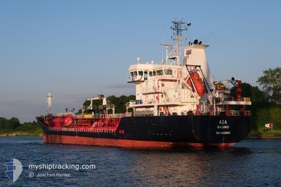
ADA
Oil/Chemical Tanker
Current Trip
| Time Travelled | 11 days |
|---|---|
| Remaining Time | --- |
| Distance Travelled | 666.91 морская миля |
| Remaining Distance | --- |
| AVG Speed | 9.4 Узлы |
| MAX Speed | 12 Узлы |
| AVG Wind | 6.7 knots |
| MAX Wind | 25 knots |
| MIN Temp | 3.7°C / 38.66°F |
| MAX Temp | 17.1°C / 62.78°F |
| Осадка | 6.8 м |
| Позиция Получена | 7 d тому назад |
Current Position
| Долгота | --- |
|---|---|
| Широта | --- |
| Статус | Under way using engine |
| Скорость | 11.5 Узлы |
| Курс | 4.8° |
| Район | Black Sea |
| Станция | T-AIS |
| Позиция Получена | 7 d тому назад |
Info
Information
The current position of ADA is in Black Sea with coordinates 41.49848° / 29.23973° as reported on 2025-12-04 21:21 by AIS to our vessel tracker app. The vessel's current speed is 11.5 Узлы and is heading at the port of CONSTANTA. The estimated time of arrival as calculated by MyShipTracking vessel tracking app is 2025-12-05 16:00 LT
The vessel ADA (IMO: 9420693, MMSI: 538003122) is a Oil/Chemical Tanker that was built in 2008 ( 17 лет ). It's sailing under the flag of [MH] Marshall Is.
In this page you can find informations about the vessels current position, last detected port calls, and current voyage information. If the vessels is not in coverage by AIS you will find the latest position.
The current position of ADA is detected by our AIS receivers and we are not responsible for the reliability of the data. The last position was recorded while the vessel was in Coverage by the Ais receivers of our vessel tracking app.
The current draught of ADA as reported by AIS is 6.8 meters
Weather
| Temperature | 5.3°C / 41.54°F |
|---|---|
| Wind Speed | 4 knots |
| Direction | 315° NW |
| Pressure | 1024.9 hPa |
| Humidity | 65.7 % |
| Cloud Coverage | 45 % |
Featured Company
Last Port Calls
| Port | Arrival | Departure | Time In Port |
|---|---|---|---|
| 2025-11-29 17:46 | 2025-11-30 20:24 | 1 d | |
| 2025-11-25 17:34 | 2025-11-27 14:16 | 1 d | |
| 2025-11-17 08:53 | 2025-11-18 17:12 | 1 d | |
| 2025-11-13 11:44 | 2025-11-14 20:36 | 1 d | |
| 2025-11-09 00:54 | 2025-11-09 01:09 | 15 m | |
| 2025-11-07 13:02 | 2025-11-07 13:30 | 27 m | |
| 2025-10-31 11:48 | 2025-11-02 07:36 | 1 d | |
| 2025-10-29 16:26 | 2025-10-30 20:34 | 1 d | |
| 2025-10-24 15:10 | 2025-10-26 08:26 | 1 d | |
| 2025-10-21 15:30 | 2025-10-22 14:18 | 22 h |
Most Visited Ports (Last year)
| Port | Arrivals | |
|---|---|---|
| 5 | ||
| 5 | ||
| 4 | ||
| 4 | ||
| 4 | ||
| 3 |
Last Trips
| Origin | Departure | Destination | Arrival | Distance | |
|---|---|---|---|---|---|
| 2025-11-27 14:16 | 2025-11-29 17:46 | 46.61 морская миля | |||
| 2025-11-18 17:12 | 2025-11-25 17:34 | 1537.40 морская миля | |||
| 2025-11-14 20:36 | 2025-11-17 08:53 | 178.60 морская миля | |||
| 2025-11-09 01:09 | 2025-11-13 11:44 | 303.13 морская миля | |||
| 2025-11-07 13:30 | 2025-11-09 00:54 | 6.96 морская миля | |||
| 2025-11-02 07:36 | 2025-11-07 13:02 | 364.67 морская миля | |||
| 2025-10-30 20:34 | 2025-10-31 11:48 | 167.97 морская миля | |||
| 2025-10-26 08:26 | 2025-10-29 16:26 | 457.66 морская миля | |||
| 2025-10-22 14:18 | 2025-10-24 15:10 | 427.67 морская миля | |||
| 2025-10-19 04:40 | 2025-10-21 15:30 | 252.90 морская миля |
Events
| Время | Событие | Детали | Позиция / Направление | Информация |
|---|---|---|---|---|
| 2025-12-09 07:26 | Начало движения | 2.13 nm, East of SULINA |
45.16430 / 29.69697
ROCND
|
Скорость: 4.1 kn Курс: 254° |
| 2025-12-09 06:12 | Окончание движения | 2.5 nm, East of SULINA |
45.16623 / 29.70542
ROCND
|
Скорость: 0.2 kn Курс: 269° |
| 2025-12-09 04:10 | Начало движения | 10.89 nm, South East of SULINA |
45.08202 / 29.88113
ROCND
|
Скорость: 3.5 kn Курс: 316° |
| 2025-12-05 22:07 | Окончание движения | 11.17 nm, South East of SULINA |
45.07798 / 29.88559
ROCND
|
Скорость: 0.2 kn Курс: 71° |
| 2025-12-04 21:28 | Статус изменился | Default Under way using engine |
41.52245 / 29.24250
ROCND
|
Скорость: 11.5 kn Курс: 4.8° |
| 2025-12-04 21:21 | Вне покрытия |
41.49848 / 29.23973
Black Sea
ROCND
|
Скорость: 11.5 kn Курс: 4.8° |
|
| 2025-12-04 19:53 | Изменение морского района | Turkish part of the Black Sea Turkish part of the Sea of Marmara |
41.23440 / 29.14596
Black Sea
ROCND
|
Скорость: 11.6 kn Курс: 35.5° |
| 2025-12-04 16:02 | Статус изменился | Under way using engine At anchor |
40.95578 / 28.73771
ROCND
|
Скорость: 5.6 kn Курс: 217° |
| 2025-12-04 16:02 | Начало движения | 2.92 nm, East of AMBARLI |
40.95673 / 28.73860
ROCND
|
Скорость: 5.6 kn Курс: 217° |
| 2025-12-04 15:58 | Пункт назначения изменился | ROCND TRIST ANCH |
40.95996 / 28.73947
ROCND
|
Скорость: 1.2 kn Курс: 86° |