
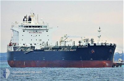
SEA NAVIGATOR
Tanker
Current Trip
COMAM>COPOC
| Time Travelled | 9 days |
|---|---|
| Remaining Time | --- |
| Distance Travelled | 424.67 морская миля |
| Remaining Distance | --- |
| AVG Speed | 9.2 Узлы |
| MAX Speed | 13.4 Узлы |
| AVG Wind | 7.2 knots |
| MAX Wind | 17.8 knots |
| MIN Temp | 22.8°C / 73.04°F |
| MAX Temp | 33.1°C / 91.58°F |
| Осадка | 11.2 м |
| Позиция Получена | 3 d тому назад |
Current Position
| Долгота | -74.25695° |
|---|---|
| Широта | 11.14838° |
| Статус | At anchor |
| Скорость | |
| Курс | 213° |
| Район | Caribbean Sea |
| Станция | T-AIS |
| Позиция Получена | 3 d тому назад |
Info
Information
The current position of SEA NAVIGATOR is in Caribbean Sea with coordinates 11.14838° / -74.25695° as reported on 2024-05-25 14:36 by AIS to our vessel tracker app. The vessel's current speed is 0 Узлы
The vessel SEA NAVIGATOR (IMO: 9724594, MMSI: 538010130) is a Tanker It's sailing under the flag of [MH] Marshall Is.
In this page you can find informations about the vessels current position, last detected port calls, and current voyage information. If the vessels is not in coverage by AIS you will find the latest position.
The current position of SEA NAVIGATOR is detected by our AIS receivers and we are not responsible for the reliability of the data. The last position was recorded while the vessel was in Coverage by the Ais receivers of our vessel tracking app.
The current draught of SEA NAVIGATOR as reported by AIS is 11.2 meters
Weather
| Temperature | 28.9°C / 84.02°F |
|---|---|
| Wind Speed | 11 knots |
| Direction | 38° NE |
| Pressure | 1009.3 hPa |
| Humidity | 78.5 % |
| Cloud Coverage | 96 % |
Featured Company
Last Port Calls
| Port | Arrival | Departure | Time In Port |
|---|---|---|---|
| 2024-05-17 03:38 | 2024-05-19 09:38 | 2 d | |
| 2024-05-08 05:40 | 2024-05-11 04:14 | 2 d | |
| 2024-04-30 13:41 | 2024-05-02 05:06 | 1 d | |
| 2024-04-22 07:08 | 2024-04-24 10:51 | 2 d | |
| 2024-03-10 19:28 | 2024-03-14 06:24 | 3 d | |
| 2024-03-01 03:50 | 2024-03-02 21:53 | 1 d |
Most Visited Ports (Last year)
| Port | Arrivals | |
|---|---|---|
| 4 | ||
| 2 | ||
| 2 | ||
| 1 | ||
| 1 | ||
| 1 |
Last Trips
| Origin | Departure | Destination | Arrival | Distance | |
|---|---|---|---|---|---|
| 2024-05-10 23:14 | 2024-05-16 22:38 | 1630.70 морская миля | |||
| 2024-05-01 23:06 | 2024-05-08 00:40 | 1671.61 морская миля | |||
| 2024-04-24 05:51 | 2024-04-30 07:41 | 1670.58 морская миля | |||
| 2024-03-14 07:24 | 2024-04-22 02:08 | 6526.37 морская миля | |||
| 2024-03-02 22:53 | 2024-03-10 20:28 | 468.06 морская миля | |||
| 2024-02-26 23:17 | 2024-03-01 04:50 | 561.31 морская миля |
Events
| Время | Событие | Детали | Позиция / Направление | Информация |
|---|---|---|---|---|
| 2024-05-25 14:39 | Статус изменился | Default At anchor |
11.14838 / -74.25696
COMAM>COPOC
|
Скорость: Курс: 213° |
| 2024-05-25 14:36 | Вне покрытия |
11.14838 / -74.25695
Caribbean Sea
|
Скорость: Курс: 193.7° |
|
| 2024-05-25 14:12 | Статус изменился | At anchor Default |
11.14845 / -74.25709
COMAM>COPOC
|
Скорость: Курс: 206° |
| 2024-05-25 14:06 | Статус изменился | Default At anchor |
11.14846 / -74.25711
COMAM>COPOC
|
Скорость: Курс: 194° |
| 2024-05-25 13:06 | Статус изменился | At anchor Default |
11.14848 / -74.25753
COMAM>COPOC
|
Скорость: Курс: 195° |
| 2024-05-25 12:41 | Статус изменился | Default At anchor |
11.14849 / -74.25745
COMAM>COPOC
|
Скорость: Курс: 196° |
| 2024-05-25 12:35 | Статус изменился | At anchor Default |
11.14850 / -74.25741
COMAM>COPOC
|
Скорость: Курс: 188° |
| 2024-05-25 12:35 | В покрытии |
11.14850 / -74.25741
Caribbean Sea
|
Скорость: Курс: 278.7° |
|
| 2024-05-24 12:16 | Окончание движения | 5.32 nm, North of PUERTO DRUMMOND |
11.14829 / -74.25782
COMAM>COPOC
|
Скорость: 0.2 kn Курс: 170° |
| 2024-05-24 10:59 | Начало движения | 1.31 nm, West of SANTA MARTA |
11.24329 / -74.24223
COMAM>COPOC
|
Скорость: 3.1 kn Курс: 195° |