
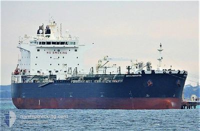
SEA NAVIGATOR
Tanker
Current Trip
COMOM>COPOC
| Time Travelled | 20 days |
|---|---|
| Remaining Time | --- |
| Distance Travelled | 806.69 nm |
| Remaining Distance | --- |
| AVG Speed | 8.9 Noeuds |
| MAX Speed | 14.2 Noeuds |
| AVG Wind | 6.5 knots |
| MAX Wind | 17.8 knots |
| MIN Temp | 22.8°C / 73.04°F |
| MAX Temp | 33.1°C / 91.58°F |
| Tirant d eau | 9 m |
| Position reçue | 2 d depuis |
Current Position
| Longitude | -74.48668° |
|---|---|
| Latitude | 11.26887° |
| Etat | Under way using engine |
| Vitesse | 9.7 Noeuds |
| Parcours | 96° |
| Zone | Caribbean Sea |
| Station | T-AIS |
| Position reçue | 2 d depuis |
Info
Information
The current position of SEA NAVIGATOR is in Caribbean Sea with coordinates 11.26887° / -74.48668° as reported on 2024-06-05 22:22 by AIS to our vessel tracker app. The vessel's current speed is 9.7 Noeuds
The vessel SEA NAVIGATOR (IMO: 9724594, MMSI: 538010130) is a Tanker It's sailing under the flag of [MH] Marshall Is.
In this page you can find informations about the vessels current position, last detected port calls, and current voyage information. If the vessels is not in coverage by AIS you will find the latest position.
The current position of SEA NAVIGATOR is detected by our AIS receivers and we are not responsible for the reliability of the data. The last position was recorded while the vessel was in Coverage by the Ais receivers of our vessel tracking app.
The current draught of SEA NAVIGATOR as reported by AIS is 9 meters
Weather
| Temperature | 28.8°C / 83.84°F |
|---|---|
| Wind Speed | 13 knots |
| Direction | 80° E |
| Pressure | 1010 hPa |
| Humidity | 81.7 % |
| Cloud Coverage | 93 % |
Featured Company
Most Visited Ports (Last year)
| Port | Arrivals | |
|---|---|---|
| 2 | ||
| 2 | ||
| 1 | ||
| 1 | ||
| 1 | ||
| 1 |
Events
| Heure | Evenement | Détails | Position/ Destination | Info |
|---|---|---|---|---|
| 2024-06-08 00:54 | Démarrage | 4.55 nm, South West of SANTA MARTA |
11.18160 / -74.26356
COMOM>COPOC
|
Vitesse: 11.4 kn Parcours: 313° |
| 2024-06-07 21:55 | Arret | 4.91 nm, South of SANTA MARTA |
11.16754 / -74.24960
COMOM>COPOC
|
Vitesse: 0.3 kn Parcours: 302° |
| 2024-06-07 21:41 | Démarrage | 5.23 nm, South of SANTA MARTA |
11.16177 / -74.24936
COMOM>COPOC
|
Vitesse: 5.1 kn Parcours: 20° |
| 2024-06-07 06:34 | Arret | 5.53 nm, South of SANTA MARTA |
11.15760 / -74.25270
COMOM>COPOC
|
Vitesse: 0.3 kn Parcours: 200° |
| 2024-06-07 05:59 | Démarrage | 5.3 nm, South of SANTA MARTA |
11.16053 / -74.24919
COMOM>COPOC
|
Vitesse: 5 kn Parcours: 9° |
| 2024-06-05 22:22 | Hors de la zone couverte |
11.26887 / -74.48668
Caribbean Sea
COMOM>COPOC
|
Vitesse: 9.7 kn Parcours: 96° |
|
| 2024-06-05 22:22 | Etat Changé | Under way using engine Default |
11.26887 / -74.48668
COMOM>COPOC
|
Vitesse: 9.5 kn Parcours: 94° |
| 2024-06-05 22:22 | Dans la zone couverte |
11.26887 / -74.48668
Caribbean Sea
COMOM>COPOC
|
Vitesse: 9.7 kn Parcours: 96° |
|
| 2024-06-05 21:15 | Etat Changé | Default Under way using engine |
11.28369 / -74.66859
COMOM>COPOC
|
Vitesse: 9.5 kn Parcours: 92.2° |
| 2024-06-05 21:07 | Hors de la zone couverte |
11.28441 / -74.68834
Caribbean Sea
COMOM>COPOC
|
Vitesse: 9.5 kn Parcours: 92.2° |