
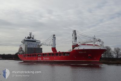
RONNIE
Cargo
Current Trip
| Time Travelled | 16 h, 5 mins |
|---|---|
| Remaining Time | 16 h, 50 mins |
| Distance Travelled | 104.67 морская миля |
| Remaining Distance | 191.73 морская миля |
| AVG Speed | 8.4 Узлы |
| MAX Speed | 13.4 Узлы |
| AVG Wind | 3 knots |
| MAX Wind | 7 knots |
| MIN Temp | 2.3°C / 36.14°F |
| MAX Temp | 13.3°C / 55.94°F |
| Осадка | 6.3 м |
| Позиция Получена | 1 m тому назад |
Current Position
| Долгота | -75.52575° |
|---|---|
| Широта | 44.69106° |
| Статус | Under way using engine |
| Скорость | 13.4 Узлы |
| Курс | 223.4° |
| Район | Gulf of St-Lawrence |
| Станция | T-AIS |
| Позиция Получена | 1 m тому назад |
Info
Information
The current position of RONNIE is in Gulf of St-Lawrence with coordinates 44.69106° / -75.52575° as reported on 2024-04-27 03:15 by AIS to our vessel tracker app. The vessel's current speed is 13.4 Узлы and is heading at the port of PORT WELLER. The estimated time of arrival as calculated by MyShipTracking vessel tracking app is 2024-04-27 20:06 LT
The vessel RONNIE (IMO: 9736224, MMSI: 305434000) is a Cargo It's sailing under the flag of [AG] Antigua Barbuda.
In this page you can find informations about the vessels current position, last detected port calls, and current voyage information. If the vessels is not in coverage by AIS you will find the latest position.
The current position of RONNIE is detected by our AIS receivers and we are not responsible for the reliability of the data. The last position was recorded while the vessel was in Coverage by the Ais receivers of our vessel tracking app.
The current draught of RONNIE as reported by AIS is 6.3 meters
Weather
| Temperature | 3.4°C / 38.12°F |
|---|---|
| Wind Speed | 5 knots |
| Direction | 109° ESE |
| Pressure | 1030.6 hPa |
| Humidity | 76.9 % |
| Cloud Coverage | --- |
Featured Company
Last Port Calls
| Port | Arrival | Departure | Time In Port |
|---|---|---|---|
| 2024-04-26 10:31 | 2024-04-26 11:11 | 40 m | |
| 2024-04-14 00:09 | 2024-04-14 17:45 | 17 h | |
| 2024-04-07 15:09 | 2024-04-11 14:45 | 3 d | |
| 2024-03-28 18:01 | 2024-03-31 00:56 | 2 d | |
| 2024-03-24 15:01 | 2024-03-25 19:46 | 1 d | |
| 2024-03-21 03:43 | 2024-03-22 03:06 | 23 h | |
| 2024-03-18 00:05 | 2024-03-19 20:30 | 1 d | |
| 2024-03-01 08:39 | 2024-03-03 11:49 | 2 d | |
| 2024-02-24 21:40 | 2024-02-25 20:38 | 22 h | |
| 2024-02-22 10:07 | 2024-02-24 12:15 | 2 d |
Most Visited Ports (Last year)
| Port | Arrivals | |
|---|---|---|
| 3 | ||
| 3 | ||
| 3 | ||
| 2 | ||
| 2 | ||
| 2 |
Last Trips
| Origin | Departure | Destination | Arrival | Distance | |
|---|---|---|---|---|---|
| 2024-04-14 12:45 | 2024-04-26 06:31 | 3472.53 морская миля | |||
| 2024-04-11 09:45 | 2024-04-13 19:09 | 12.40 морская миля | |||
| 2024-03-30 20:56 | 2024-04-07 10:09 | 903.98 морская миля | |||
| 2024-03-25 15:46 | 2024-03-28 14:01 | 894.05 морская миля | |||
| 2024-03-21 23:06 | 2024-03-24 11:01 | 657.15 морская миля | |||
| 2024-03-19 16:30 | 2024-03-20 23:43 | 400.89 морская миля | |||
| 2024-03-03 12:49 | 2024-03-17 20:05 | 3850.10 морская миля | |||
| 2024-02-25 21:38 | 2024-03-01 09:39 | 1451.16 морская миля | |||
| 2024-02-24 13:15 | 2024-02-24 22:40 | 110.26 морская миля | |||
| 2024-02-20 17:48 | 2024-02-22 11:07 | 410.05 морская миля |
Events
| Время | Событие | Детали | Позиция / Направление | Информация |
|---|---|---|---|---|
| 2024-04-27 02:06 | Начало движения | 3.46 nm, North East of CARDINAL |
44.82877 / -75.31403
CAPWE
|
Скорость: 3.1 kn Курс: 206° |
| 2024-04-27 01:45 | Окончание движения | 3.63 nm, North East of CARDINAL |
44.83134 / -75.31219
CAPWE
|
Скорость: 0.1 kn Курс: 205° |
| 2024-04-27 01:20 | Статус изменился | Under way using engine Default |
44.84311 / -75.30076
CAPWE
|
Скорость: 4.4 kn Курс: 229° |
| 2024-04-27 01:20 | В покрытии |
44.84311 / -75.30076
Gulf of St-Lawrence
CAPWE
|
Скорость: 3.7 kn Курс: 234.6° |
|
| 2024-04-26 23:26 | Начало движения | 6.75 nm, West of CORNWALL |
44.97786 / -74.86033
CAPWE
|
Скорость: 8.4 kn Курс: 258° |
| 2024-04-26 23:10 | Окончание движения | 6.27 nm, West of CORNWALL |
44.97937 / -74.84898
CAPWE
|
Скорость: Курс: 260° |
| 2024-04-26 22:24 | Начало движения | 4.01 nm, South West of CORNWALL |
44.98500 / -74.79500
CAPWE
|
Скорость: 7 kn Курс: 262° |
| 2024-04-26 22:02 | Окончание движения | 3.25 nm, South West of CORNWALL |
44.98788 / -74.77686
CAPWE
|
Скорость: Курс: 259° |
| 2024-04-26 17:03 | Статус изменился | Default Under way using engine |
45.24667 / -73.97667
CAPWE
|
Скорость: 4.3 kn Курс: 205° |
| 2024-04-26 16:40 | Вне покрытия |
45.30033 / -73.92880
Gulf of St-Lawrence
CAPWE
|
Скорость: 4.3 kn Курс: 205.4° |