
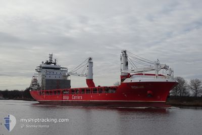
RONNIE
Cargo
Current Trip
| Time Travelled | 8 days |
|---|---|
| Remaining Time | --- |
| Distance Travelled | 2715.28 nm |
| Remaining Distance | 736.28 nm |
| AVG Speed | 12.4 Knop |
| MAX Speed | 17.2 Knop |
| AVG Wind | 12.8 knots |
| MAX Wind | 21.7 knots |
| MIN Temp | --- |
| MAX Temp | 25.5°C / 77.9°F |
| Djupgående | 6.2 m |
| Position mottagen | 5 d sen |
Current Position
| Longitud | -79.44546° |
|---|---|
| Latitude | 26.26904° |
| Status | Under way using engine |
| Fart | 16.7 Knop |
| Kurs | 8.1° |
| Område | North Atlantic Ocean |
| Station | T-AIS |
| Position mottagen | 5 d sen |
Info
Information
The current position of RONNIE is in North Atlantic Ocean with coordinates 26.26904° / -79.44546° as reported on 2024-04-17 20:54 by AIS to our vessel tracker app. The vessel's current speed is 16.7 Knop and is heading at the port of MONTREAL. The estimated time of arrival as calculated by MyShipTracking vessel tracking app is 2024-04-23 22:00 LT
The vessel RONNIE (IMO: 9736224, MMSI: 305434000) is a Cargo It's sailing under the flag of [AG] Antigua Barbuda.
In this page you can find informations about the vessels current position, last detected port calls, and current voyage information. If the vessels is not in coverage by AIS you will find the latest position.
The current position of RONNIE is detected by our AIS receivers and we are not responsible for the reliability of the data. The last position was recorded while the vessel was in Coverage by the Ais receivers of our vessel tracking app.
The current draught of RONNIE as reported by AIS is 6.2 meters
Weather
| Temperature | 0.1°C / 32.18°F |
|---|---|
| Wind Speed | 17 knots |
| Direction | 298° WNW |
| Pressure | 1021.8 hPa |
| Humidity | 56.2 % |
| Cloud Coverage | 3 % |
Featured Company
Last Port Calls
| Port | Arrival | Departure | Time In Port |
|---|---|---|---|
| 2024-04-14 00:09 | 2024-04-14 17:45 | 17 h | |
| 2024-04-07 15:09 | 2024-04-11 14:45 | 3 d | |
| 2024-03-28 18:01 | 2024-03-31 00:56 | 2 d | |
| 2024-03-24 15:01 | 2024-03-25 19:46 | 1 d | |
| 2024-03-21 03:43 | 2024-03-22 03:06 | 23 h | |
| 2024-03-18 00:05 | 2024-03-19 20:30 | 1 d | |
| 2024-03-01 08:39 | 2024-03-03 11:49 | 2 d | |
| 2024-02-24 21:40 | 2024-02-25 20:38 | 22 h | |
| 2024-02-22 10:07 | 2024-02-24 12:15 | 2 d | |
| 2024-02-20 16:02 | 2024-02-20 16:48 | 46 m |
Most Visited Ports (Last year)
| Port | Arrivals | |
|---|---|---|
| 3 | ||
| 3 | ||
| 2 | ||
| 2 | ||
| 2 | ||
| 2 |
Last Trips
| Origin | Departure | Destination | Arrival | Distance | |
|---|---|---|---|---|---|
| 2024-04-11 09:45 | 2024-04-13 19:09 | 12.40 nm | |||
| 2024-03-30 20:56 | 2024-04-07 10:09 | 903.98 nm | |||
| 2024-03-25 15:46 | 2024-03-28 14:01 | 894.05 nm | |||
| 2024-03-21 23:06 | 2024-03-24 11:01 | 657.15 nm | |||
| 2024-03-19 16:30 | 2024-03-20 23:43 | 400.89 nm | |||
| 2024-03-03 12:49 | 2024-03-17 20:05 | 3850.10 nm | |||
| 2024-02-25 21:38 | 2024-03-01 09:39 | 1451.16 nm | |||
| 2024-02-24 13:15 | 2024-02-24 22:40 | 110.26 nm | |||
| 2024-02-20 17:48 | 2024-02-22 11:07 | 410.05 nm | |||
| 2024-02-18 10:01 | 2024-02-20 17:02 | 780.96 nm |
Events
| Tid | Event | Detaljer | Position / Dest | Information |
|---|---|---|---|---|
| 2024-04-22 18:12 | STARTAR förflyttning |
44.51333 / -60.46167
CAMTR
|
Fart: 4 kn Kurs: -1° |
|
| 2024-04-22 17:30 | STOPPAR förflyttning |
44.50667 / -60.46833
CAMTR
|
Fart: Kurs: -1° |
|
| 2024-04-17 21:06 | Status ändrad | Default Under way using engine |
26.32167 / -79.43667
CAMTR
|
Fart: 16.7 kn Kurs: 8.1° |
| 2024-04-17 20:54 | UTANFÖR täckningsområde |
26.26904 / -79.44546
North Atlantic Ocean
CAMTR
|
Fart: 16.7 kn Kurs: 8.1° |
|
| 2024-04-17 20:45 | ETA ändrat | 2024/04/23 22:00 2024/04/23 20:00 |
26.22432 / -79.45264
CAMTR
|
Fart: 16.7 kn Kurs: 8.7° |
| 2024-04-17 20:11 | Status ändrad | Under way using engine Default |
26.06821 / -79.48682
CAMTR
|
Fart: 17 kn Kurs: 9° |
| 2024-04-17 19:57 | Status ändrad | Default Under way using engine |
26.00333 / -79.49834
CAMTR
|
Fart: 17 kn Kurs: 8.7° |
| 2024-04-17 19:53 | Status ändrad | Under way using engine Default |
25.98544 / -79.50273
CAMTR
|
Fart: 17 kn Kurs: 7° |
| 2024-04-17 19:36 | Status ändrad | Default Under way using engine |
25.90333 / -79.51500
CAMTR
|
Fart: 16.9 kn Kurs: 8.1° |
| 2024-04-17 19:34 | Status ändrad | Under way using engine Default |
25.89721 / -79.51655
CAMTR
|
Fart: 16 kn Kurs: 8° |