
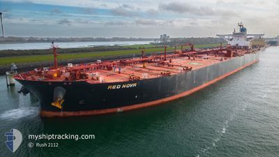
RED NOVA
Crude Oil Tanker
Current Trip
| Time Travelled | 2 days |
|---|---|
| Remaining Time | --- |
| Distance Travelled | 477.14 морская миля |
| Remaining Distance | 40.90 морская миля |
| AVG Speed | 10.1 Узлы |
| MAX Speed | 14.2 Узлы |
| AVG Wind | 11.4 knots |
| MAX Wind | 17.1 knots |
| MIN Temp | 7°C / 44.6°F |
| MAX Temp | 10.8°C / 51.44°F |
| Осадка | 13 м |
| Позиция Получена | 19 m тому назад |
Current Position
| Долгота | 7.43299° |
|---|---|
| Широта | 54.04586° |
| Статус | At anchor |
| Скорость | |
| Курс | 335° |
| Район | North Sea |
| Станция | T-AIS |
| Позиция Получена | 19 m тому назад |
Info
Information
The current position of RED NOVA is in North Sea with coordinates 54.04586° / 7.43299° as reported on 2024-04-27 11:31 by AIS to our vessel tracker app. The vessel's current speed is 0 Узлы and is heading at the port of WILHELMSHAVEN. The estimated time of arrival as calculated by MyShipTracking vessel tracking app is 2024-04-27 09:00 LT
The vessel RED NOVA (IMO: 9602643, MMSI: 636019391) is a Crude Oil Tanker that was built in 2013 ( 11 лет ). It's sailing under the flag of [LR] Liberia.
In this page you can find informations about the vessels current position, last detected port calls, and current voyage information. If the vessels is not in coverage by AIS you will find the latest position.
The current position of RED NOVA is detected by our AIS receivers and we are not responsible for the reliability of the data. The last position was recorded while the vessel was in Coverage by the Ais receivers of our vessel tracking app.
The current draught of RED NOVA as reported by AIS is 13 meters
Weather
| Temperature | 10.1°C / 50.18°F |
|---|---|
| Wind Speed | 13 knots |
| Direction | 100° E |
| Pressure | 1007.2 hPa |
| Humidity | 87.9 % |
| Cloud Coverage | 100 % |
Featured Company
Events
| Время | Событие | Детали | Позиция / Направление | Информация |
|---|---|---|---|---|
| 2024-04-27 11:37 | Статус изменился | Default At anchor |
54.04583 / 7.43267
DEWVN
|
Скорость: Курс: 335° |
| 2024-04-27 11:25 | Статус изменился | At anchor Default |
54.04588 / 7.43324
DEWVN
|
Скорость: Курс: 330° |
| 2024-04-27 11:22 | Статус изменился | Default At anchor |
54.04594 / 7.43334
DEWVN
|
Скорость: Курс: 328° |
| 2024-04-27 10:43 | Статус изменился | At anchor Default |
54.04623 / 7.43409
DEWVN
|
Скорость: Курс: 318° |
| 2024-04-27 10:31 | Статус изменился | Default At anchor |
54.04652 / 7.43383
DEWVN
|
Скорость: Курс: 312° |
| 2024-04-27 10:25 | Статус изменился | At anchor Default |
54.04660 / 7.43391
DEWVN
|
Скорость: Курс: 311° |
| 2024-04-27 10:22 | Статус изменился | Default At anchor |
54.04657 / 7.43397
DEWVN
|
Скорость: 0.1 kn Курс: 311° |
| 2024-04-27 10:01 | Статус изменился | At anchor Default |
54.04580 / 7.43408
DEWVN
|
Скорость: 0.4 kn Курс: 312° |
| 2024-04-27 09:58 | Статус изменился | Default At anchor |
54.04574 / 7.43396
DEWVN
|
Скорость: 0.2 kn Курс: 294° |
| 2024-04-27 09:13 | Статус изменился | At anchor Default |
54.04766 / 7.43492
DEWVN
|
Скорость: 0.1 kn Курс: 236° |