
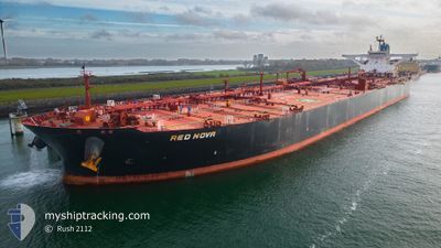
RED NOVA
Crude Oil Tanker
Current Trip
| Time Travelled | 19 days |
|---|---|
| Remaining Time | 1 day |
| Distance Travelled | 5107.32 nm |
| Remaining Distance | 317.89 nm |
| AVG Speed | 11.5 Knop |
| MAX Speed | 14.8 Knop |
| AVG Wind | 14.2 knots |
| MAX Wind | 25 knots |
| MIN Temp | 2.4°C / 36.32°F |
| MAX Temp | 25.2°C / 77.36°F |
| Djupgående | 20.5 m |
| Position mottagen | Nu |
Current Position
| Longitud | -3.33771° |
|---|---|
| Latitude | 50.13369° |
| Status | Under way using engine |
| Fart | 8.6 Knop |
| Kurs | 6.3° |
| Område | English Channel |
| Station | T-AIS |
| Position mottagen | Nu |
Info
Information
The current position of RED NOVA is in English Channel with coordinates 50.13369° / -3.33771° as reported on 2024-04-19 04:51 by AIS to our vessel tracker app. The vessel's current speed is 8.6 Knop and is heading at the port of ROTTERDAM. The estimated time of arrival as calculated by MyShipTracking vessel tracking app is 2024-04-20 14:26 LT
The vessel RED NOVA (IMO: 9602643, MMSI: 636019391) is a Crude Oil Tanker that was built in 2013 ( 11 År gammal ). It's sailing under the flag of [LR] Liberia.
In this page you can find informations about the vessels current position, last detected port calls, and current voyage information. If the vessels is not in coverage by AIS you will find the latest position.
The current position of RED NOVA is detected by our AIS receivers and we are not responsible for the reliability of the data. The last position was recorded while the vessel was in Coverage by the Ais receivers of our vessel tracking app.
The current draught of RED NOVA as reported by AIS is 20.5 meters
Weather
| Temperature | 9.4°C / 48.92°F |
|---|---|
| Wind Speed | 17 knots |
| Direction | 289° WNW |
| Pressure | 1021.1 hPa |
| Humidity | 89.9 % |
| Cloud Coverage | 12 % |
Featured Company
Events
| Tid | Event | Detaljer | Position / Dest | Information |
|---|---|---|---|---|
| 2024-04-18 23:09 | ETA ändrat | 2024/04/20 10:00 2024/04/19 11:00 |
49.77336 / -4.93638
NLRTM
|
Fart: 10.7 kn Kurs: 73.4° |
| 2024-04-18 21:32 | Upptäckt i hav | United Kingdom part of the English Channel |
49.71246 / -5.42446
English Channel
NLRTM
|
Fart: 10.5 kn Kurs: 79.7° |
| 2024-04-18 20:48 | Status ändrad | Under way using engine Default |
49.68727 / -5.64382
NLRTM
|
Fart: 10.4 kn Kurs: 83° |
| 2024-04-18 20:45 | Status ändrad | Default Under way using engine |
49.68610 / -5.65885
NLRTM
|
Fart: 10.4 kn Kurs: 83.4° |
| 2024-04-18 19:58 | Status ändrad | Under way using engine Default |
49.66537 / -5.89490
NLRTM
|
Fart: 10.3 kn Kurs: 82° |
| 2024-04-18 19:57 | Status ändrad | Default Under way using engine |
49.66493 / -5.89977
NLRTM
|
Fart: 10.3 kn Kurs: 82.8° |
| 2024-04-18 17:57 | Status ändrad | Under way using engine Default |
49.63035 / -6.49719
NLRTM
|
Fart: 10.4 kn Kurs: 94° |
| 2024-04-18 17:56 | Status ändrad | Default Under way using engine |
49.63052 / -6.50142
NLRTM
|
Fart: 10.6 kn Kurs: 95.6° |
| 2024-04-18 16:57 | Status ändrad | Under way using engine Default |
49.64406 / -6.80171
NLRTM
|
Fart: 10.5 kn Kurs: 95° |
| 2024-04-18 16:43 | Status ändrad | Default Under way using engine |
49.64760 / -6.87650
NLRTM
|
Fart: 10.5 kn Kurs: 96.8° |