
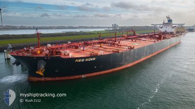
RED NOVA
Crude Oil Tanker
Current Trip
| Trip Time | 1 day |
|---|---|
| Trip Distance | 268.02 nm |
| AVG Speed | 8.2 Knopen |
| MAX Speed | 12.8 Knopen |
| Diepgang | 13.6 M |
| AVG Wind | 11.4 knots |
| MAX Wind | 17.3 knots |
| MIN Temp | 5.4°C / 41.72°F |
| MAX Temp | 10.4°C / 50.72°F |
| Positie ontvangen | 2 m geleden |
Current Position
| Lengtegraad | -1.32627° |
|---|---|
| Breedtegraat | 50.83747° |
| Status | Moored |
| Snelheid | |
| Koers | 140° |
| Gebied | English Channel |
| Station | T-AIS |
| Positie ontvangen | 2 m geleden |
Info
Information
The current position of RED NOVA is in English Channel with coordinates 50.83747° / -1.32627° as reported on 2024-04-24 06:26 by AIS to our vessel tracker app. The vessel's current speed is 0 Knopen and is currently inside the port of FAWLEY.
The vessel RED NOVA (IMO: 9602643, MMSI: 636019391) is a Crude Oil Tanker that was built in 2013 ( 11 Jaar oud ). It's sailing under the flag of [LR] Liberia.
In this page you can find informations about the vessels current position, last detected port calls, and current voyage information. If the vessels is not in coverage by AIS you will find the latest position.
The current position of RED NOVA is detected by our AIS receivers and we are not responsible for the reliability of the data. The last position was recorded while the vessel was in Coverage by the Ais receivers of our vessel tracking app.
The current draught of RED NOVA as reported by AIS is 13.6 meters
Weather
| Temperature | 6.6°C / 43.88°F |
|---|---|
| Wind Speed | 3 knots |
| Direction | 326° NW |
| Pressure | 1018.7 hPa |
| Humidity | 71 % |
| Cloud Coverage | 85 % |
Featured Company
Events
| Tijd | Evenement | Details | Positie / Bestemming | Info |
|---|---|---|---|---|
| 2024-04-23 23:17 | Status Changed | Moored At anchor |
50.83749 / -1.32623
[GB] FAWLEY
|
Snelheid: Koers: 138° |
| 2024-04-23 22:59 | Aankomsthaven |
|
50.83752 / -1.32556
[GB] FAWLEY
|
Snelheid: 0.5 kn Koers: 143° |
| 2024-04-23 22:41 | Stop beweging | 0.42 nm, East of FAWLEY |
50.83779 / -1.32104
GBFAW
|
Snelheid: 0.1 kn Koers: 281° |
| 2024-04-23 19:25 | Start beweging | 5 nm, South East of SANDOWN |
50.59987 / -1.04985
GBFAW
|
Snelheid: 3.1 kn Koers: 342° |
| 2024-04-23 11:36 | Stop beweging | 4.95 nm, South East of SANDOWN |
50.59456 / -1.05860
GBFAW
|
Snelheid: 0.3 kn Koers: 58° |
| 2024-04-23 11:30 | Status Changed | At anchor Under way using engine |
50.59407 / -1.05541
GBFAW
|
Snelheid: 1.1 kn Koers: 354° |
| 2024-04-23 00:35 | Wijzig zee gebeid | United Kingdom part of the English Channel United Kingdom part of the North Sea |
51.08170 / 1.46579
English Channel
GBFAW
|
Snelheid: 9 kn Koers: 253.7° |
| 2024-04-22 19:35 | Wijzig zee gebeid | United Kingdom part of the North Sea Belgian part of the North Sea |
51.76894 / 2.43713
North Sea
GBFAW
|
Snelheid: 12.8 kn Koers: 222.2° |
| 2024-04-22 19:05 | Wijzig zee gebeid | Belgian part of the North Sea Dutch part of the North Sea |
51.84889 / 2.55171
North Sea
GBFAW
|
Snelheid: 12.7 kn Koers: 222.3° |
| 2024-04-22 12:40 | Status Changed | Under way using engine Moored |
51.97069 / 4.10913
GBFAW
|
Snelheid: 8.5 kn Koers: 294.1° |