
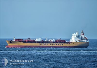
STOLT INNOVATION
Oil/Chemical Tanker
Current Trip
| Trip Time | 3 days |
|---|---|
| Trip Distance | 1275.73 nm |
| AVG Speed | 13.3 Knopen |
| MAX Speed | 15.7 Knopen |
| Diepgang | 5.6 M |
| AVG Wind | 15.5 knots |
| MAX Wind | 30.8 knots |
| MIN Temp | 2.1°C / 35.78°F |
| MAX Temp | 12°C / 53.6°F |
| Positie ontvangen | 6 d geleden |
Current Position
| Lengtegraad | 21.16166° |
|---|---|
| Breedtegraat | 55.65041° |
| Status | Moored |
| Snelheid | |
| Koers | 286° |
| Gebied | Baltic Sea |
| Station | T-AIS |
| Positie ontvangen | 6 d geleden |
Info
Information
The current position of STOLT INNOVATION is in Baltic Sea with coordinates 55.65041° / 21.16166° as reported on 2024-04-23 18:29 by AIS to our vessel tracker app. The vessel's current speed is 0 Knopen and is currently inside the port of KLAIPEDA.
The vessel STOLT INNOVATION (IMO: 9102069, MMSI: 319489000) is a Oil/Chemical Tanker that was built in 1996 ( 28 Jaar oud ). It's sailing under the flag of [KY] Cayman Is.
In this page you can find informations about the vessels current position, last detected port calls, and current voyage information. If the vessels is not in coverage by AIS you will find the latest position.
The current position of STOLT INNOVATION is detected by our AIS receivers and we are not responsible for the reliability of the data. The last position was recorded while the vessel was in Coverage by the Ais receivers of our vessel tracking app.
The current draught of STOLT INNOVATION as reported by AIS is 5.6 meters
Weather
| Temperature | 1.9°C / 35.42°F |
|---|---|
| Wind Speed | 8 knots |
| Direction | 213° SSW |
| Pressure | 1017 hPa |
| Humidity | 79.6 % |
| Cloud Coverage | 83 % |
Featured Company
Last Port Calls
| Port | Arrival | Departure | Time In Port |
|---|---|---|---|
| 2024-04-23 15:58 | |||
| 2024-04-19 16:24 | 2024-04-19 17:23 | 58 m | |
| 2024-04-18 12:23 | 2024-04-18 14:14 | 1 h | |
| 2024-04-11 09:00 | 2024-04-14 21:33 | 3 d | |
| 2024-04-03 21:52 | 2024-04-09 23:04 | 6 d | |
| 2024-03-07 20:22 | 2024-03-09 16:55 | 1 d | |
| 2024-03-01 20:24 | 2024-03-04 20:13 | 2 d | |
| 2024-02-28 06:48 | 2024-03-01 18:05 | 2 d | |
| 2024-02-23 02:33 | 2024-02-26 07:59 | 3 d | |
| 2024-02-16 18:02 | 2024-02-18 16:47 | 1 d |
Most Visited Ports (Last year)
| Port | Arrivals | |
|---|---|---|
| 9 | ||
| 4 | ||
| 4 | ||
| 3 | ||
| 3 | ||
| 2 |
Last Trips
| Origin | Departure | Destination | Arrival | Distance | |
|---|---|---|---|---|---|
| 2024-04-19 19:23 | 2024-04-23 18:58 | 1275.73 nm | |||
| 2024-04-18 16:14 | 2024-04-19 18:24 | 2.92 nm | |||
| 2024-04-14 23:33 | 2024-04-18 14:23 | 296.51 nm | |||
| 2024-04-10 01:04 | 2024-04-11 11:00 | 109.75 nm | |||
| 2024-03-09 10:55 | 2024-04-03 23:52 | 5631.81 nm | |||
| 2024-03-04 14:13 | 2024-03-07 14:22 | 51.36 nm | |||
| 2024-03-01 12:05 | 2024-03-01 14:24 | 20.25 nm | |||
| 2024-02-26 01:59 | 2024-02-28 00:48 | 510.93 nm | |||
| 2024-02-18 11:47 | 2024-02-22 20:33 | 1239.11 nm | |||
| 2024-02-06 11:56 | 2024-02-16 13:02 | 1633.84 nm |
Events
| Tijd | Evenement | Details | Positie / Bestemming | Info |
|---|---|---|---|---|
| 2024-04-23 18:29 | Status Changed | Default Moored |
55.65041 / 21.16166
[LT] KLAIPEDA
|
Snelheid: Koers: 286° |
| 2024-04-23 18:29 | Buitenbereik |
55.65041 / 21.16166
Baltic Sea
[LT] KLAIPEDA
|
Snelheid: Koers: 106.8° |
|
| 2024-04-23 18:11 | Status Changed | Moored Under way using engine |
55.65039 / 21.16164
[LT] KLAIPEDA
|
Snelheid: Koers: 286° |
| 2024-04-23 17:02 | Stop beweging |
55.65096 / 21.15802
[LT] KLAIPEDA
|
Snelheid: 0.3 kn Koers: 287° |
|
| 2024-04-23 15:58 | Aankomsthaven |
|
55.72451 / 21.09353
[LT] KLAIPEDA
|
Snelheid: 9.7 kn Koers: 115.6° |
| 2024-04-23 14:34 | Wijzig zee gebeid | Lithuanian part of the Baltic Sea Polish part of the Baltic Sea |
55.75937 / 20.62408
Baltic Sea
FRLEH>LTKLJ
|
Snelheid: 14.9 kn Koers: 98.8° |
| 2024-04-23 14:34 | Status Changed | Under way using engine Default |
55.75950 / 20.62264
FRLEH>LTKLJ
|
Snelheid: 14.8 kn Koers: 98° |
| 2024-04-23 14:34 | Binnenbereik |
55.75937 / 20.62408
Baltic Sea
FRLEH>LTKLJ
|
Snelheid: 14.9 kn Koers: 98.8° |
|
| 2024-04-23 14:34 | Draught Changed | 5.6 8.1 |
55.76070 / 20.60897
FRLEH>LTKLJ
|
Snelheid: 14.8 kn Koers: 98° |
| 2024-04-23 14:34 | ETA Changed | 2024/04/23 15:00 2024/04/23 17:00 |
55.76070 / 20.60897
FRLEH>LTKLJ
|
Snelheid: 14.8 kn Koers: 98° |