
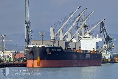
PROPEL SUCCESS
Cargo
Current Trip
| Time Travelled | 36 days |
|---|---|
| Remaining Time | --- |
| Distance Travelled | 6207.32 nm |
| Remaining Distance | --- |
| AVG Speed | 8.4 Knopen |
| MAX Speed | 12.3 Knopen |
| AVG Wind | 14.7 knots |
| MAX Wind | 36.1 knots |
| MIN Temp | 12.7°C / 54.86°F |
| MAX Temp | 28.8°C / 83.84°F |
| Diepgang | 11.8 M |
| Positie ontvangen | 1 d geleden |
Current Position
| Lengtegraad | --- |
|---|---|
| Breedtegraat | --- |
| Status | Under way using engine |
| Snelheid | 6.9 Knopen |
| Koers | 268.8° |
| Gebied | South Atlantic Ocean |
| Station | T-AIS |
| Positie ontvangen | 1 d geleden |
Info
Information
The current position of PROPEL SUCCESS is in South Atlantic Ocean with coordinates -33.88054° / 17.19434° as reported on 2025-12-04 22:24 by AIS to our vessel tracker app. The vessel's current speed is 6.9 Knopen
The vessel PROPEL SUCCESS (IMO: 9640607, MMSI: 563155700) is a Cargo It's sailing under the flag of [SG] Singapore.
In this page you can find informations about the vessels current position, last detected port calls, and current voyage information. If the vessels is not in coverage by AIS you will find the latest position.
The current position of PROPEL SUCCESS is detected by our AIS receivers and we are not responsible for the reliability of the data. The last position was recorded while the vessel was in Coverage by the Ais receivers of our vessel tracking app.
The current draught of PROPEL SUCCESS as reported by AIS is 11.8 meters
Weather
| Temperature | 18.9°C / 66.02°F |
|---|---|
| Wind Speed | 22 knots |
| Direction | 165° SSE |
| Pressure | 1019.6 hPa |
| Humidity | 68 % |
| Cloud Coverage | 47 % |
Featured Company
Last Port Calls
| Port | Arrival | Departure | Time In Port |
|---|---|---|---|
| 2025-10-27 03:29 | 2025-10-30 12:55 | 3 d | |
| 2025-10-19 03:21 | 2025-10-26 14:11 | 7 d |
Last Trips
| Origin | Departure | Destination | Arrival | Distance | |
|---|---|---|---|---|---|
| 2025-10-26 14:11 | 2025-10-27 03:29 | 112.73 nm | |||
| 2025-09-06 12:51 | 2025-10-19 03:21 | 10778.13 nm |
Events
| Tijd | Evenement | Details | Positie / Bestemming | Info |
|---|---|---|---|---|
| 2025-12-06 01:25 | Stop beweging |
-33.73667 / 15.36667
CAPETOWN
|
Snelheid: Koers: -1° |
|
| 2025-12-04 22:31 | Status Changed | Default Under way using engine |
-33.88131 / 17.17739
CAPETOWN
|
Snelheid: 6.9 kn Koers: 268.8° |
| 2025-12-04 22:24 | Buitenbereik |
-33.88054 / 17.19434
South Atlantic Ocean
|
Snelheid: 6.9 kn Koers: 268.8° |
|
| 2025-12-04 22:23 | Status Changed | Under way using engine Default |
-33.88046 / 17.19666
CAPETOWN
|
Snelheid: 6.9 kn Koers: 269° |
| 2025-12-04 21:53 | Status Changed | Default Under way using engine |
-33.87851 / 17.26640
CAPETOWN
|
Snelheid: 7.2 kn Koers: 272.3° |
| 2025-12-04 21:37 | Status Changed | Under way using engine Default |
-33.87927 / 17.30339
CAPETOWN
|
Snelheid: 7.2 kn Koers: 276° |
| 2025-12-04 21:28 | Status Changed | Default Under way using engine |
-33.88023 / 17.32638
CAPETOWN
|
Snelheid: 7.1 kn Koers: 274.2° |
| 2025-12-04 19:49 | Status Changed | Under way using engine Default |
-33.88132 / 17.56275
CAPETOWN
|
Snelheid: 7.1 kn Koers: 270° |
| 2025-12-04 19:44 | Status Changed | Default Under way using engine |
-33.88049 / 17.57548
CAPETOWN
|
Snelheid: 7.1 kn Koers: 267.7° |
| 2025-12-04 19:43 | Status Changed | Under way using engine Default |
-33.88042 / 17.57706
CAPETOWN
|
Snelheid: 7 kn Koers: 269° |