
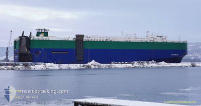
PLATINUM RAY
Ro-Ro/Passenger Ship
Current Trip
| Time Travelled | 19 days |
|---|---|
| Remaining Time | --- |
| Distance Travelled | 5882.79 nm |
| Remaining Distance | --- |
| AVG Speed | 13.9 Knopen |
| MAX Speed | 19 Knopen |
| AVG Wind | 9.7 knots |
| MAX Wind | 27.4 knots |
| MIN Temp | 9.8°C / 49.64°F |
| MAX Temp | 34°C / 93.2°F |
| Diepgang | 7.5 M |
| Positie ontvangen | 5 d geleden |
Current Position
| Lengtegraad | -107.46979° |
|---|---|
| Breedtegraat | 19.05436° |
| Status | Under way using engine |
| Snelheid | 14.4 Knopen |
| Koers | 302° |
| Gebied | North Pacific Ocean |
| Station | T-AIS |
| Positie ontvangen | 5 d geleden |
Info
Information
The current position of PLATINUM RAY is in North Pacific Ocean with coordinates 19.05436° / -107.46979° as reported on 2024-04-23 11:30 by AIS to our vessel tracker app. The vessel's current speed is 14.4 Knopen and is heading at the port of ULSAN. The estimated time of arrival as calculated by MyShipTracking vessel tracking app is 2024-05-12 03:00 LT
The vessel PLATINUM RAY (IMO: 9210438, MMSI: 308726000) is a Ro-Ro/Passenger Ship that was built in 2000 ( 24 Jaar oud ). It's sailing under the flag of [BS] Bahamas.
In this page you can find informations about the vessels current position, last detected port calls, and current voyage information. If the vessels is not in coverage by AIS you will find the latest position.
The current position of PLATINUM RAY is detected by our AIS receivers and we are not responsible for the reliability of the data. The last position was recorded while the vessel was in Coverage by the Ais receivers of our vessel tracking app.
The current draught of PLATINUM RAY as reported by AIS is 7.5 meters
Weather
| Temperature | 14.2°C / 57.56°F |
|---|---|
| Wind Speed | 9 knots |
| Direction | 287° WNW |
| Pressure | 1030 hPa |
| Humidity | 90.9 % |
| Cloud Coverage | 18 % |
Featured Company
Last Port Calls
Last Trips
Events
| Tijd | Evenement | Details | Positie / Bestemming | Info |
|---|---|---|---|---|
| 2024-04-23 11:37 | Status Changed | Default Under way using engine |
19.06965 / -107.49502
KRUSN
|
Snelheid: 14.4 kn Koers: 302° |
| 2024-04-23 11:30 | Buitenbereik |
19.05436 / -107.46979
North Pacific Ocean
KRUSN
|
Snelheid: 14.4 kn Koers: 302° |
|
| 2024-04-23 10:34 | Status Changed | Under way using engine Default |
18.93196 / -107.26917
KRUSN
|
Snelheid: 14.5 kn Koers: 304° |
| 2024-04-23 10:27 | Status Changed | Default Under way using engine |
18.91550 / -107.24274
KRUSN
|
Snelheid: 14.5 kn Koers: 303.8° |
| 2024-04-23 10:07 | Status Changed | Under way using engine Default |
18.87293 / -107.17487
KRUSN
|
Snelheid: 14.2 kn Koers: 304° |
| 2024-04-23 09:54 | Status Changed | Default Under way using engine |
18.84148 / -107.12683
KRUSN
|
Snelheid: 14.3 kn Koers: 304° |
| 2024-04-23 09:36 | Status Changed | Under way using engine Default |
18.80335 / -107.06744
KRUSN
|
Snelheid: 14.2 kn Koers: 302° |
| 2024-04-23 09:34 | Status Changed | Default Under way using engine |
18.79713 / -107.05776
KRUSN
|
Snelheid: 14.3 kn Koers: 303.6° |
| 2024-04-23 08:16 | Status Changed | Under way using engine Default |
18.62214 / -106.78763
KRUSN
|
Snelheid: 14.6 kn Koers: 304° |
| 2024-04-23 07:55 | Status Changed | Default Under way using engine |
18.57389 / -106.71268
KRUSN
|
Snelheid: 14.5 kn Koers: 304.7° |