
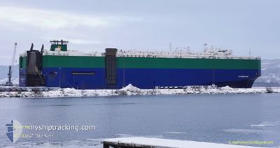
PLATINUM RAY
Ro-Ro/Passenger Ship
Current Trip
| Time Travelled | 10 days |
|---|---|
| Remaining Time | --- |
| Distance Travelled | 2934.53 nm |
| Remaining Distance | 585.42 nm |
| AVG Speed | 12.8 Knots |
| MAX Speed | 19 Knots |
| AVG Wind | 9.5 knots |
| MAX Wind | 27.4 knots |
| MIN Temp | 9.8°C / 49.64°F |
| MAX Temp | 34°C / 93.2°F |
| Draught | 7.5 m |
| Position Received | 2 d ago |
Current Position
| Longitude | -79.44827° |
|---|---|
| Latitude | 8.45313° |
| Status | Under way using engine |
| Speed | 14.6 Knots |
| Course | 180.7° |
| Area | North Pacific Ocean |
| Station | T-AIS |
| Position Received | 2 d ago |
Info
Information
The current position of PLATINUM RAY is in North Pacific Ocean with coordinates 8.45313° / -79.44827° as reported on 2024-04-17 22:56 by AIS to our vessel tracker app. The vessel's current speed is 14.6 Knots and is heading at the port of CRISTOBAL. The estimated time of arrival as calculated by MyShipTracking vessel tracking app is 2024-04-16 18:00 LT
The vessel PLATINUM RAY (IMO: 9210438, MMSI: 308726000) is a Ro-Ro/Passenger Ship that was built in 2000 ( 24 years old ). It's sailing under the flag of [BS] Bahamas.
In this page you can find informations about the vessels current position, last detected port calls, and current voyage information. If the vessels is not in coverage by AIS you will find the latest position.
The current position of PLATINUM RAY is detected by our AIS receivers and we are not responsible for the reliability of the data. The last position was recorded while the vessel was in Coverage by the Ais receivers of our vessel tracking app.
The current draught of PLATINUM RAY as reported by AIS is 7.5 meters
Weather
| Temperature | 27.1°C / 80.78°F |
|---|---|
| Wind Speed | 11 knots |
| Direction | 29° NNE |
| Pressure | 1009.7 hPa |
| Humidity | 85.1 % |
| Cloud Coverage | 84 % |
Featured Company
Last Port Calls
Last Trips
Events
| Time | Event | Details | Position / Dest | Info |
|---|---|---|---|---|
| 2024-04-17 22:59 | Status Changed | Default Under way using engine |
8.43627 / -79.44850
PACTB! OPS
|
Speed: 14.6 kn Course: 180.7° |
| 2024-04-17 22:56 | Status Changed | Under way using engine Default |
8.45313 / -79.44827
PACTB! OPS
|
Speed: 14.6 kn Course: 181° |
| 2024-04-17 22:56 | OUT of Coverage |
8.45313 / -79.44827
North Pacific Ocean
|
Speed: 14.6 kn Course: 180.7° |
|
| 2024-04-17 22:49 | Status Changed | Default Under way using engine |
8.48065 / -79.44794
PACTB! OPS
|
Speed: 14.7 kn Course: 180.8° |
| 2024-04-17 22:35 | Status Changed | Under way using engine Default |
8.53848 / -79.44737
PACTB! OPS
|
Speed: 14.5 kn Course: 181° |
| 2024-04-17 22:29 | Status Changed | Default Under way using engine |
8.56081 / -79.44710
PACTB! OPS
|
Speed: 14.4 kn Course: 177.2° |
| 2024-04-17 20:49 | Change Sea Area | Panamanian part of the North Pacific Ocean Panamanian part of the Caribbean Sea |
8.90765 / -79.53724
North Pacific Ocean
|
Speed: 13.1 kn Course: 142.3° |
| 2024-04-17 20:08 | START Moving | 2.4 nm, North of RODMAN |
8.99307 / -79.58837
PACTB! OPS
|
Speed: 3.5 kn Course: 136° |
| 2024-04-17 18:52 | STOP Moving | 3.09 nm, North West of RODMAN |
9.00174 / -79.59708
PACTB! OPS
|
Speed: 0.2 kn Course: 130° |
| 2024-04-17 18:35 | START Moving | 3.91 nm, North West of RODMAN |
9.01216 / -79.60682
PACTB! OPS
|
Speed: 4.7 kn Course: 133° |