
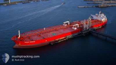
NORDIC BREEZE
Crude Oil Tanker
Current Trip
WAFR
| Time Travelled | 44 days |
|---|---|
| Remaining Time | --- |
| Distance Travelled | 9039.10 nm |
| Remaining Distance | --- |
| AVG Speed | 11.8 Knopen |
| MAX Speed | 15 Knopen |
| AVG Wind | 11.9 knots |
| MAX Wind | 35.8 knots |
| MIN Temp | 10.9°C / 51.62°F |
| MAX Temp | 28.8°C / 83.84°F |
| Diepgang | 9.1 M |
| Positie ontvangen | 2 h, 33 m geleden |
Current Position
| Lengtegraad | --- |
|---|---|
| Breedtegraat | --- |
| Status | Under way using engine |
| Snelheid | 12 Knopen |
| Koers | 201.4° |
| Gebied | North Atlantic Ocean |
| Station | T-AIS |
| Positie ontvangen | 2 h, 33 m geleden |
Info
Information
The current position of NORDIC BREEZE is in North Atlantic Ocean with coordinates 22.32036° / -18.72278° as reported on 2025-12-10 06:12 by AIS to our vessel tracker app. The vessel's current speed is 12 Knopen
The vessel NORDIC BREEZE (IMO: 9588445, MMSI: 636014868) is a Crude Oil Tanker that was built in 2011 ( 14 Jaar oud ). It's sailing under the flag of [LR] Liberia.
In this page you can find informations about the vessels current position, last detected port calls, and current voyage information. If the vessels is not in coverage by AIS you will find the latest position.
The current position of NORDIC BREEZE is detected by our AIS receivers and we are not responsible for the reliability of the data. The last position was recorded while the vessel was in Coverage by the Ais receivers of our vessel tracking app.
The current draught of NORDIC BREEZE as reported by AIS is 9.1 meters
Weather
| Temperature | 21.5°C / 70.7°F |
|---|---|
| Wind Speed | 16 knots |
| Direction | 51° NE |
| Pressure | 1020.2 hPa |
| Humidity | 62.4 % |
| Cloud Coverage | --- |
Featured Company
Most Visited Ports (Last year)
| Port | Arrivals | |
|---|---|---|
| 2 | ||
| 1 | ||
| 1 | ||
| 1 | ||
| 1 | ||
| 1 |
Events
| Tijd | Evenement | Details | Positie / Bestemming | Info |
|---|---|---|---|---|
| 2025-12-10 06:19 | Status Changed | Default Under way using engine |
22.29901 / -18.73136
WAFR
|
Snelheid: 12 kn Koers: 201.4° |
| 2025-12-10 06:12 | Status Changed | Under way using engine Default |
22.32036 / -18.72278
WAFR
|
Snelheid: 11.8 kn Koers: 200° |
| 2025-12-10 06:12 | Binnenbereik |
22.32036 / -18.72278
North Atlantic Ocean
WAFR
|
Snelheid: 12 kn Koers: 201.4° |
|
| 2025-12-10 06:12 | Buitenbereik |
22.32036 / -18.72278
North Atlantic Ocean
WAFR
|
Snelheid: 12 kn Koers: 201.4° |
|
| 2025-12-09 23:47 | Status Changed | Default Under way using engine |
23.50741 / -18.21342
WAFR
|
Snelheid: 12.3 kn Koers: 204.4° |
| 2025-12-09 23:41 | Buitenbereik |
23.52643 / -18.20450
North Atlantic Ocean
WAFR
|
Snelheid: 12.3 kn Koers: 204.4° |
|
| 2025-12-09 23:39 | Status Changed | Under way using engine Default |
23.53180 / -18.20191
WAFR
|
Snelheid: 12.3 kn Koers: 203° |
| 2025-12-09 23:35 | Status Changed | Default Under way using engine |
23.54604 / -18.19515
WAFR
|
Snelheid: 12.4 kn Koers: 203.1° |
| 2025-12-09 23:35 | Status Changed | Under way using engine Default |
23.54651 / -18.19493
WAFR
|
Snelheid: 12.4 kn Koers: 205° |
| 2025-12-09 23:31 | Status Changed | Default Under way using engine |
23.55882 / -18.18910
WAFR
|
Snelheid: 12.5 kn Koers: 203.4° |