
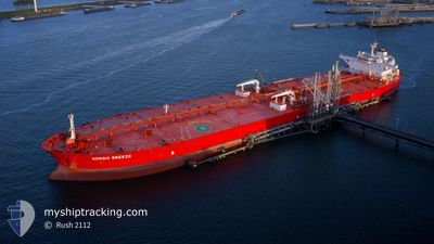
NORDIC BREEZE
Crude Oil Tanker
Current Trip
| Time Travelled | 42 days |
|---|---|
| Remaining Time | --- |
| Distance Travelled | 8275.25 nm |
| Remaining Distance | --- |
| AVG Speed | 11.7 Knots |
| MAX Speed | 15 Knots |
| AVG Wind | 12.5 knots |
| MAX Wind | 35.8 knots |
| MIN Temp | 10.9°C / 51.62°F |
| MAX Temp | 28.8°C / 83.84°F |
| Dybgang | 9.1 m |
| Position Modtaget | 1 d siden |
Current Position
| Longitude | --- |
|---|---|
| Latitude | --- |
| Status | Under way using engine |
| Fart | 12.7 Knots |
| Kurs | 216.5° |
| Område | North Atlantic Ocean |
| Station | T-AIS |
| Position Modtaget | 1 d siden |
Info
Information
The current position of NORDIC BREEZE is in North Atlantic Ocean with coordinates 36.95545° / -7.06661° as reported on 2025-12-06 14:13 by AIS to our vessel tracker app. The vessel's current speed is 12.7 Knots
The vessel NORDIC BREEZE (IMO: 9588445, MMSI: 636014868) is a Crude Oil Tanker that was built in 2011 ( 14 år gamle ). It's sailing under the flag of [LR] Liberia.
In this page you can find informations about the vessels current position, last detected port calls, and current voyage information. If the vessels is not in coverage by AIS you will find the latest position.
The current position of NORDIC BREEZE is detected by our AIS receivers and we are not responsible for the reliability of the data. The last position was recorded while the vessel was in Coverage by the Ais receivers of our vessel tracking app.
The current draught of NORDIC BREEZE as reported by AIS is 9.1 meters
Weather
| Temperature | 18.9°C / 66.02°F |
|---|---|
| Wind Speed | 3 knots |
| Direction | 44° NE |
| Pressure | 1022.1 hPa |
| Humidity | 65.7 % |
| Cloud Coverage | 3 % |
Featured Company
Most Visited Ports (Last year)
| Port | Arrivals | |
|---|---|---|
| 2 | ||
| 1 | ||
| 1 | ||
| 1 | ||
| 1 | ||
| 1 |
Events
| Tid | Hændelsen | Detaljer | Position / Dest | Info |
|---|---|---|---|---|
| 2025-12-06 14:15 | Status er ændret | Default Under way using engine |
36.95169 / -7.07001
HUELVA
|
Fart: 12.7 kn Kurs: 216.5° |
| 2025-12-06 14:13 | Status er ændret | Under way using engine Default |
36.95545 / -7.06661
HUELVA
|
Fart: 12.7 kn Kurs: 223° |
| 2025-12-06 14:13 | Udenfor Dækning |
36.95545 / -7.06661
North Atlantic Ocean
|
Fart: 12.7 kn Kurs: 216.5° |
|
| 2025-12-06 13:23 | Status er ændret | Default Under way using engine |
37.06858 / -6.91773
HUELVA
|
Fart: 6.9 kn Kurs: 208.5° |
| 2025-12-06 13:10 | START Sejllads | 3.78 nm, South of HUELVA |
37.08816 / -6.90477
HUELVA
|
Fart: 3.6 kn Kurs: 209° |
| 2025-12-06 13:04 | Status er ændret | Under way using engine At anchor |
37.09118 / -6.90270
HUELVA
|
Fart: 0.6 kn Kurs: 227° |
| 2025-12-06 13:01 | Status er ændret | At anchor Default |
37.09136 / -6.90216
HUELVA
|
Fart: 0.5 kn Kurs: 233° |
| 2025-12-06 12:37 | Status er ændret | Default At anchor |
37.09171 / -6.90086
HUELVA
|
Fart: Kurs: 229° |
| 2025-12-06 12:07 | Status er ændret | At anchor Default |
37.09158 / -6.90051
HUELVA
|
Fart: 0.1 kn Kurs: 236° |
| 2025-12-06 11:58 | Status er ændret | Default At anchor |
37.09144 / -6.90040
HUELVA
|
Fart: 0.1 kn Kurs: 241° |