
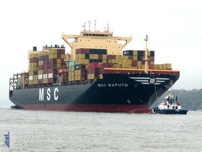
MSC MAPUTO
Cargo
Current Trip
| Time Travelled | 7 days |
|---|---|
| Remaining Time | --- |
| Distance Travelled | 2050.57 nm |
| Remaining Distance | --- |
| AVG Speed | 13.7 Knopen |
| MAX Speed | 20.6 Knopen |
| AVG Wind | 14.7 knots |
| MAX Wind | 30.8 knots |
| MIN Temp | 19.9°C / 67.82°F |
| MAX Temp | 28.2°C / 82.76°F |
| Diepgang | 13.5 M |
| Positie ontvangen | 4 d geleden |
Current Position
| Lengtegraad | --- |
|---|---|
| Breedtegraat | --- |
| Status | Under way using engine |
| Snelheid | 15.7 Knopen |
| Koers | 147.2° |
| Gebied | South China Sea |
| Station | T-AIS |
| Positie ontvangen | 4 d geleden |
Info
Information
The current position of MSC MAPUTO is in South China Sea with coordinates 20.41129° / 107.03978° as reported on 2025-12-06 03:05 by AIS to our vessel tracker app. The vessel's current speed is 15.7 Knopen and is heading at the port of VUNG TAU. The estimated time of arrival as calculated by MyShipTracking vessel tracking app is 2025-12-08 06:30 LT
The vessel MSC MAPUTO (IMO: 9967263, MMSI: 636023023) is a Cargo It's sailing under the flag of [LR] Liberia.
In this page you can find informations about the vessels current position, last detected port calls, and current voyage information. If the vessels is not in coverage by AIS you will find the latest position.
The current position of MSC MAPUTO is detected by our AIS receivers and we are not responsible for the reliability of the data. The last position was recorded while the vessel was in Coverage by the Ais receivers of our vessel tracking app.
The current draught of MSC MAPUTO as reported by AIS is 13.5 meters
Weather
| Temperature | 26.9°C / 80.42°F |
|---|---|
| Wind Speed | 11 knots |
| Direction | 345° NNW |
| Pressure | 1010.8 hPa |
| Humidity | 79 % |
| Cloud Coverage | 98 % |
Featured Company
Last Port Calls
| Port | Arrival | Departure | Time In Port |
|---|---|---|---|
| 2025-12-02 02:04 | 2025-12-03 15:53 | 1 d | |
| 2025-11-25 13:57 | 2025-11-26 21:43 | 1 d | |
| 2025-11-21 08:02 | 2025-11-23 11:50 | 2 d | |
| 2025-10-29 08:48 | 2025-10-30 12:28 | 1 d | |
| 2025-10-09 19:06 | 2025-10-12 03:56 | 2 d | |
| 2025-10-06 14:31 | 2025-10-07 20:13 | 1 d | |
| 2025-10-04 00:02 | 2025-10-05 08:16 | 1 d | |
| 2025-10-01 16:06 | 2025-10-02 13:22 | 21 h |
Last Trips
| Origin | Departure | Destination | Arrival | Distance | |
|---|---|---|---|---|---|
| 2025-11-26 21:43 | 2025-12-02 02:04 | 1729.90 nm | |||
| 2025-11-23 11:50 | 2025-11-25 13:57 | 847.49 nm | |||
| 2025-10-30 12:28 | 2025-11-21 08:02 | 8304.85 nm | |||
| 2025-10-12 03:56 | 2025-10-29 08:48 | 5118.23 nm | |||
| 2025-10-07 20:13 | 2025-10-09 19:06 | 164.15 nm | |||
| 2025-10-05 08:16 | 2025-10-06 14:31 | 490.60 nm | |||
| 2025-10-02 13:22 | 2025-10-04 00:02 | 431.68 nm | |||
| 2025-09-30 03:34 | 2025-10-01 16:06 | 566.59 nm |
Events
| Tijd | Evenement | Details | Positie / Bestemming | Info |
|---|---|---|---|---|
| 2025-12-10 05:46 | Start beweging |
4.54833 / 106.10500
VUNG TAU
|
Snelheid: 5 kn Koers: 211° |
|
| 2025-12-10 04:28 | Stop beweging |
4.57833 / 106.11833
VUNG TAU
|
Snelheid: Koers: -1° |
|
| 2025-12-08 22:21 | Start beweging | 2.72 nm, South West of CAI MEP |
10.50436 / 106.99995
VUNG TAU
|
Snelheid: 5.4 kn Koers: 218° |
| 2025-12-08 04:26 | Stop beweging | 2.31 nm, South West of CAI MEP |
10.50766 / 107.00758
VUNG TAU
|
Snelheid: 0.3 kn Koers: 48° |
| 2025-12-06 03:07 | Status Changed | Default Under way using engine |
20.40333 / 107.04333
VUNG TAU
|
Snelheid: 15.7 kn Koers: 147.2° |
| 2025-12-06 03:05 | Buitenbereik |
20.41129 / 107.03978
South China Sea
VUNG TAU
|
Snelheid: 15.7 kn Koers: 147.2° |
|
| 2025-12-06 00:42 | Start beweging | 10.6 nm, East of HAI PHONG |
20.79644 / 106.91393
VUNG TAU
|
Snelheid: 3.1 kn Koers: 153° |
| 2025-12-06 00:35 | Stop beweging | 10.5 nm, East of HAI PHONG |
20.79826 / 106.91263
VUNG TAU
|
Snelheid: 0.3 kn Koers: 152° |
| 2025-12-06 00:20 | Start beweging | 10.51 nm, East of HAI PHONG |
20.79581 / 106.91183
VUNG TAU
|
Snelheid: 3.1 kn Koers: 331° |
| 2025-12-06 00:13 | Status Changed | Under way using engine Moored |
20.79339 / 106.91232
VUNG TAU
|
Snelheid: 0.2 kn Koers: 328° |