
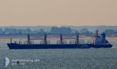
PERSENK
Bulk Carrier
Current Trip
| Time Travelled | 5 days |
|---|---|
| Remaining Time | --- |
| Distance Travelled | 743.37 nm |
| Remaining Distance | --- |
| AVG Speed | 8.4 Noeuds |
| MAX Speed | 14.4 Noeuds |
| AVG Wind | 5.4 knots |
| MAX Wind | 11.9 knots |
| MIN Temp | 23.1°C / 73.58°F |
| MAX Temp | 31.5°C / 88.7°F |
| Tirant d eau | 8.4 m |
| Position reçue | 3 m depuis |
Current Position
| Longitude | -54.81274° |
|---|---|
| Latitude | -2.39229° |
| Etat | At anchor |
| Vitesse | |
| Parcours | 336° |
| Zone | South Atlantic Ocean |
| Station | T-AIS |
| Position reçue | 3 m depuis |
Info
Information
The current position of PERSENK is in South Atlantic Ocean with coordinates -2.39229° / -54.81274° as reported on 2024-04-26 14:03 by AIS to our vessel tracker app. The vessel's current speed is 0 Noeuds
The vessel PERSENK (IMO: 9578995, MMSI: 256350000) is a Bulk Carrier that was built in 2010 ( 14 Age ). It's sailing under the flag of [MT] Malta.
In this page you can find informations about the vessels current position, last detected port calls, and current voyage information. If the vessels is not in coverage by AIS you will find the latest position.
The current position of PERSENK is detected by our AIS receivers and we are not responsible for the reliability of the data. The last position was recorded while the vessel was in Coverage by the Ais receivers of our vessel tracking app.
The current draught of PERSENK as reported by AIS is 8.4 meters
Weather
| Temperature | 24.6°C / 76.28°F |
|---|---|
| Wind Speed | --- |
| Direction | 255° WSW |
| Pressure | 1013.1 hPa |
| Humidity | 95.3 % |
| Cloud Coverage | 100 % |
Featured Company
Last Port Calls
| Port | Arrival | Departure | Time In Port |
|---|---|---|---|
| 2024-04-13 15:39 | 2024-04-21 09:59 | 7 d | |
| 2024-02-16 08:10 | 2024-02-21 08:52 | 5 d | |
| 2024-02-08 11:38 |
Most Visited Ports (Last year)
| Port | Arrivals | |
|---|---|---|
| 3 | ||
| 2 | ||
| 1 | ||
| 1 | ||
| 1 | ||
| 1 |
Last Trips
| Origin | Departure | Destination | Arrival | Distance | |
|---|---|---|---|---|---|
| 2024-02-21 11:52 | 2024-04-13 12:39 | 4181.49 nm | |||
| 2024-02-08 11:38 | 2024-02-16 11:10 | 1610.14 nm |
Events
| Heure | Evenement | Détails | Position/ Destination | Info |
|---|---|---|---|---|
| 2024-04-26 13:09 | Etat Changé | At anchor Default |
-2.39275 / -54.81336
BRSTM
|
Vitesse: Parcours: -1° |
| 2024-04-26 13:03 | Etat Changé | Default At anchor |
-2.39167 / -54.81333
BRSTM
|
Vitesse: Parcours: 353° |
| 2024-04-26 09:18 | Etat Changé | At anchor Default |
-2.39248 / -54.81240
BRSTM
|
Vitesse: Parcours: -1° |
| 2024-04-26 09:15 | Etat Changé | Default At anchor |
-2.39167 / -54.81167
BRSTM
|
Vitesse: Parcours: 318° |
| 2024-04-26 02:09 | Etat Changé | At anchor Default |
-2.39172 / -54.81184
BRSTM
|
Vitesse: Parcours: -1° |
| 2024-04-26 02:03 | Etat Changé | Default At anchor |
-2.39167 / -54.81167
BRSTM
|
Vitesse: Parcours: 287° |
| 2024-04-25 12:09 | Etat Changé | At anchor Under way using engine |
-2.39114 / -54.81200
BRSTM
|
Vitesse: Parcours: 240° |
| 2024-04-25 12:09 | Changement de destination | BRSTM FAZENDINHA |
-2.39114 / -54.81200
BRSTM
|
Vitesse: Parcours: 240° |
| 2024-04-25 10:05 | Arret | 6.29 nm, West of SANTAREM |
-2.39081 / -54.81344
FAZENDINHA
|
Vitesse: 0.3 kn Parcours: 219° |
| 2024-04-25 05:08 | Etat Changé | Under way using engine Default |
-2.37179 / -54.13530
FAZENDINHA
|
Vitesse: 9 kn Parcours: 253° |