
PERSENK
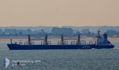
Bulk Carrier
Current Trip
| Time Travelled | 4 days |
|---|---|
| Remaining Time | --- |
| Distance Travelled | 969.64 nm |
| Remaining Distance | --- |
| AVG Speed | 10.2 Knopen |
| MAX Speed | 16.3 Knopen |
| AVG Wind | 8.1 knots |
| MAX Wind | 19.8 knots |
| MIN Temp | 23.3°C / 73.94°F |
| MAX Temp | 30.7°C / 87.26°F |
| Diepgang | 10 M |
| Positie ontvangen | 2 d geleden |
Current Position
| Lengtegraad | -50.84826° |
|---|---|
| Breedtegraat | 0.17178° |
| Status | Under way using engine |
| Snelheid | 14.3 Knopen |
| Koers | 83.7° |
| Gebied | North Atlantic Ocean |
| Station | T-AIS |
| Positie ontvangen | 2 d geleden |
Info
Information
The current position of PERSENK is in North Atlantic Ocean with coordinates 0.17178° / -50.84826° as reported on 2024-05-11 14:27 by AIS to our vessel tracker app. The vessel's current speed is 14.3 Knopen and is heading at the port of BIZERTE. The estimated time of arrival as calculated by MyShipTracking vessel tracking app is 2024-05-29 08:00 LT
The vessel PERSENK (IMO: 9578995, MMSI: 256350000) is a Bulk Carrier that was built in 2010 ( 14 Jaar oud ). It's sailing under the flag of [MT] Malta.
In this page you can find informations about the vessels current position, last detected port calls, and current voyage information. If the vessels is not in coverage by AIS you will find the latest position.
The current position of PERSENK is detected by our AIS receivers and we are not responsible for the reliability of the data. The last position was recorded while the vessel was in Coverage by the Ais receivers of our vessel tracking app.
The current draught of PERSENK as reported by AIS is 10 meters
Weather
| Temperature | 27.5°C / 81.5°F |
|---|---|
| Wind Speed | 10 knots |
| Direction | 67° ENE |
| Pressure | 1011.9 hPa |
| Humidity | 81.9 % |
| Cloud Coverage | 94 % |
Featured Company
Last Port Calls
| Port | Arrival | Departure | Time In Port |
|---|---|---|---|
| 2024-04-27 18:02 | 2024-05-09 16:17 | 11 d | |
| 2024-04-13 12:39 | 2024-04-21 06:59 | 7 d |
Most Visited Ports (Last year)
| Port | Arrivals | |
|---|---|---|
| 3 | ||
| 2 | ||
| 1 | ||
| 1 | ||
| 1 | ||
| 1 |
Last Trips
| Origin | Departure | Destination | Arrival | Distance | |
|---|---|---|---|---|---|
| 2024-04-21 06:59 | 2024-04-27 18:02 | 749.71 nm | |||
| 2024-02-21 11:52 | 2024-04-13 12:39 | 4181.49 nm |
Events
| Tijd | Evenement | Details | Positie / Bestemming | Info |
|---|---|---|---|---|
| 2024-05-11 14:31 | Status Changed | Default Under way using engine |
.17167 / -50.83333
BIZERTE
|
Snelheid: 14.3 kn Koers: 83.7° |
| 2024-05-11 14:27 | Status Changed | Under way using engine Default |
.17178 / -50.84826
BIZERTE
|
Snelheid: 14 kn Koers: 81° |
| 2024-05-11 14:27 | Buitenbereik |
.17178 / -50.84826
North Atlantic Ocean
BIZERTE
|
Snelheid: 14.3 kn Koers: 83.7° |
|
| 2024-05-11 14:22 | Status Changed | Default Under way using engine |
.16865 / -50.87049
BIZERTE
|
Snelheid: 14.2 kn Koers: 63.4° |
| 2024-05-11 13:55 | Status Changed | Under way using engine Default |
.12318 / -50.96350
BIZERTE
|
Snelheid: 13.9 kn Koers: 30° |
| 2024-05-11 13:43 | Status Changed | Default Under way using engine |
.08167 / -50.98500
BIZERTE
|
Snelheid: 13.3 kn Koers: 26.8° |
| 2024-05-11 13:19 | Wijzig zee gebeid | Brazilian part of the North Atlantic Ocean Brazilian part of the South Atlantic Ocean |
.00481 / -51.02632
North Atlantic Ocean
BIZERTE
|
Snelheid: 12.9 kn Koers: 32.5° |
| 2024-05-11 12:46 | Status Changed | Under way using engine At anchor |
-.06204 / -51.09792
BIZERTE
|
Snelheid: 3.5 kn Koers: 152° |
| 2024-05-11 12:45 | Start beweging | 4.4 nm, East of SANTANA |
-.06139 / -51.09861
BIZERTE
|
Snelheid: 3.2 kn Koers: 157° |
| 2024-05-11 12:05 | Destination Changed | BIZERTE FAZENDINHA |
-.06000 / -51.10032
BIZERTE
|
Snelheid: 0.5 kn Koers: 266° |