
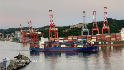
PANAY
Cargo A
Current Trip
TWTXG
| Time Travelled | 3 days |
|---|---|
| Remaining Time | --- |
| Distance Travelled | 1170.07 nm |
| Remaining Distance | --- |
| AVG Speed | 15.5 Noeuds |
| MAX Speed | 16.9 Noeuds |
| AVG Wind | 13.3 knots |
| MAX Wind | 26.9 knots |
| MIN Temp | 18.8°C / 65.84°F |
| MAX Temp | 26°C / 78.8°F |
| Tirant d eau | 9.7 m |
| Position reçue | 2 d depuis |
Current Position
| Longitude | 121.23324° |
|---|---|
| Latitude | 25.34770° |
| Etat | Under way using engine |
| Vitesse | 14.4 Noeuds |
| Parcours | 54.3° |
| Zone | Eastern China Sea |
| Station | T-AIS |
| Position reçue | 2 d depuis |
Info
Information
The current position of PANAY is in Eastern China Sea with coordinates 25.34770° / 121.23324° as reported on 2024-06-01 19:51 by AIS to our vessel tracker app. The vessel's current speed is 14.4 Noeuds
The vessel PANAY (IMO: 9937373, MMSI: 305545000) is a Cargo A It's sailing under the flag of [AG] Antigua Barbuda.
In this page you can find informations about the vessels current position, last detected port calls, and current voyage information. If the vessels is not in coverage by AIS you will find the latest position.
The current position of PANAY is detected by our AIS receivers and we are not responsible for the reliability of the data. The last position was recorded while the vessel was in Coverage by the Ais receivers of our vessel tracking app.
The current draught of PANAY as reported by AIS is 9.7 meters
Weather
| Temperature | 19°C / 66.2°F |
|---|---|
| Wind Speed | 12 knots |
| Direction | 34° NE |
| Pressure | 1014.4 hPa |
| Humidity | 75.3 % |
| Cloud Coverage | 1 % |
Featured Company
Last Port Calls
| Port | Arrival | Departure | Time In Port |
|---|---|---|---|
| 2024-06-01 07:33 | 2024-06-01 14:50 | 7 h | |
| 2024-05-31 07:14 | 2024-05-31 22:51 | 15 h | |
| 2024-05-29 14:31 | 2024-05-30 16:10 | 1 d | |
| 2024-05-26 08:58 | 2024-05-26 20:29 | 11 h | |
| 2024-05-20 21:00 | 2024-05-21 16:28 | 19 h | |
| 2024-05-10 04:24 | 2024-05-10 15:03 | 10 h | |
| 2024-05-08 21:52 | 2024-05-09 12:10 | 14 h | |
| 2024-05-07 22:32 | 2024-05-08 02:48 | 4 h | |
| 2024-05-07 03:36 | 2024-05-07 09:16 | 5 h | |
| 2024-05-06 09:28 | 2024-05-06 18:26 | 8 h |
Last Trips
| Origin | Departure | Destination | Arrival | Distance | |
|---|---|---|---|---|---|
| 2024-06-01 06:51 | 2024-06-01 15:33 | 127.76 nm | |||
| 2024-05-31 00:10 | 2024-05-31 15:14 | 253.42 nm | |||
| 2024-05-27 04:29 | 2024-05-29 22:31 | 544.84 nm | |||
| 2024-05-21 23:28 | 2024-05-26 16:58 | 1505.92 nm | |||
| 2024-05-11 00:03 | 2024-05-21 04:00 | 2995.49 nm | |||
| 2024-05-09 21:10 | 2024-05-10 13:24 | 247.05 nm | |||
| 2024-05-08 11:48 | 2024-05-09 06:52 | 8.94 nm | |||
| 2024-05-07 18:16 | 2024-05-08 07:32 | 140.19 nm | |||
| 2024-05-07 03:26 | 2024-05-07 12:36 | 108.80 nm | |||
| 2024-05-06 17:44 | 2024-05-06 18:28 | 3.34 nm |
Events
| Heure | Evenement | Détails | Position/ Destination | Info |
|---|---|---|---|---|
| 2024-06-01 19:58 | Etat Changé | Default Under way using engine |
25.36488 / 121.25924
TWTXG
|
Vitesse: 14.4 kn Parcours: 54.3° |
| 2024-06-01 19:51 | Hors de la zone couverte |
25.34770 / 121.23324
Eastern China Sea
|
Vitesse: 14.4 kn Parcours: 54.3° |
|
| 2024-06-01 19:38 | Changement de zone | Taiwanese part of the Eastern China Sea Taiwanese part of the South China Sea |
25.31712 / 121.18712
Eastern China Sea
|
Vitesse: 14.3 kn Parcours: 53.9° |
| 2024-06-01 19:31 | Etat Changé | Under way using engine Default |
25.30023 / 121.16509
TWTXG
|
Vitesse: 14.9 kn Parcours: 49° |
| 2024-06-01 18:35 | Etat Changé | Default Under way using engine |
25.12645 / 120.99238
TWTXG
|
Vitesse: 14.9 kn Parcours: 39.8° |
| 2024-06-01 18:31 | Etat Changé | Under way using engine Default |
25.11455 / 120.98105
TWTXG
|
Vitesse: 15 kn Parcours: 42° |
| 2024-06-01 18:31 | Dans la zone couverte |
25.11455 / 120.98105
South China Sea
|
Vitesse: 14.9 kn Parcours: 39.8° |
|
| 2024-06-01 14:50 | PORT DE DEPART |
|
24.29344 / 120.49599
TWTXG
|
Vitesse: 8.1 kn Parcours: 294° |
| 2024-06-01 14:38 | Démarrage |
24.27912 / 120.52161
[TW] TAICHUNG
|
Vitesse: 7 kn Parcours: 320° |
|
| 2024-06-01 08:02 | Arret |
24.27501 / 120.52622
[TW] TAICHUNG
|
Vitesse: Parcours: 331° |