
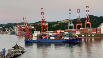
PANAY
Cargo A
Current Trip
| Trip Time | 3 days |
|---|---|
| Trip Distance | 1240.39 nm |
| AVG Speed | 14.8 Knop |
| MAX Speed | 16.9 Knop |
| Djupgående | 9 m |
| AVG Wind | 11.8 knots |
| MAX Wind | 26.9 knots |
| MIN Temp | 17.2°C / 62.96°F |
| MAX Temp | 26°C / 78.8°F |
| Position mottagen | 5 m sen |
Current Position
| Longitud | 139.75988° |
|---|---|
| Latitude | 35.62001° |
| Status | Moored |
| Fart | 0.2 Knop |
| Kurs | 358° |
| Område | North Pacific Ocean |
| Station | T-AIS |
| Position mottagen | 5 m sen |
Info
Information
The current position of PANAY is in North Pacific Ocean with coordinates 35.62001° / 139.75988° as reported on 2024-06-04 22:14 by AIS to our vessel tracker app. The vessel's current speed is 0.2 Knop and is currently inside the port of TOKYO.
The vessel PANAY (IMO: 9937373, MMSI: 305545000) is a Cargo A It's sailing under the flag of [AG] Antigua Barbuda.
In this page you can find informations about the vessels current position, last detected port calls, and current voyage information. If the vessels is not in coverage by AIS you will find the latest position.
The current position of PANAY is detected by our AIS receivers and we are not responsible for the reliability of the data. The last position was recorded while the vessel was in Coverage by the Ais receivers of our vessel tracking app.
The current draught of PANAY as reported by AIS is 9 meters
Weather
| Temperature | 17.5°C / 63.5°F |
|---|---|
| Wind Speed | 7 knots |
| Direction | 49° NE |
| Pressure | 1016.9 hPa |
| Humidity | 75.6 % |
| Cloud Coverage | 76 % |
Featured Company
Last Port Calls
| Port | Arrival | Departure | Time In Port |
|---|---|---|---|
| 2024-06-04 22:03 | |||
| 2024-06-01 07:33 | 2024-06-01 14:50 | 7 h | |
| 2024-05-31 07:14 | 2024-05-31 22:51 | 15 h | |
| 2024-05-29 14:31 | 2024-05-30 16:10 | 1 d | |
| 2024-05-26 08:58 | 2024-05-26 20:29 | 11 h | |
| 2024-05-20 21:00 | 2024-05-21 16:28 | 19 h | |
| 2024-05-10 04:24 | 2024-05-10 15:03 | 10 h | |
| 2024-05-08 21:52 | 2024-05-09 12:10 | 14 h | |
| 2024-05-07 22:32 | 2024-05-08 02:48 | 4 h | |
| 2024-05-07 03:36 | 2024-05-07 09:16 | 5 h |
Last Trips
| Origin | Departure | Destination | Arrival | Distance | |
|---|---|---|---|---|---|
| 2024-06-01 22:50 | 2024-06-05 07:03 | 1240.39 nm | |||
| 2024-06-01 06:51 | 2024-06-01 15:33 | 127.76 nm | |||
| 2024-05-31 00:10 | 2024-05-31 15:14 | 253.42 nm | |||
| 2024-05-27 04:29 | 2024-05-29 22:31 | 544.84 nm | |||
| 2024-05-21 23:28 | 2024-05-26 16:58 | 1505.92 nm | |||
| 2024-05-11 00:03 | 2024-05-21 04:00 | 2995.49 nm | |||
| 2024-05-09 21:10 | 2024-05-10 13:24 | 247.05 nm | |||
| 2024-05-08 11:48 | 2024-05-09 06:52 | 8.94 nm | |||
| 2024-05-07 18:16 | 2024-05-08 07:32 | 140.19 nm | |||
| 2024-05-07 03:26 | 2024-05-07 12:36 | 108.80 nm |
Events
| Tid | Event | Detaljer | Position / Dest | Information |
|---|---|---|---|---|
| 2024-06-04 22:14 | Status ändrad | Moored Under way using engine |
35.62001 / 139.75988
[JP] TOKYO
|
Fart: 0.1 kn Kurs: 358° |
| 2024-06-04 22:03 | STOPPAR förflyttning |
35.62002 / 139.76063
[JP] TOKYO
|
Fart: 0.3 kn Kurs: 349° |
|
| 2024-06-04 22:03 | ANLÄNDER HAMN |
|
35.62002 / 139.76063
[JP] TOKYO
|
Fart: 1.3 kn Kurs: 344° |
| 2024-06-04 19:10 | Djupgående ändrat | 9 9.7 |
35.11052 / 139.75200
JP TYO S
|
Fart: 12.8 kn Kurs: 17.9° |
| 2024-06-04 19:10 | Destination ändrad | JP TYO S TWTXG |
35.11052 / 139.75200
JP TYO S
|
Fart: 12.8 kn Kurs: 17.9° |
| 2024-06-04 19:10 | ETA ändrat | 2024/06/04 19:30 2024/05/01 06:00 |
35.11052 / 139.75200
JP TYO S
|
Fart: 12.8 kn Kurs: 17.9° |
| 2024-06-04 18:20 | Status ändrad | Under way using engine Default |
35.00075 / 139.57190
TWTXG
|
Fart: 15.4 kn Kurs: 57° |
| 2024-06-04 18:16 | Status ändrad | Default Under way using engine |
34.99029 / 139.55054
TWTXG
|
Fart: 15.4 kn Kurs: 55.6° |
| 2024-06-04 18:09 | Byter havsområde | Japanese part of the North Pacific Ocean Taiwanese part of the Eastern China Sea |
34.97473 / 139.52283
North Pacific Ocean
|
Fart: 15.9 kn Kurs: 54° |
| 2024-06-04 18:09 | Status ändrad | Under way using engine Default |
34.97473 / 139.52283
TWTXG
|
Fart: 15.6 kn Kurs: 49° |