
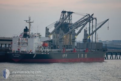
IVS KESTREL
Cargo
Current Trip
MA AGA / MOROCCO
| Time Travelled | 20 days |
|---|---|
| Remaining Time | --- |
| Distance Travelled | 5178.74 nm |
| Remaining Distance | --- |
| AVG Speed | 10.9 Noeuds |
| MAX Speed | 13.4 Noeuds |
| AVG Wind | 11.1 knots |
| MAX Wind | 33.3 knots |
| MIN Temp | 14.1°C / 57.38°F |
| MAX Temp | 37.7°C / 99.86°F |
| Tirant d eau | 10 m |
| Position reçue | 12 h, 57 m depuis |
Current Position
| Longitude | --- |
|---|---|
| Latitude | --- |
| Etat | Under way using engine |
| Vitesse | 11.9 Noeuds |
| Parcours | 95.7° |
| Zone | North Atlantic Ocean |
| Station | T-AIS |
| Position reçue | 12 h, 57 m depuis |
Info
Information
The current position of IVS KESTREL is in North Atlantic Ocean with coordinates 30.28346° / -10.09978° as reported on 2025-12-10 06:50 by AIS to our vessel tracker app. The vessel's current speed is 11.9 Noeuds
The vessel IVS KESTREL (IMO: 9700926, MMSI: 538010647) is a Cargo It's sailing under the flag of [MH] Marshall Is.
In this page you can find informations about the vessels current position, last detected port calls, and current voyage information. If the vessels is not in coverage by AIS you will find the latest position.
The current position of IVS KESTREL is detected by our AIS receivers and we are not responsible for the reliability of the data. The last position was recorded while the vessel was in Coverage by the Ais receivers of our vessel tracking app.
The current draught of IVS KESTREL as reported by AIS is 10 meters
Weather
| Temperature | 16.7°C / 62.06°F |
|---|---|
| Wind Speed | 10 knots |
| Direction | 344° NNW |
| Pressure | 1021.6 hPa |
| Humidity | 67.5 % |
| Cloud Coverage | 89 % |
Featured Company
Events
| Heure | Evenement | Détails | Position/ Destination | Info |
|---|---|---|---|---|
| 2025-12-10 09:20 | Arret | 3.62 nm, North West of AGADIR |
30.45167 / -9.69167
MA AGA / MOROCCO
|
Vitesse: Parcours: -1° |
| 2025-12-10 06:53 | Etat Changé | Default Under way using engine |
30.28167 / -10.08667
MA AGA / MOROCCO
|
Vitesse: 11.9 kn Parcours: 95.7° |
| 2025-12-10 06:50 | Etat Changé | Under way using engine Default |
30.28346 / -10.09978
MA AGA / MOROCCO
|
Vitesse: 11.9 kn Parcours: 93° |
| 2025-12-10 06:50 | Hors de la zone couverte |
30.28346 / -10.09978
North Atlantic Ocean
MA AGA / MOROCCO
|
Vitesse: 11.9 kn Parcours: 95.7° |
|
| 2025-12-10 06:41 | Etat Changé | Default Under way using engine |
30.28419 / -10.13036
MA AGA / MOROCCO
|
Vitesse: 11.7 kn Parcours: 80.8° |
| 2025-12-10 06:27 | Etat Changé | Under way using engine Default |
30.27865 / -10.18367
MA AGA / MOROCCO
|
Vitesse: 11 kn Parcours: 80° |
| 2025-12-10 06:20 | Etat Changé | Default Under way using engine |
30.27333 / -10.21167
MA AGA / MOROCCO
|
Vitesse: 11.7 kn Parcours: 80.1° |
| 2025-12-10 06:01 | Etat Changé | Under way using engine Default |
30.26497 / -10.28285
MA AGA / MOROCCO
|
Vitesse: 12 kn Parcours: 81° |
| 2025-12-10 05:36 | Etat Changé | Default Under way using engine |
30.25027 / -10.37739
MA AGA / MOROCCO
|
Vitesse: 12 kn Parcours: 80.7° |
| 2025-12-10 05:29 | Etat Changé | Under way using engine Default |
30.24601 / -10.40670
MA AGA / MOROCCO
|
Vitesse: 12 kn Parcours: 81° |