
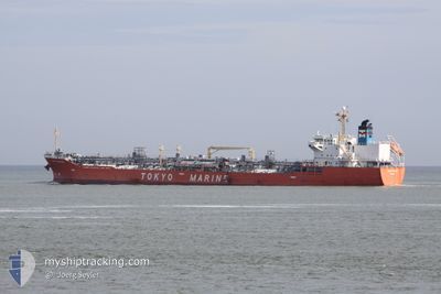
GINGA PANTHER
Oil/Chemical Tanker
Current Trip
| Time Travelled | 14 h, 38 mins |
|---|---|
| Remaining Time | --- |
| Distance Travelled | 111.59 nm |
| Remaining Distance | --- |
| AVG Speed | 10.5 Noeuds |
| MAX Speed | 14.3 Noeuds |
| AVG Wind | 18.2 knots |
| MAX Wind | 23.7 knots |
| MIN Temp | 23.4°C / 74.12°F |
| MAX Temp | 27.6°C / 81.68°F |
| Tirant d eau | 8 m |
| Position reçue | 6 h, 28 m depuis |
Current Position
| Longitude | -94.19778° |
|---|---|
| Latitude | 29.28982° |
| Etat | Under way using engine |
| Vitesse | 12.6 Noeuds |
| Parcours | 228° |
| Zone | Gulf of Mexico |
| Station | T-AIS |
| Position reçue | 6 h, 28 m depuis |
Info
Information
The current position of GINGA PANTHER is in Gulf of Mexico with coordinates 29.28982° / -94.19778° as reported on 2024-04-29 05:37 by AIS to our vessel tracker app. The vessel's current speed is 12.6 Noeuds
The vessel GINGA PANTHER (IMO: 9379985, MMSI: 372792000) is a Oil/Chemical Tanker that was built in 2007 ( 17 Age ). It's sailing under the flag of [PA] Panama.
In this page you can find informations about the vessels current position, last detected port calls, and current voyage information. If the vessels is not in coverage by AIS you will find the latest position.
The current position of GINGA PANTHER is detected by our AIS receivers and we are not responsible for the reliability of the data. The last position was recorded while the vessel was in Coverage by the Ais receivers of our vessel tracking app.
The current draught of GINGA PANTHER as reported by AIS is 8 meters
Weather
| Temperature | 24°C / 75.2°F |
|---|---|
| Wind Speed | 24 knots |
| Direction | 184° S |
| Pressure | 1009.4 hPa |
| Humidity | 88.8 % |
| Cloud Coverage | 100 % |
Featured Company
Last Port Calls
| Port | Arrival | Departure | Time In Port |
|---|---|---|---|
| 2024-04-27 23:18 | 2024-04-28 21:27 | 22 h | |
| 2024-04-19 10:09 | 2024-04-21 18:20 | 2 d | |
| 2024-04-14 13:32 | 2024-04-18 19:44 | 4 d | |
| 2024-03-31 06:23 | 2024-04-04 07:03 | 4 d | |
| 2024-03-13 16:30 | 2024-03-14 08:10 | 15 h | |
| 2024-03-11 17:47 | 2024-03-12 08:26 | 14 h | |
| 2024-03-07 11:40 | 2024-03-08 19:10 | 1 d | |
| 2024-03-01 01:38 | 2024-03-03 07:15 | 2 d | |
| 2024-02-24 17:18 | 2024-02-25 23:15 | 1 d | |
| 2024-02-13 04:33 | 2024-02-13 18:53 | 14 h |
Most Visited Ports (Last year)
| Port | Arrivals | |
|---|---|---|
| 12 | ||
| 8 | ||
| 5 | ||
| 4 | ||
| 4 | ||
| 4 |
Last Trips
| Origin | Departure | Destination | Arrival | Distance | |
|---|---|---|---|---|---|
| 2024-04-21 14:20 | 2024-04-27 18:18 | 1959.50 nm | |||
| 2024-04-18 15:44 | 2024-04-19 06:09 | 128.79 nm | |||
| 2024-04-04 01:03 | 2024-04-14 09:32 | 1840.72 nm | |||
| 2024-03-14 05:10 | 2024-03-31 00:23 | 3517.40 nm | |||
| 2024-03-12 05:26 | 2024-03-13 13:30 | 71.24 nm | |||
| 2024-03-08 16:10 | 2024-03-11 14:47 | 661.79 nm | |||
| 2024-03-03 02:15 | 2024-03-07 08:40 | 794.27 nm | |||
| 2024-02-25 18:15 | 2024-02-29 20:38 | 1188.64 nm | |||
| 2024-02-13 12:53 | 2024-02-24 12:18 | 1973.68 nm | |||
| 2024-02-11 22:22 | 2024-02-12 22:33 | 48.31 nm |
Events
| Heure | Evenement | Détails | Position/ Destination | Info |
|---|---|---|---|---|
| 2024-04-29 08:06 | Arret | 12.76 nm, South East of BOLIVAR |
29.29335 / -94.55032
USHOU
|
Vitesse: Parcours: 98° |
| 2024-04-29 05:42 | Etat Changé | Default Under way using engine |
29.27718 / -94.21343
USHOU
|
Vitesse: 12.6 kn Parcours: 228° |
| 2024-04-29 05:37 | Hors de la zone couverte |
29.28982 / -94.19778
Gulf of Mexico
USHOU
|
Vitesse: 12.6 kn Parcours: 228° |
|
| 2024-04-29 01:52 | Changement d'ETA | 2024/04/29 08:00 2024/04/29 07:00 |
29.60612 / -93.37165
USHOU
|
Vitesse: 12.2 kn Parcours: 225° |
| 2024-04-28 22:40 | Tirant d'eau modifié | 8 7.2 |
30.08458 / -93.32563
USHOU
|
Vitesse: 6.8 kn Parcours: 184° |
| 2024-04-28 22:40 | Changement de destination | USHOU USLCH |
30.08458 / -93.32563
USHOU
|
Vitesse: 6.8 kn Parcours: 184° |
| 2024-04-28 22:40 | Changement d'ETA | 2024/04/29 07:00 2024/04/27 19:00 |
30.08458 / -93.32563
USHOU
|
Vitesse: 6.8 kn Parcours: 184° |
| 2024-04-28 21:27 | Etat Changé | Under way using engine Default |
30.19943 / -93.28410
USLCH
|
Vitesse: 5.2 kn Parcours: 240° |
| 2024-04-28 21:27 | PORT DE DEPART |
|
30.19943 / -93.28410
USLCH
|
Vitesse: 5.2 kn Parcours: 240° |
| 2024-04-28 21:21 | Etat Changé | Default Under way using engine |
30.20577 / -93.27420
[US] LAKE CHARLES
|
Vitesse: 5.3 kn Parcours: 242° |