
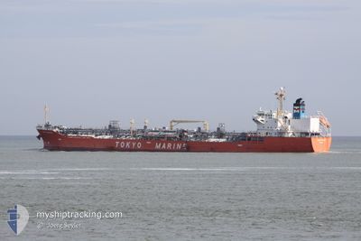
GINGA PANTHER
Oil/Chemical Tanker
Current Trip
| Time Travelled | 3 days |
|---|---|
| Remaining Time | 2 days |
| Distance Travelled | 1047.27 nm |
| Remaining Distance | 882.97 nm |
| AVG Speed | 12.5 Knots |
| MAX Speed | 14.7 Knots |
| AVG Wind | 11.1 knots |
| MAX Wind | 19.7 knots |
| MIN Temp | 26.7°C / 80.06°F |
| MAX Temp | 29.2°C / 84.56°F |
| Draught | 7.2 m |
| Position Received | 3 d ago |
Current Position
| Longitude | -67.28625° |
|---|---|
| Latitude | 17.68987° |
| Status | Under way using engine |
| Speed | 13.4 Knots |
| Course | 251° |
| Area | Caribbean Sea |
| Station | T-AIS |
| Position Received | 3 d ago |
Info
Information
The current position of GINGA PANTHER is in Caribbean Sea with coordinates 17.68987° / -67.28625° as reported on 2024-04-21 21:44 by AIS to our vessel tracker app. The vessel's current speed is 13.4 Knots and is heading at the port of LAKE CHARLES. The estimated time of arrival as calculated by MyShipTracking vessel tracking app is 2024-04-27 15:09 LT
The vessel GINGA PANTHER (IMO: 9379985, MMSI: 372792000) is a Oil/Chemical Tanker that was built in 2007 ( 17 years old ). It's sailing under the flag of [PA] Panama.
In this page you can find informations about the vessels current position, last detected port calls, and current voyage information. If the vessels is not in coverage by AIS you will find the latest position.
The current position of GINGA PANTHER is detected by our AIS receivers and we are not responsible for the reliability of the data. The last position was recorded while the vessel was in Coverage by the Ais receivers of our vessel tracking app.
The current draught of GINGA PANTHER as reported by AIS is 7.2 meters
Weather
| Temperature | 27.2°C / 80.96°F |
|---|---|
| Wind Speed | 11 knots |
| Direction | 75° ENE |
| Pressure | 1015.6 hPa |
| Humidity | 75.5 % |
| Cloud Coverage | 5 % |
Featured Company
Last Port Calls
| Port | Arrival | Departure | Time In Port |
|---|---|---|---|
| 2024-04-19 10:09 | 2024-04-21 18:20 | 2 d | |
| 2024-04-14 13:32 | 2024-04-18 19:44 | 4 d | |
| 2024-03-31 06:23 | 2024-04-04 07:03 | 4 d | |
| 2024-03-13 16:30 | 2024-03-14 08:10 | 15 h | |
| 2024-03-11 17:47 | 2024-03-12 08:26 | 14 h | |
| 2024-03-07 11:40 | 2024-03-08 19:10 | 1 d | |
| 2024-03-01 01:38 | 2024-03-03 07:15 | 2 d | |
| 2024-02-24 17:18 | 2024-02-25 23:15 | 1 d | |
| 2024-02-13 04:33 | 2024-02-13 18:53 | 14 h | |
| 2024-02-09 20:45 | 2024-02-12 04:22 | 2 d |
Most Visited Ports (Last year)
| Port | Arrivals | |
|---|---|---|
| 12 | ||
| 8 | ||
| 5 | ||
| 4 | ||
| 4 | ||
| 4 |
Last Trips
| Origin | Departure | Destination | Arrival | Distance | |
|---|---|---|---|---|---|
| 2024-04-18 15:44 | 2024-04-19 06:09 | 128.79 nm | |||
| 2024-04-04 01:03 | 2024-04-14 09:32 | 1840.72 nm | |||
| 2024-03-14 05:10 | 2024-03-31 00:23 | 3517.40 nm | |||
| 2024-03-12 05:26 | 2024-03-13 13:30 | 71.24 nm | |||
| 2024-03-08 16:10 | 2024-03-11 14:47 | 661.79 nm | |||
| 2024-03-03 02:15 | 2024-03-07 08:40 | 794.27 nm | |||
| 2024-02-25 18:15 | 2024-02-29 20:38 | 1188.64 nm | |||
| 2024-02-13 12:53 | 2024-02-24 12:18 | 1973.68 nm | |||
| 2024-02-11 22:22 | 2024-02-12 22:33 | 48.31 nm | |||
| 2024-02-09 13:00 | 2024-02-09 14:45 | 18.60 nm |
Events
| Time | Event | Details | Position / Dest | Info |
|---|---|---|---|---|
| 2024-04-21 22:02 | Status Changed | Default Under way using engine |
17.66820 / -67.35059
USLCH
|
Speed: 13.4 kn Course: 251° |
| 2024-04-21 21:44 | OUT of Coverage |
17.68987 / -67.28625
Caribbean Sea
USLCH
|
Speed: 13.4 kn Course: 251° |
|
| 2024-04-21 21:39 | Status Changed | Under way using engine Default |
17.69560 / -67.26903
USLCH
|
Speed: 13.5 kn Course: 250° |
| 2024-04-21 21:27 | Status Changed | Default Under way using engine |
17.71137 / -67.22290
USLCH
|
Speed: 13.5 kn Course: 250° |
| 2024-04-21 18:39 | ETA Changed | 2024/04/27 21:00 2024/04/28 15:00 |
17.93855 / -66.63215
USLCH
|
Speed: 9 kn Course: 197° |
| 2024-04-21 18:21 | START Moving | 0.24 nm, South West of PONCE |
17.96488 / -66.62535
USLCH
|
Speed: 3.1 kn Course: 182° |
| 2024-04-21 18:20 | PORT DEPARTURE |
|
17.96578 / -66.62487
USLCH
|
Speed: 2.4 kn Course: 189° |
| 2024-04-21 18:19 | Status Changed | Under way using engine Moored |
17.96647 / -66.62440
[PR] PONCE
|
Speed: 0.3 kn Course: 176° |
| 2024-04-21 18:03 | Status Changed | Moored Default |
17.96717 / -66.62138
[PR] PONCE
|
Speed: Course: 39° |
| 2024-04-21 18:00 | Status Changed | Default Moored |
17.96713 / -66.62141
[PR] PONCE
|
Speed: 0.1 kn Course: 39° |