
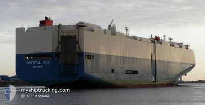
CRYSTAL ACE
Cargo
Current Trip
| Time Travelled | 2 days |
|---|---|
| Remaining Time | 8 h, 41 mins |
| Distance Travelled | 904.72 nm |
| Remaining Distance | 299.28 nm |
| AVG Speed | 14.8 Noeuds |
| MAX Speed | 17.6 Noeuds |
| AVG Wind | 18.5 knots |
| MAX Wind | 23.9 knots |
| MIN Temp | 21.4°C / 70.52°F |
| MAX Temp | 27.5°C / 81.5°F |
| Tirant d eau | 8 m |
| Position reçue | 16 h, 21 m depuis |
Current Position
| Longitude | -76.98975° |
|---|---|
| Latitude | 26.99166° |
| Etat | Under way using engine |
| Vitesse | 12.9 Noeuds |
| Parcours | 321° |
| Zone | North Atlantic Ocean |
| Station | T-AIS |
| Position reçue | 16 h, 21 m depuis |
Info
Information
The current position of CRYSTAL ACE is in North Atlantic Ocean with coordinates 26.99166° / -76.98975° as reported on 2024-04-28 06:24 by AIS to our vessel tracker app. The vessel's current speed is 12.9 Noeuds and is heading at the port of JACKSONVILLE. The estimated time of arrival as calculated by MyShipTracking vessel tracking app is 2024-04-29 07:27 LT
The vessel CRYSTAL ACE (MMSI: 538004619) is a Cargo It's sailing under the flag of [MH] Marshall Is.
In this page you can find informations about the vessels current position, last detected port calls, and current voyage information. If the vessels is not in coverage by AIS you will find the latest position.
The current position of CRYSTAL ACE is detected by our AIS receivers and we are not responsible for the reliability of the data. The last position was recorded while the vessel was in Coverage by the Ais receivers of our vessel tracking app.
The current draught of CRYSTAL ACE as reported by AIS is 8 meters
Weather
| Temperature | 22.6°C / 72.68°F |
|---|---|
| Wind Speed | 13 knots |
| Direction | 105° ESE |
| Pressure | 1021.9 hPa |
| Humidity | 60.1 % |
| Cloud Coverage | 100 % |
Featured Company
Last Port Calls
| Port | Arrival | Departure | Time In Port |
|---|---|---|---|
| 2024-04-24 15:10 | 2024-04-26 09:18 | 1 d | |
| 2024-04-22 10:06 | 2024-04-22 18:39 | 8 h | |
| 2024-03-30 05:26 | 2024-03-31 16:02 | 1 d | |
| 2024-03-27 21:49 | 2024-03-28 21:23 | 23 h | |
| 2024-03-26 21:05 | 2024-03-27 14:25 | 17 h | |
| 2024-03-24 23:36 | 2024-03-26 07:26 | 1 d | |
| 2024-02-23 01:05 | 2024-02-23 17:36 | 16 h | |
| 2024-02-22 08:58 | 2024-02-23 00:34 | 15 h | |
| 2024-02-06 18:16 | 2024-02-07 05:36 | 11 h |
Last Trips
| Origin | Departure | Destination | Arrival | Distance | |
|---|---|---|---|---|---|
| 2024-04-22 14:39 | 2024-04-24 10:10 | 475.91 nm | |||
| 2024-04-01 01:02 | 2024-04-22 06:06 | 8606.16 nm | |||
| 2024-03-29 06:23 | 2024-03-30 14:26 | 534.11 nm | |||
| 2024-03-27 23:25 | 2024-03-28 06:49 | 95.27 nm | |||
| 2024-03-26 16:26 | 2024-03-27 06:05 | 174.77 nm | |||
| 2024-02-23 12:36 | 2024-03-25 08:36 | 10776.90 nm | |||
| 2024-02-22 19:34 | 2024-02-22 20:05 | 0.95 nm | |||
| 2024-02-06 23:36 | 2024-02-22 03:58 | 3941.21 nm | |||
| 2024-01-21 16:44 | 2024-02-06 12:16 | 7139.61 nm |
Events
| Heure | Evenement | Détails | Position/ Destination | Info |
|---|---|---|---|---|
| 2024-04-28 06:34 | Etat Changé | Default Under way using engine |
27.01676 / -77.01440
US JAX
|
Vitesse: 12.9 kn Parcours: 321° |
| 2024-04-28 06:24 | Etat Changé | Under way using engine Default |
26.99166 / -76.98975
US JAX
|
Vitesse: 12.9 kn Parcours: 327° |
| 2024-04-28 06:24 | Hors de la zone couverte |
26.99166 / -76.98975
North Atlantic Ocean
|
Vitesse: 12.9 kn Parcours: 321° |
|
| 2024-04-28 06:21 | Etat Changé | Default Under way using engine |
26.98106 / -76.98170
US JAX
|
Vitesse: 12.9 kn Parcours: 326° |
| 2024-04-28 02:51 | Tirant d'eau modifié | 8 9 |
26.32095 / -76.49524
US JAX
|
Vitesse: 12.9 kn Parcours: 325° |
| 2024-04-28 02:51 | Changement de destination | US JAX JMKIN |
26.32095 / -76.49524
US JAX
|
Vitesse: 12.9 kn Parcours: 325° |
| 2024-04-28 02:24 | Etat Changé | Under way using engine Default |
26.23628 / -76.43290
JMKIN
|
Vitesse: 13.4 kn Parcours: 325° |
| 2024-04-28 02:24 | Dans la zone couverte |
26.24470 / -76.43916
North Atlantic Ocean
|
Vitesse: 12.9 kn Parcours: 326° |
|
| 2024-04-27 19:20 | Etat Changé | Default Under way using engine |
24.81882 / -75.39709
JMKIN
|
Vitesse: 13.8 kn Parcours: 326.2° |
| 2024-04-27 19:19 | Hors de la zone couverte |
24.81510 / -75.39446
North Atlantic Ocean
|
Vitesse: 13.8 kn Parcours: 326.2° |