
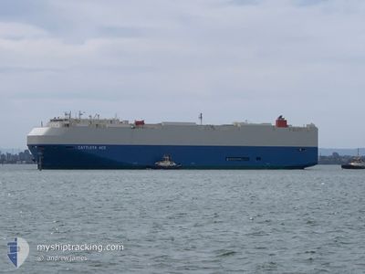
CATTLEYA ACE
Vehicles Carrier
Current Trip
| Time Travelled | 8 h, 53 mins |
|---|---|
| Remaining Time | 3 days |
| Distance Travelled | 126.70 nm |
| Remaining Distance | 1146.72 nm |
| AVG Speed | 14 Noeuds |
| MAX Speed | 19.8 Noeuds |
| AVG Wind | 15.4 knots |
| MAX Wind | 22 knots |
| MIN Temp | 7.2°C / 44.96°F |
| MAX Temp | 10.6°C / 51.08°F |
| Tirant d eau | 9 m |
| Position reçue | 3 m depuis |
Current Position
| Longitude | --- |
|---|---|
| Latitude | --- |
| Etat | Under way using engine |
| Vitesse | 14.5 Noeuds |
| Parcours | 291.9° |
| Zone | The Coastal Waters of Southeast Alaska and British Columbia |
| Station | T-AIS |
| Position reçue | 3 m depuis |
Info
Information
The current position of CATTLEYA ACE is in The Coastal Waters of Southeast Alaska and British Columbia with coordinates 48.43966° / -124.47027° as reported on 2025-12-11 16:18 by AIS to our vessel tracker app. The vessel's current speed is 14.5 Noeuds and is heading at the port of SAN DIEGO. The estimated time of arrival as calculated by MyShipTracking vessel tracking app is 2025-12-14 19:24 LT
The vessel CATTLEYA ACE (IMO: 9544918, MMSI: 431573000) is a Vehicles Carrier that was built in 2011 ( 14 Age ). It's sailing under the flag of [JP] Japan.
In this page you can find informations about the vessels current position, last detected port calls, and current voyage information. If the vessels is not in coverage by AIS you will find the latest position.
The current position of CATTLEYA ACE is detected by our AIS receivers and we are not responsible for the reliability of the data. The last position was recorded while the vessel was in Coverage by the Ais receivers of our vessel tracking app.
The current draught of CATTLEYA ACE as reported by AIS is 9 meters
Weather
| Temperature | 8.9°C / 48.02°F |
|---|---|
| Wind Speed | 8 knots |
| Direction | 264° W |
| Pressure | 1020.3 hPa |
| Humidity | 86.5 % |
| Cloud Coverage | 100 % |
Featured Company
Last Port Calls
| Port | Arrival | Departure | Time In Port |
|---|---|---|---|
| 2025-12-10 07:00 | 2025-12-10 23:28 | 16 h | |
| 2025-12-07 18:23 | 2025-12-09 17:01 | 1 d | |
| 2025-11-23 07:28 | 2025-11-23 15:27 | 7 h | |
| 2025-11-21 07:25 | 2025-11-21 17:23 | 9 h | |
| 2025-11-19 07:12 | 2025-11-19 17:25 | 10 h | |
| 2025-11-17 06:53 | 2025-11-18 17:16 | 1 d | |
| 2025-11-02 23:36 | 2025-11-03 10:12 | 10 h | |
| 2025-10-31 10:02 | 2025-11-01 00:07 | 14 h | |
| 2025-10-30 02:54 | 2025-10-30 08:16 | 5 h | |
| 2025-10-27 13:32 | 2025-10-28 03:03 | 13 h |
Last Trips
| Origin | Departure | Destination | Arrival | Distance | |
|---|---|---|---|---|---|
| 2025-12-09 17:01 | 2025-12-10 07:00 | 179.48 nm | |||
| 2025-11-23 15:27 | 2025-12-07 18:23 | 4883.95 nm | |||
| 2025-11-21 17:23 | 2025-11-23 07:28 | 382.39 nm | |||
| 2025-11-19 17:25 | 2025-11-21 07:25 | 357.47 nm | |||
| 2025-11-18 17:16 | 2025-11-19 07:12 | 175.26 nm | |||
| 2025-11-03 10:12 | 2025-11-17 06:53 | 5969.17 nm | |||
| 2025-11-01 00:07 | 2025-11-02 23:36 | 715.80 nm | |||
| 2025-10-30 08:16 | 2025-10-31 10:02 | 312.45 nm | |||
| 2025-10-28 03:03 | 2025-10-30 02:54 | 367.29 nm | |||
| 2025-10-27 09:09 | 2025-10-27 13:32 | 49.52 nm |
Events
| Heure | Evenement | Détails | Position/ Destination | Info |
|---|---|---|---|---|
| 2025-12-11 16:01 | Etat Changé | Under way using engine Default |
48.41459 / -124.37640
US SAN
|
Vitesse: 14.8 kn Parcours: 292° |
| 2025-12-11 15:59 | Etat Changé | Default Under way using engine |
48.41107 / -124.36337
US SAN
|
Vitesse: 14.6 kn Parcours: 291.2° |
| 2025-12-11 11:37 | Changement de zone | Canadian part of the The Coastal Waters of Southeast Alaska and British Columbia United States part of the The Coastal Waters of Southeast Alaska and British Columbia |
48.51335 / -123.20963
The Coastal Waters of Southeast Alaska and British Columbia
US SAN
|
Vitesse: 19.3 kn Parcours: 174.3° |
| 2025-12-11 11:04 | Changement de zone | United States part of the The Coastal Waters of Southeast Alaska and British Columbia Canadian part of the The Coastal Waters of Southeast Alaska and British Columbia |
48.68543 / -123.26015
The Coastal Waters of Southeast Alaska and British Columbia
US SAN
|
Vitesse: 17.6 kn Parcours: 170.4° |
| 2025-12-11 10:28 | Changement de zone | Canadian part of the The Coastal Waters of Southeast Alaska and British Columbia United States part of the The Coastal Waters of Southeast Alaska and British Columbia |
48.77914 / -123.02807
The Coastal Waters of Southeast Alaska and British Columbia
US SAN
|
Vitesse: 18.5 kn Parcours: 224.3° |
| 2025-12-11 10:22 | Changement de zone | United States part of the The Coastal Waters of Southeast Alaska and British Columbia Canadian part of the The Coastal Waters of Southeast Alaska and British Columbia |
48.80378 / -123.00292
The Coastal Waters of Southeast Alaska and British Columbia
US SAN
|
Vitesse: 18.2 kn Parcours: 180.1° |
| 2025-12-11 09:52 | Changement de zone | Canadian part of the The Coastal Waters of Southeast Alaska and British Columbia United States part of the The Coastal Waters of Southeast Alaska and British Columbia |
48.91746 / -123.17451
The Coastal Waters of Southeast Alaska and British Columbia
US SAN
|
Vitesse: 19.8 kn Parcours: 133.7° |
| 2025-12-11 09:37 | Changement de zone | United States part of the The Coastal Waters of Southeast Alaska and British Columbia Canadian part of the The Coastal Waters of Southeast Alaska and British Columbia |
48.97622 / -123.26286
The Coastal Waters of Southeast Alaska and British Columbia
US SAN
|
Vitesse: 19.6 kn Parcours: 135.2° |
| 2025-12-11 07:28 | PORT DE DEPART |
|
49.16855 / -122.92918
US SAN
|
Vitesse: 10.6 kn Parcours: 215° |
| 2025-12-11 07:21 | Démarrage |
49.18371 / -122.92114
[CA] ANNACIS ISLAND
|
Vitesse: 3.2 kn Parcours: 198° |