
AXIOS
Cargo
Current Trip
BR SSZ
| Time Travelled | 8 days |
|---|---|
| Remaining Time | --- |
| Distance Travelled | 2352.04 nm |
| Remaining Distance | --- |
| AVG Speed | 11.2 Noeuds |
| MAX Speed | 13 Noeuds |
| AVG Wind | 10.4 knots |
| MAX Wind | 24 knots |
| MIN Temp | 23.3°C / 73.94°F |
| MAX Temp | 29°C / 84.2°F |
| Tirant d eau | 6.8 m |
| Position reçue | 6 d depuis |
Current Position
| Longitude | -40.67150° |
|---|---|
| Latitude | -22.22275° |
| Etat | Under way using engine |
| Vitesse | 10.2 Noeuds |
| Parcours | 45.3° |
| Zone | South Atlantic Ocean |
| Station | T-AIS |
| Position reçue | 6 d depuis |
Info
Information
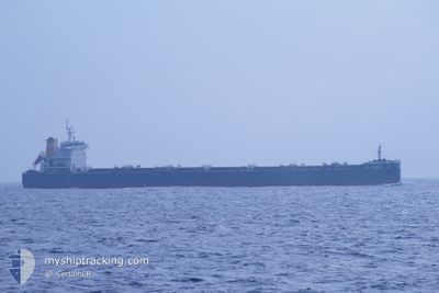
The current position of AXIOS is in South Atlantic Ocean with coordinates -22.22275° / -40.67150° as reported on 2024-05-07 15:36 by AIS to our vessel tracker app. The vessel's current speed is 10.2 Noeuds
The vessel AXIOS (IMO: 9706542, MMSI: 538007138) is a Cargo It's sailing under the flag of [MH] Marshall Is.
In this page you can find informations about the vessels current position, last detected port calls, and current voyage information. If the vessels is not in coverage by AIS you will find the latest position.
The current position of AXIOS is detected by our AIS receivers and we are not responsible for the reliability of the data. The last position was recorded while the vessel was in Coverage by the Ais receivers of our vessel tracking app.
The current draught of AXIOS as reported by AIS is 6.8 meters
Weather
| Temperature | 27.2°C / 80.96°F |
|---|---|
| Wind Speed | 13 knots |
| Direction | 34° NE |
| Pressure | 1012 hPa |
| Humidity | 77.2 % |
| Cloud Coverage | 96 % |
Featured Company
Last Trips
| Origin | Departure | Destination | Arrival | Distance |
|---|
Events
| Heure | Evenement | Détails | Position/ Destination | Info |
|---|---|---|---|---|
| 2024-05-07 15:40 | Etat Changé | Default Under way using engine |
-22.21370 / -40.66254
BR SSZ
|
Vitesse: 10.2 kn Parcours: 45.3° |
| 2024-05-07 15:36 | Etat Changé | Under way using engine Default |
-22.22275 / -40.67150
BR SSZ
|
Vitesse: 10.2 kn Parcours: 49° |
| 2024-05-07 15:36 | Hors de la zone couverte |
-22.22275 / -40.67150
South Atlantic Ocean
|
Vitesse: 10.2 kn Parcours: 45.3° |
|
| 2024-05-07 15:32 | Etat Changé | Default Under way using engine |
-22.22968 / -40.67920
BR SSZ
|
Vitesse: 10.2 kn Parcours: 48.5° |
| 2024-05-07 15:17 | Etat Changé | Under way using engine Default |
-22.25811 / -40.71397
BR SSZ
|
Vitesse: 10.2 kn Parcours: 44° |
| 2024-05-07 15:13 | Dans la zone couverte |
-22.25811 / -40.71397
South Atlantic Ocean
|
Vitesse: 10.1 kn Parcours: 48.4° |
|
| 2024-05-06 19:37 | Etat Changé | Default Under way using engine |
-24.15895 / -43.63726
BR SSZ
|
Vitesse: 10.1 kn Parcours: 55° |
| 2024-05-06 19:37 | Etat Changé | Under way using engine Default |
-24.15919 / -43.63764
BR SSZ
|
Vitesse: 10.1 kn Parcours: 55° |
| 2024-05-06 19:37 | Hors de la zone couverte |
-24.15919 / -43.63764
South Atlantic Ocean
|
Vitesse: 10.1 kn Parcours: 55° |
|
| 2024-05-06 19:20 | Dans la zone couverte |
-24.15919 / -43.63764
South Atlantic Ocean
|
Vitesse: 10.1 kn Parcours: 55° |