
AXIOS
Cargo
Current Trip
| Time Travelled | --- |
|---|---|
| Remaining Time | 9 days |
| Distance Travelled | --- |
| Remaining Distance | 2635.61 nm |
| AVG Speed | --- |
| MAX Speed | --- |
| AVG Wind | --- |
| MAX Wind | --- |
| MIN Temp | --- |
| MAX Temp | --- |
| Diepgang | 6.8 M |
| Positie ontvangen | 2 d geleden |
Current Position
| Lengtegraad | 18.26917° |
|---|---|
| Breedtegraat | -34.73663° |
| Status | Under way using engine |
| Snelheid | 12.5 Knopen |
| Koers | 278.1° |
| Gebied | South Atlantic Ocean |
| Station | T-AIS |
| Positie ontvangen | 2 d geleden |
Info
Information
The current position of AXIOS is in South Atlantic Ocean with coordinates -34.73663° / 18.26917° as reported on 2024-04-13 11:04 by AIS to our vessel tracker app. The vessel's current speed is 12.5 Knopen and is heading at the port of SANTOS. The estimated time of arrival as calculated by MyShipTracking vessel tracking app is 2024-04-25 15:43 LT
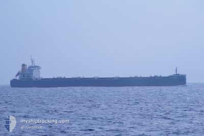
The vessel AXIOS (IMO: 9706542, MMSI: 538007138) is a Cargo It's sailing under the flag of [MH] Marshall Is.
In this page you can find informations about the vessels current position, last detected port calls, and current voyage information. If the vessels is not in coverage by AIS you will find the latest position.
The current position of AXIOS is detected by our AIS receivers and we are not responsible for the reliability of the data. The last position was recorded while the vessel was in Coverage by the Ais receivers of our vessel tracking app.
The current draught of AXIOS as reported by AIS is 6.8 meters
Weather
| Temperature | 20.8°C / 69.44°F |
|---|---|
| Wind Speed | 15 knots |
| Direction | 330° NNW |
| Pressure | 1016.6 hPa |
| Humidity | 88.7 % |
| Cloud Coverage | 100 % |
Featured Company
Events
| Tijd | Evenement | Details | Positie / Bestemming | Info |
|---|---|---|---|---|
| 2024-04-13 11:04 | Buitenbereik |
-34.73663 / 18.26917
South Atlantic Ocean
BR SSZ
|
Snelheid: 12.5 kn Koers: 278.1° |
|
| 2024-04-13 10:34 | Status Changed | Under way using engine Default |
-34.75212 / 18.39331
BR SSZ
|
Snelheid: 12.3 kn Koers: 280° |
| 2024-04-13 10:26 | Status Changed | Default Under way using engine |
-34.75722 / 18.42686
BR SSZ
|
Snelheid: 12.8 kn Koers: 280.4° |
| 2024-04-13 09:47 | Status Changed | Under way using engine Default |
-34.78294 / 18.58914
BR SSZ
|
Snelheid: 12.6 kn Koers: 281° |
| 2024-04-13 09:47 | Binnenbereik |
-34.78294 / 18.58914
South Atlantic Ocean
BR SSZ
|
Snelheid: 12.8 kn Koers: 279.3° |
|
| 2024-04-13 08:43 | Status Changed | Default Under way using engine |
-34.82488 / 18.85633
BR SSZ
|
Snelheid: 12.3 kn Koers: 280.8° |
| 2024-04-13 08:33 | Buitenbereik |
-34.83047 / 18.89611
South Atlantic Ocean
BR SSZ
|
Snelheid: 12.3 kn Koers: 280.8° |
|
| 2024-04-13 07:13 | Draught Changed | 6.8 14.8 |
-34.87321 / 19.21371
BR SSZ
|
Snelheid: 11.6 kn Koers: 278.4° |
| 2024-04-13 07:13 | Destination Changed | BR SSZ VIZAG INDIA |
-34.87321 / 19.21371
BR SSZ
|
Snelheid: 11.6 kn Koers: 278.4° |
| 2024-04-13 07:13 | ETA Changed | 2024/04/25 15:00 2024/03/19 08:00 |
-34.87321 / 19.21371
BR SSZ
|
Snelheid: 11.6 kn Koers: 278.4° |