
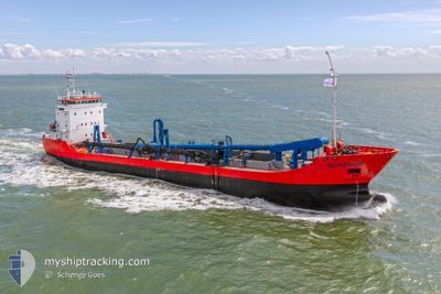
SCHENGE
General Cargo
Current Trip
| Time Travelled | 10 days |
|---|---|
| Remaining Time | --- |
| Distance Travelled | 930.47 nm |
| Remaining Distance | 26.67 nm |
| AVG Speed | 8.7 Knots |
| MAX Speed | 14.3 Knots |
| AVG Wind | 14.8 knots |
| MAX Wind | 26.2 knots |
| MIN Temp | 3.3°C / 37.94°F |
| MAX Temp | 14°C / 57.2°F |
| Dybgang | 6.5 m |
| Position Modtaget | 4 m siden |
Current Position
| Longitude | --- |
|---|---|
| Latitude | --- |
| Status | At anchor |
| Fart | 1.7 Knots |
| Kurs | 215° |
| Område | North Sea |
| Station | T-AIS |
| Position Modtaget | 4 m siden |
Info
Information
The current position of SCHENGE is in North Sea with coordinates 51.62322° / 3.30019° as reported on 2025-12-10 22:37 by AIS to our vessel tracker app. The vessel's current speed is 1.7 Knots and is heading at the port of TERNEUZEN. The estimated time of arrival as calculated by MyShipTracking vessel tracking app is 2025-12-10 13:00 LT
The vessel SCHENGE (IMO: 9108829, MMSI: 244146000) is a General Cargo that was built in 1996 ( 29 år gamle ). It's sailing under the flag of [NL] Netherlands.
In this page you can find informations about the vessels current position, last detected port calls, and current voyage information. If the vessels is not in coverage by AIS you will find the latest position.
The current position of SCHENGE is detected by our AIS receivers and we are not responsible for the reliability of the data. The last position was recorded while the vessel was in Coverage by the Ais receivers of our vessel tracking app.
The current draught of SCHENGE as reported by AIS is 6.5 meters
Weather
| Temperature | 10.2°C / 50.36°F |
|---|---|
| Wind Speed | 17 knots |
| Direction | 240° WSW |
| Pressure | 1021.7 hPa |
| Humidity | 90.9 % |
| Cloud Coverage | --- |
Featured Company
Most Visited Ports (Last year)
| Port | Arrivals | |
|---|---|---|
| 22 |
Events
| Tid | Hændelsen | Detaljer | Position / Dest | Info |
|---|---|---|---|---|
| 2025-12-10 19:02 | START Sejllads | 1.84 nm, West of ELLEWOUTSDIJK |
51.38380 / 3.76871
DRDGEAREA<>EVERINGEN
|
Fart: 5.1 kn Kurs: 343.5° |
| 2025-12-10 18:02 | STOP Sejllads | 1.84 nm, West of ELLEWOUTSDIJK |
51.38185 / 3.76900
DRDGEAREA<>EVERINGEN
|
Fart: Kurs: 284° |
| 2025-12-10 17:51 | START Sejllads | 1.96 nm, West of ELLEWOUTSDIJK |
51.38460 / 3.76538
DRDGEAREA<>EVERINGEN
|
Fart: 3.1 kn Kurs: 154° |
| 2025-12-10 11:20 | STOP Sejllads | 2.05 nm, South East of ZEELAND REFINERY |
51.38615 / 3.76258
DRDGEAREA<>EVERINGEN
|
Fart: 0.3 kn Kurs: 113° |
| 2025-12-10 11:14 | ETA er ændret | 2025/12/10 12:00 2025/12/07 15:00 |
51.38912 / 3.75693
DRDGEAREA<>EVERINGEN
|
Fart: 5.2 kn Kurs: 129.5° |
| 2025-12-10 11:14 | Status er ændret | At anchor Under way using engine |
51.38912 / 3.75693
DRDGEAREA<>EVERINGEN
|
Fart: 5.4 kn Kurs: 128.4° |
| 2025-12-10 10:17 | START Sejllads | 1.61 nm, North East of BRESKENS |
51.41901 / 3.59464
DRDGEAREA<>EVERINGEN
|
Fart: 3.1 kn Kurs: 73° |
| 2025-12-10 10:00 | STOP Sejllads | 1.5 nm, North East of BRESKENS |
51.41774 / 3.59257
DRDGEAREA<>EVERINGEN
|
Fart: 0.3 kn Kurs: 96° |
| 2025-12-10 01:30 | START Sejllads | 2.05 nm, South East of ZEELAND REFINERY |
51.38612 / 3.76232
DRDGEAREA<>EVERINGEN
|
Fart: 5.1 kn Kurs: 309.6° |
| 2025-12-10 00:37 | STOP Sejllads | 1.96 nm, West of ELLEWOUTSDIJK |
51.38544 / 3.76530
DRDGEAREA<>EVERINGEN
|
Fart: 0.3 kn Kurs: 262° |