
SCHENGE
General Cargo
Current Trip
EVERINGEN<->DREDGE
| Time Travelled | 12 days |
|---|---|
| Remaining Time | --- |
| Distance Travelled | 1189.66 nm |
| Remaining Distance | --- |
| AVG Speed | 9.1 Noeuds |
| MAX Speed | 16.4 Noeuds |
| AVG Wind | 16.2 knots |
| MAX Wind | 32.9 knots |
| MIN Temp | 4.4°C / 39.92°F |
| MAX Temp | 20.9°C / 69.62°F |
| Tirant d eau | 6.5 m |
| Position reçue | 2 m depuis |
Current Position
| Longitude | 3.75694° |
|---|---|
| Latitude | 51.38935° |
| Etat | At anchor |
| Vitesse | |
| Parcours | 94° |
| Zone | North Sea |
| Station | T-AIS |
| Position reçue | 2 m depuis |
Info
Information
The current position of SCHENGE is in North Sea with coordinates 51.38935° / 3.75694° as reported on 2024-04-19 14:42 by AIS to our vessel tracker app. The vessel's current speed is 0 Noeuds
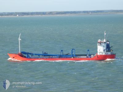
The vessel SCHENGE (IMO: 9108829, MMSI: 244146000) is a General Cargo that was built in 1996 ( 28 Age ). It's sailing under the flag of [NL] Netherlands.
In this page you can find informations about the vessels current position, last detected port calls, and current voyage information. If the vessels is not in coverage by AIS you will find the latest position.
The current position of SCHENGE is detected by our AIS receivers and we are not responsible for the reliability of the data. The last position was recorded while the vessel was in Coverage by the Ais receivers of our vessel tracking app.
The current draught of SCHENGE as reported by AIS is 6.5 meters
Weather
| Temperature | 9.9°C / 49.82°F |
|---|---|
| Wind Speed | 21 knots |
| Direction | 332° NNW |
| Pressure | 1012.7 hPa |
| Humidity | 68.3 % |
| Cloud Coverage | 98 % |
Featured Company
Most Visited Ports (Last year)
| Port | Arrivals | |
|---|---|---|
| 11 | ||
| 5 | ||
| 1 |
Events
| Heure | Evenement | Détails | Position/ Destination | Info |
|---|---|---|---|---|
| 2024-04-19 14:18 | Etat Changé | At anchor Under way using engine |
51.38935 / 3.75692
EVERINGEN<->DREDGE
|
Vitesse: Parcours: 92° |
| 2024-04-19 12:42 | Arret | 1.88 nm, South East of ZEELAND REFINERY |
51.38741 / 3.75773
EVERINGEN<->DREDGE
|
Vitesse: 0.3 kn Parcours: 16° |
| 2024-04-19 10:05 | Etat Changé | Under way using engine Restricted manoeuverability |
51.64320 / 3.31835
EVERINGEN<->DREDGE
|
Vitesse: 2.7 kn Parcours: 330° |
| 2024-04-19 09:04 | Etat Changé | Restricted manoeuverability Under way using engine |
51.63728 / 3.33138
EVERINGEN<->DREDGE
|
Vitesse: 8.4 kn Parcours: 89° |
| 2024-04-19 04:19 | Démarrage | 1.96 nm, West of ELLEWOUTSDIJK |
51.38384 / 3.76545
EVERINGEN<->DREDGE
|
Vitesse: 6.8 kn Parcours: 309° |
| 2024-04-19 01:17 | Arret | 1.86 nm, West of ELLEWOUTSDIJK |
51.38311 / 3.76822
EVERINGEN<->DREDGE
|
Vitesse: 0.3 kn Parcours: 157° |
| 2024-04-18 21:23 | Changement d'ETA | 2024/04/19 03:36 2024/04/19 01:36 |
51.59703 / 3.25437
EVERINGEN<->DREDGE
|
Vitesse: 11.1 kn Parcours: 73° |
| 2024-04-18 21:14 | Etat Changé | Under way using engine Restricted manoeuverability |
51.58787 / 3.21765
EVERINGEN<->DREDGE
|
Vitesse: 4.8 kn Parcours: 28° |
| 2024-04-18 17:38 | Changement d'ETA | 2024/04/19 01:36 2024/04/19 00:14 |
51.60349 / 3.29882
EVERINGEN<->DREDGE
|
Vitesse: 12.8 kn Parcours: 266° |
| 2024-04-18 17:38 | Etat Changé | Restricted manoeuverability Under way using engine |
51.60349 / 3.29882
EVERINGEN<->DREDGE
|
Vitesse: 12.8 kn Parcours: 266° |