
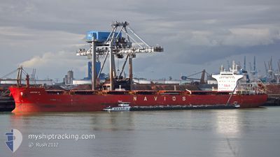
W-NAUTILUS
Bulk Carrier
Current Trip
| Trip Time | 85 days |
|---|---|
| Trip Distance | 6274.63 морская миля |
| AVG Speed | 9.9 Узлы |
| MAX Speed | 14.3 Узлы |
| Осадка | 7.1 м |
| AVG Wind | 10.3 knots |
| MAX Wind | 25 knots |
| MIN Temp | 17.7°C / 63.86°F |
| MAX Temp | 31°C / 87.8°F |
| Позиция Получена | 9 d тому назад |
Current Position
| Долгота | 54.78342° |
|---|---|
| Широта | -20.94533° |
| Статус | Under way using engine |
| Скорость | 9.8 Узлы |
| Курс | 241.8° |
| Район | Indian Ocean |
| Станция | T-AIS |
| Позиция Получена | 9 d тому назад |
Info
Information
The current position of W-NAUTILUS is in Indian Ocean with coordinates -20.94533° / 54.78342° as reported on 2024-05-14 09:50 by AIS to our vessel tracker app. The vessel's current speed is 9.8 Узлы and is currently inside the port of RICHARDS BAY.
The vessel W-NAUTILUS (IMO: 9537915, MMSI: 636017030) is a Bulk Carrier that was built in 2011 ( 13 лет ). It's sailing under the flag of [LR] Liberia.
In this page you can find informations about the vessels current position, last detected port calls, and current voyage information. If the vessels is not in coverage by AIS you will find the latest position.
The current position of W-NAUTILUS is detected by our AIS receivers and we are not responsible for the reliability of the data. The last position was recorded while the vessel was in Coverage by the Ais receivers of our vessel tracking app.
The current draught of W-NAUTILUS as reported by AIS is 7.1 meters
Weather
| Temperature | 16.3°C / 61.34°F |
|---|---|
| Wind Speed | 3 knots |
| Direction | 300° WNW |
| Pressure | 1018.4 hPa |
| Humidity | 61.5 % |
| Cloud Coverage | --- |
Featured Company
Last Port Calls
| Port | Arrival | Departure | Time In Port |
|---|---|---|---|
| 2024-05-23 07:17 |
Most Visited Ports (Last year)
| Port | Arrivals | |
|---|---|---|
| 2 | ||
| 1 | ||
| 1 | ||
| 1 | ||
| 1 | ||
| 1 |
Last Trips
| Origin | Departure | Destination | Arrival | Distance | |
|---|---|---|---|---|---|
| 2024-02-28 01:56 | 2024-05-23 07:17 | 6274.63 морская миля |
Events
| Время | Событие | Детали | Позиция / Направление | Информация |
|---|---|---|---|---|
| 2024-05-23 05:55 | Окончание движения |
-28.79167 / 32.03833
[ZA] RICHARDS BAY
|
Скорость: Курс: -1° |
|
| 2024-05-23 05:17 | Порт |
|
-28.81114 / 32.09576
[ZA] RICHARDS BAY
|
Скорость: 11.8 kn Курс: 289° |
| 2024-05-23 03:59 | Начало движения | 7.72 nm, South East of RICHARDS BAY |
-28.88811 / 32.16267
ZA RCB
|
Скорость: 4.1 kn Курс: 331° |
| 2024-05-22 05:50 | Окончание движения | 8.09 nm, South East of RICHARDS BAY |
-28.89500 / 32.16500
ZA RCB
|
Скорость: Курс: -1° |
| 2024-05-22 05:08 | Начало движения | 9.31 nm, East of RICHARDS BAY |
-28.85895 / 32.21763
ZA RCB
|
Скорость: 8.4 kn Курс: 188° |
| 2024-05-19 01:14 | Окончание движения | 8.94 nm, East of RICHARDS BAY |
-28.84667 / 32.21500
ZA RCB
|
Скорость: Курс: -1° |
| 2024-05-14 09:53 | Статус изменился | Default Under way using engine |
-20.94833 / 54.77500
ZA RCB
|
Скорость: 9.8 kn Курс: 241.8° |
| 2024-05-14 09:50 | Статус изменился | Under way using engine Default |
-20.94533 / 54.78342
ZA RCB
|
Скорость: 9 kn Курс: 242° |
| 2024-05-14 09:50 | Вне покрытия |
-20.94533 / 54.78342
Indian Ocean
ZA RCB
|
Скорость: 9.8 kn Курс: 241.8° |
|
| 2024-05-14 09:44 | Статус изменился | Default Under way using engine |
-20.93667 / 54.79666
ZA RCB
|
Скорость: 9.8 kn Курс: 240.5° |