
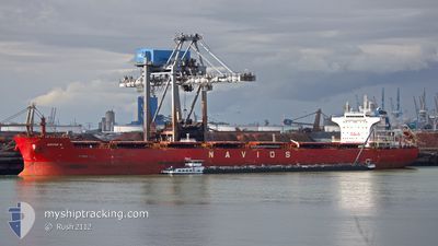
W-NAUTILUS
Bulk Carrier
Current Trip
| Time Travelled | --- |
|---|---|
| Remaining Time | 15 h, 16 mins |
| Distance Travelled | 6033.93 nm |
| Remaining Distance | 206.59 nm |
| AVG Speed | 9.9 Knots |
| MAX Speed | 14.3 Knots |
| AVG Wind | 9.7 knots |
| MAX Wind | 25 knots |
| MIN Temp | 20.6°C / 69.08°F |
| MAX Temp | 31°C / 87.8°F |
| Dybgang | 7.1 m |
| Position Modtaget | 3 d siden |
Current Position
| Longitude | 54.78342° |
|---|---|
| Latitude | -20.94533° |
| Status | Under way using engine |
| Fart | 9.8 Knots |
| Kurs | 241.8° |
| Område | Indian Ocean |
| Station | T-AIS |
| Position Modtaget | 3 d siden |
Info
Information
The current position of W-NAUTILUS is in Indian Ocean with coordinates -20.94533° / 54.78342° as reported on 2024-05-14 09:50 by AIS to our vessel tracker app. The vessel's current speed is 9.8 Knots and is heading at the port of RICHARDS BAY. The estimated time of arrival as calculated by MyShipTracking vessel tracking app is 2024-05-19 02:09 LT
The vessel W-NAUTILUS (IMO: 9537915, MMSI: 636017030) is a Bulk Carrier that was built in 2011 ( 13 år gamle ). It's sailing under the flag of [LR] Liberia.
In this page you can find informations about the vessels current position, last detected port calls, and current voyage information. If the vessels is not in coverage by AIS you will find the latest position.
The current position of W-NAUTILUS is detected by our AIS receivers and we are not responsible for the reliability of the data. The last position was recorded while the vessel was in Coverage by the Ais receivers of our vessel tracking app.
The current draught of W-NAUTILUS as reported by AIS is 7.1 meters
Weather
| Temperature | 23.6°C / 74.48°F |
|---|---|
| Wind Speed | 14 knots |
| Direction | 140° SE |
| Pressure | 1021.3 hPa |
| Humidity | 77.9 % |
| Cloud Coverage | 10 % |
Featured Company
Last Port Calls
Most Visited Ports (Last year)
| Port | Arrivals | |
|---|---|---|
| 1 | ||
| 1 | ||
| 1 | ||
| 1 | ||
| 1 | ||
| 1 |
Last Trips
| Origin | Departure | Destination | Arrival | Distance |
|---|
Events
| Tid | Hændelsen | Detaljer | Position / Dest | Info |
|---|---|---|---|---|
| 2024-05-14 09:53 | Status er ændret | Default Under way using engine |
-20.94833 / 54.77500
ZA RCB
|
Fart: 9.8 kn Kurs: 241.8° |
| 2024-05-14 09:50 | Status er ændret | Under way using engine Default |
-20.94533 / 54.78342
ZA RCB
|
Fart: 9 kn Kurs: 242° |
| 2024-05-14 09:50 | Udenfor Dækning |
-20.94533 / 54.78342
Indian Ocean
ZA RCB
|
Fart: 9.8 kn Kurs: 241.8° |
|
| 2024-05-14 09:44 | Status er ændret | Default Under way using engine |
-20.93667 / 54.79666
ZA RCB
|
Fart: 9.8 kn Kurs: 240.5° |
| 2024-05-14 09:31 | Status er ændret | Under way using engine Default |
-20.92114 / 54.83090
ZA RCB
|
Fart: 9 kn Kurs: 241° |
| 2024-05-14 09:23 | Status er ændret | Default Under way using engine |
-20.91022 / 54.85143
ZA RCB
|
Fart: 9.7 kn Kurs: 239° |
| 2024-05-14 06:11 | Dybgangen er ændret | 7.1 7.8 |
-20.60026 / 55.39917
ZA RCB
|
Fart: 9.9 kn Kurs: 240.5° |
| 2024-05-14 06:11 | ETA er ændret | 2024/05/19 06:00 2024/05/16 18:30 |
-20.60026 / 55.39917
ZA RCB
|
Fart: 9.9 kn Kurs: 240.5° |
| 2024-05-14 05:51 | Ændre havområde | R�union part of the Indian Ocean Malaysian part of the Singapore Strait |
-20.57418 / 55.45268
Indian Ocean
ZA RCB
|
Fart: 9.9 kn Kurs: 241.1° |
| 2024-05-14 05:51 | Status er ændret | Under way using engine Default |
-20.57393 / 55.45315
ZA RCB
|
Fart: 9 kn Kurs: 237° |