
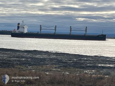
ZY DONGSHA
Cargo
Current Trip
| Time Travelled | 31 days |
|---|---|
| Remaining Time | 16 days |
| Distance Travelled | 6385.57 nm |
| Remaining Distance | 2960.31 nm |
| AVG Speed | 11.1 Knots |
| MAX Speed | 11.1 Knots |
| AVG Wind | 18.2 knots |
| MAX Wind | 35 knots |
| MIN Temp | 1.5°C / 34.7°F |
| MAX Temp | 22.6°C / 72.68°F |
| Draught | 12.7 m |
| Position Received | 1 h, 27 m ago |
Current Position
| Longitude | --- |
|---|---|
| Latitude | --- |
| Status | Under way using engine |
| Speed | 6.7 Knots |
| Course | 239.7° |
| Area | English Channel |
| Station | T-AIS |
| Position Received | 1 h, 27 m ago |
Info
Information
The current position of ZY DONGSHA is in English Channel with coordinates 49.27593° / -4.80947° as reported on 2025-12-15 14:39 by AIS to our vessel tracker app. The vessel's current speed is 6.7 Knots and is heading at the port of PORT SAID. The estimated time of arrival as calculated by MyShipTracking vessel tracking app is 2026-01-01 03:12 LT
The vessel ZY DONGSHA (IMO: 9832640, MMSI: 538008033) is a Cargo It's sailing under the flag of [MH] Marshall Is.
In this page you can find informations about the vessels current position, last detected port calls, and current voyage information. If the vessels is not in coverage by AIS you will find the latest position.
The current position of ZY DONGSHA is detected by our AIS receivers and we are not responsible for the reliability of the data. The last position was recorded while the vessel was in Coverage by the Ais receivers of our vessel tracking app.
The current draught of ZY DONGSHA as reported by AIS is 12.7 meters
Weather
| Temperature | 11.9°C / 53.42°F |
|---|---|
| Wind Speed | 19 knots |
| Direction | 170° S |
| Pressure | 999.7 hPa |
| Humidity | 92.3 % |
| Cloud Coverage | 100 % |
Featured Company
Last Port Calls
| Port | Arrival | Departure | Time In Port |
|---|---|---|---|
| 2025-10-30 17:48 | 2025-11-13 23:36 | 14 d | |
| 2025-10-24 08:02 | 2025-10-24 17:21 | 9 h |
Last Trips
| Origin | Departure | Destination | Arrival | Distance | |
|---|---|---|---|---|---|
| 2025-09-21 13:59 | 2025-10-30 17:48 | 8409.05 nm | |||
| 2025-09-21 13:59 | 2025-10-24 08:02 | 8257.03 nm |
Events
| Time | Event | Details | Position / Dest | Info |
|---|---|---|---|---|
| 2025-12-15 14:44 | Status Changed | Default Under way using engine |
49.27118 / -4.82236
EG PSD
|
Speed: 6.7 kn Course: 239.7° |
| 2025-12-15 14:39 | Status Changed | Under way using engine Default |
49.27593 / -4.80947
EG PSD
|
Speed: 6.9 kn Course: 239° |
| 2025-12-15 14:39 | OUT of Coverage |
49.27593 / -4.80947
English Channel
EG PSD
|
Speed: 6.7 kn Course: 239.7° |
|
| 2025-12-15 14:04 | Status Changed | Default Under way using engine |
49.30835 / -4.72380
EG PSD
|
Speed: 6.3 kn Course: 243.3° |
| 2025-12-15 13:55 | Status Changed | Under way using engine Default |
49.31583 / -4.70327
EG PSD
|
Speed: 6.3 kn Course: 240° |
| 2025-12-15 13:12 | Status Changed | Default Under way using engine |
49.35380 / -4.59849
EG PSD
|
Speed: 6.4 kn Course: 240° |
| 2025-12-15 13:04 | Detected in Sea | French part of the English Channel |
49.36052 / -4.58047
English Channel
EG PSD
|
Speed: 6.4 kn Course: 240° |
| 2025-12-15 13:04 | Status Changed | Under way using engine Default |
49.36052 / -4.58047
EG PSD
|
Speed: 6.5 kn Course: 240° |
| 2025-12-15 12:46 | Status Changed | Default Under way using engine |
49.37675 / -4.53687
EG PSD
|
Speed: 6.4 kn Course: 239.8° |
| 2025-12-15 12:42 | Status Changed | Under way using engine Default |
49.37994 / -4.52869
EG PSD
|
Speed: 6.6 kn Course: 241° |