
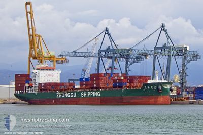
ZHONG GU YING KOU
Cargo
Current Trip
| Time Travelled | 6 days |
|---|---|
| Remaining Time | --- |
| Distance Travelled | 2196.73 nm |
| Remaining Distance | 2765.49 nm |
| AVG Speed | 12.5 Knots |
| MAX Speed | 16.5 Knots |
| AVG Wind | 9.7 knots |
| MAX Wind | 19 knots |
| MIN Temp | 26.3°C / 79.34°F |
| MAX Temp | 30.7°C / 87.26°F |
| Draught | 9.3 m |
| Position Received | 2 d ago |
Current Position
| Longitude | 103.46102° |
|---|---|
| Latitude | 1.22184° |
| Status | Under way using engine |
| Speed | 11.9 Knots |
| Course | 280.4° |
| Area | Malacca Strait |
| Station | T-AIS |
| Position Received | 2 d ago |
Info
Information
The current position of ZHONG GU YING KOU is in Malacca Strait with coordinates 1.22184° / 103.46102° as reported on 2024-06-07 02:20 by AIS to our vessel tracker app. The vessel's current speed is 11.9 Knots and is heading at the port of JEBEL ALI. The estimated time of arrival as calculated by MyShipTracking vessel tracking app is 2024-06-18 09:00 LT
The vessel ZHONG GU YING KOU (IMO: 9809239, MMSI: 413381250) is a Cargo It's sailing under the flag of [CN] China.
In this page you can find informations about the vessels current position, last detected port calls, and current voyage information. If the vessels is not in coverage by AIS you will find the latest position.
The current position of ZHONG GU YING KOU is detected by our AIS receivers and we are not responsible for the reliability of the data. The last position was recorded while the vessel was in Coverage by the Ais receivers of our vessel tracking app.
The current draught of ZHONG GU YING KOU as reported by AIS is 9.3 meters
Weather
| Temperature | 29.4°C / 84.92°F |
|---|---|
| Wind Speed | 15 knots |
| Direction | 252° WSW |
| Pressure | 1010.5 hPa |
| Humidity | 69.1 % |
| Cloud Coverage | 100 % |
Featured Company
Last Port Calls
| Port | Arrival | Departure | Time In Port |
|---|---|---|---|
| 2024-06-02 04:58 | 2024-06-02 16:58 | 12 h | |
| 2024-05-27 14:32 | 2024-05-28 00:13 | 9 h | |
| 2024-05-25 13:18 | 2024-05-26 00:48 | 11 h | |
| 2024-05-23 02:05 | 2024-05-23 12:48 | 10 h | |
| 2024-05-21 22:04 | 2024-05-22 17:28 | 19 h | |
| 2024-05-16 17:04 | 2024-05-17 19:50 | 1 d | |
| 2024-05-11 07:20 | 2024-05-12 14:04 | 1 d | |
| 2024-05-05 21:47 | 2024-05-06 06:52 | 9 h | |
| 2024-05-05 09:53 | 2024-05-05 20:24 | 10 h | |
| 2024-05-05 05:31 | 2024-05-05 06:31 | 1 h |
Last Trips
| Origin | Departure | Destination | Arrival | Distance | |
|---|---|---|---|---|---|
| 2024-05-28 00:13 | 2024-06-02 04:58 | 989.99 nm | |||
| 2024-05-26 00:48 | 2024-05-27 14:32 | 243.51 nm | |||
| 2024-05-23 12:48 | 2024-05-25 13:18 | 451.79 nm | |||
| 2024-05-22 17:28 | 2024-05-23 02:05 | 105.38 nm | |||
| 2024-05-17 19:50 | 2024-05-21 22:04 | 1206.80 nm | |||
| 2024-05-12 14:04 | 2024-05-16 17:04 | 1167.63 nm | |||
| 2024-05-06 06:52 | 2024-05-11 07:20 | 1174.84 nm | |||
| 2024-05-05 20:24 | 2024-05-05 21:47 | 9.39 nm | |||
| 2024-05-05 06:31 | 2024-05-05 09:53 | 29.70 nm | |||
| 2024-04-30 18:24 | 2024-05-05 05:31 | 1166.89 nm |
Events
| Time | Event | Details | Position / Dest | Info |
|---|---|---|---|---|
| 2024-06-07 02:25 | Status Changed | Default Under way using engine |
1.22501 / 103.44473
AEJEA
|
Speed: 11.9 kn Course: 280.4° |
| 2024-06-07 02:20 | Change Sea Area | Malaysian part of the Malacca Strait Malaysian part of the Singapore Strait |
1.22184 / 103.46102
Malacca Strait
AEJEA
|
Speed: 11.9 kn Course: 280.4° |
| 2024-06-07 02:20 | OUT of Coverage |
1.22184 / 103.46102
Malacca Strait
AEJEA
|
Speed: 11.9 kn Course: 280.4° |
|
| 2024-06-07 01:43 | Change Sea Area | Malaysian part of the Singapore Strait Indonesian part of the Singapore Strait |
1.19528 / 103.58148
Singapore Strait
AEJEA
|
Speed: 12.4 kn Course: 283.8° |
| 2024-06-07 00:58 | Change Sea Area | Indonesian part of the Singapore Strait Singaporean part of the Singapore Strait |
1.13945 / 103.72413
Singapore Strait
AEJEA
|
Speed: 10.9 kn Course: 288.7° |
| 2024-06-06 23:22 | Change Sea Area | Singaporean part of the Singapore Strait Indonesian part of the Singapore Strait |
1.24142 / 103.96426
Singapore Strait
AEJEA
|
Speed: 8.7 kn Course: 283.3° |
| 2024-06-06 22:37 | Change Sea Area | Indonesian part of the Singapore Strait Malaysian part of the Singapore Strait |
1.26816 / 104.09547
Singapore Strait
AEJEA
|
Speed: 12.7 kn Course: 267.5° |
| 2024-06-06 22:13 | Draught Changed | 9.3 7.6 |
1.27847 / 104.17970
AEJEA
|
Speed: 12 kn Course: 246.7° |
| 2024-06-06 22:13 | ETA Changed | 2024/06/18 05:00 2024/06/18 08:00 |
1.27847 / 104.17970
AEJEA
|
Speed: 12 kn Course: 246.7° |
| 2024-06-06 21:50 | Detected in Sea | Malaysian part of the Singapore Strait |
1.28925 / 104.25050
Singapore Strait
AEJEA
|
Speed: 11.5 kn Course: 259° |