
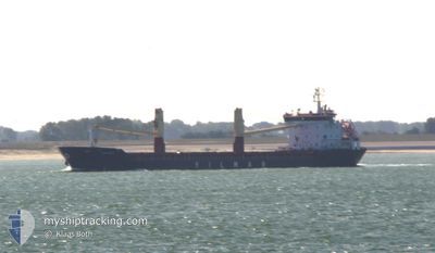
YM FUJI
Cargo
Current Trip
| Time Travelled | 10 days |
|---|---|
| Remaining Time | --- |
| Distance Travelled | 2787.90 nm |
| Remaining Distance | --- |
| AVG Speed | 11 Knots |
| MAX Speed | 15.2 Knots |
| AVG Wind | 11.5 knots |
| MAX Wind | 23 knots |
| MIN Temp | 9.9°C / 49.82°F |
| MAX Temp | 27.5°C / 81.5°F |
| Draught | 7.7 m |
| Position Received | Now |
Current Position
| Longitude | 23.85965° |
|---|---|
| Latitude | 36.94744° |
| Status | Under way using engine |
| Speed | 10.8 Knots |
| Course | 36.4° |
| Area | Aegean Sea |
| Station | T-AIS |
| Position Received | Now |
Info
Information
The current position of YM FUJI is in Aegean Sea with coordinates 36.94744° / 23.85965° as reported on 2024-05-18 06:34 by AIS to our vessel tracker app. The vessel's current speed is 10.8 Knots and is heading at the port of YARIMCA. The estimated time of arrival as calculated by MyShipTracking vessel tracking app is 2024-05-19 18:00 LT
The vessel YM FUJI (IMO: 9622760, MMSI: 256918000) is a Cargo It's sailing under the flag of [MT] Malta.
In this page you can find informations about the vessels current position, last detected port calls, and current voyage information. If the vessels is not in coverage by AIS you will find the latest position.
The current position of YM FUJI is detected by our AIS receivers and we are not responsible for the reliability of the data. The last position was recorded while the vessel was in Coverage by the Ais receivers of our vessel tracking app.
The current draught of YM FUJI as reported by AIS is 7.7 meters
Weather
| Temperature | 19.1°C / 66.38°F |
|---|---|
| Wind Speed | 6 knots |
| Direction | 73° ENE |
| Pressure | 1016.8 hPa |
| Humidity | 84.1 % |
| Cloud Coverage | 69 % |
Featured Company
Last Port Calls
| Port | Arrival | Departure | Time In Port |
|---|---|---|---|
| 2024-05-07 00:28 | 2024-05-07 21:34 | 21 h | |
| 2024-04-29 10:21 | 2024-05-04 07:01 | 4 d | |
| 2024-04-21 18:32 | 2024-04-25 19:00 | 4 d | |
| 2024-03-23 20:20 | 2024-04-04 10:08 | 11 d | |
| 2024-03-12 14:03 | 2024-03-18 13:41 | 5 d | |
| 2024-03-11 09:12 | 2024-03-12 12:57 | 1 d | |
| 2024-03-07 07:38 | 2024-03-07 12:26 | 4 h |
Last Trips
| Origin | Departure | Destination | Arrival | Distance | |
|---|---|---|---|---|---|
| 2024-05-04 07:01 | 2024-05-07 00:28 | 149.97 nm | |||
| 2024-04-25 19:00 | 2024-04-29 10:21 | 613.43 nm | |||
| 2024-04-04 10:08 | 2024-04-21 18:32 | 3478.37 nm | |||
| 2024-03-18 13:41 | 2024-03-23 20:20 | 553.00 nm | |||
| 2024-03-12 12:57 | 2024-03-12 14:03 | 8.97 nm | |||
| 2024-03-07 12:26 | 2024-03-11 09:12 | 703.03 nm | |||
| 2024-02-19 22:50 | 2024-03-07 07:38 | 2822.68 nm |
Events
| Time | Event | Details | Position / Dest | Info |
|---|---|---|---|---|
| 2024-05-18 05:20 | Status Changed | Under way using engine Default |
36.76814 / 23.69239
TRYAR
|
Speed: 10.8 kn Course: 37° |
| 2024-05-18 05:08 | Status Changed | Default Under way using engine |
36.73814 / 23.66477
TRYAR
|
Speed: 10.8 kn Course: 38.8° |
| 2024-05-18 01:43 | Status Changed | Under way using engine Default |
36.39110 / 23.05962
TRYAR
|
Speed: 11.3 kn Course: 101° |
| 2024-05-18 01:36 | Status Changed | Default Under way using engine |
36.39531 / 23.03284
TRYAR
|
Speed: 11.3 kn Course: 100.8° |
| 2024-05-18 01:33 | Change Sea Area | Greek part of the Aegean Sea Greek part of the Mediterranean Sea - Eastern Basin |
36.39702 / 23.02129
Aegean Sea
TRYAR
|
Speed: 11.3 kn Course: 100.5° |
| 2024-05-18 01:24 | IN Coverage |
36.40187 / 22.98952
Mediterranean Sea - Eastern Basin
TRYAR
|
Speed: 11.1 kn Course: 101.5° |
|
| 2024-05-18 01:24 | Status Changed | Under way using engine Default |
36.40268 / 22.98457
TRYAR
|
Speed: 11.2 kn Course: 87° |
| 2024-05-17 16:04 | Status Changed | Default Under way using engine |
36.40499 / 20.88049
TRYAR
|
Speed: 11.1 kn Course: 99.8° |
| 2024-05-17 16:02 | OUT of Coverage |
36.40583 / 20.87368
Mediterranean Sea - Eastern Basin
TRYAR
|
Speed: 11.1 kn Course: 99.8° |
|
| 2024-05-17 12:50 | Status Changed | Under way using engine Default |
36.41472 / 20.13764
TRYAR
|
Speed: 11 kn Course: 91° |