
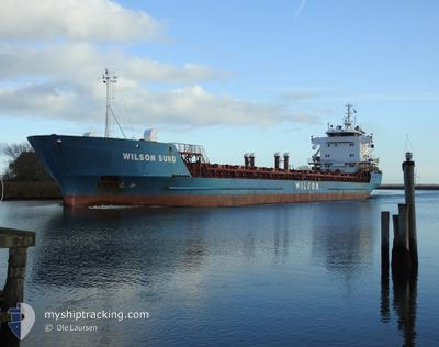
WILSON SUND
General Cargo
Current Trip
| Time Travelled | 2 days |
|---|---|
| Remaining Time | 14 h, 48 mins |
| Distance Travelled | 593.22 nm |
| Remaining Distance | 237.75 nm |
| AVG Speed | 10.9 Knots |
| MAX Speed | 16.8 Knots |
| AVG Wind | 4.6 knots |
| MAX Wind | 14.3 knots |
| MIN Temp | 2.8°C / 37.04°F |
| MAX Temp | 10.6°C / 51.08°F |
| Draught | 7 m |
| Position Received | 6 h, 7 m ago |
Current Position
| Longitude | --- |
|---|---|
| Latitude | --- |
| Status | Under way using engine |
| Speed | 11.6 Knots |
| Course | 154° |
| Area | Bay of Biscay |
| Station | T-AIS |
| Position Received | 6 h, 7 m ago |
Info
Information
The current position of WILSON SUND is in Bay of Biscay with coordinates 46.83250° / -4.51800° as reported on 2025-03-04 16:57 by AIS to our vessel tracker app. The vessel's current speed is 11.6 Knots and is heading at the port of PASAJES. The estimated time of arrival as calculated by MyShipTracking vessel tracking app is 2025-03-05 14:52 LT
The vessel WILSON SUND (IMO: 8918473, MMSI: 257077550) is a General Cargo that was built in 1999 ( 26 years old ). It's sailing under the flag of [NO] Norway.
In this page you can find informations about the vessels current position, last detected port calls, and current voyage information. If the vessels is not in coverage by AIS you will find the latest position.
The current position of WILSON SUND is detected by our AIS receivers and we are not responsible for the reliability of the data. The last position was recorded while the vessel was in Coverage by the Ais receivers of our vessel tracking app.
The current draught of WILSON SUND as reported by AIS is 7 meters
Weather
| Temperature | 10.5°C / 50.9°F |
|---|---|
| Wind Speed | 12 knots |
| Direction | 82° E |
| Pressure | 1022.3 hPa |
| Humidity | 70.4 % |
| Cloud Coverage | 19 % |
Featured Company
Last Port Calls
| Port | Arrival | Departure | Time In Port |
|---|---|---|---|
| 2025-02-27 16:47 | 2025-03-02 17:11 | 3 d | |
| 2025-02-25 11:25 | 2025-02-26 18:01 | 1 d | |
| 2025-02-22 10:40 | 2025-02-22 23:26 | 12 h | |
| 2025-02-18 21:45 | 2025-02-19 17:42 | 19 h | |
| 2025-02-14 04:47 | 2025-02-14 21:23 | 16 h | |
| 2025-02-09 03:38 | 2025-02-12 22:19 | 3 d | |
| 2025-02-05 05:57 | 2025-02-06 18:00 | 1 d | |
| 2025-02-03 04:01 | 2025-02-04 03:57 | 23 h | |
| 2025-01-30 09:14 | 2025-01-31 18:03 | 1 d | |
| 2025-01-11 16:58 | 2025-01-17 03:25 | 5 d |
Last Trips
| Origin | Departure | Destination | Arrival | Distance | |
|---|---|---|---|---|---|
| 2025-02-26 18:01 | 2025-02-27 16:47 | 229.83 nm | |||
| 2025-02-22 23:26 | 2025-02-25 11:25 | 499.47 nm | |||
| 2025-02-19 17:42 | 2025-02-22 10:40 | 479.67 nm | |||
| 2025-02-14 21:23 | 2025-02-18 21:45 | 965.31 nm | |||
| 2025-02-12 22:19 | 2025-02-14 04:47 | 388.63 nm | |||
| 2025-02-06 18:00 | 2025-02-09 03:38 | 626.25 nm | |||
| 2025-02-04 03:57 | 2025-02-05 05:57 | 93.44 nm | |||
| 2025-01-31 18:03 | 2025-02-03 04:01 | 549.54 nm | |||
| 2025-01-17 03:25 | 2025-01-30 09:14 | 1267.06 nm | |||
| 2024-12-21 11:42 | 2025-01-11 16:58 | 2704.26 nm |
Events
| Time | Event | Details | Position / Dest | Info |
|---|---|---|---|---|
| 2025-03-04 17:03 | Status Changed | Default Under way using engine |
46.81300 / -4.50367
NLRTM>>ESPAS
|
Speed: 11.6 kn Course: 154° |
| 2025-03-04 16:57 | OUT of Coverage |
46.83250 / -4.51800
Bay of Biscay
NLRTM>>ESPAS
|
Speed: 11.6 kn Course: 154° |
|
| 2025-03-04 16:55 | Status Changed | Under way using engine Default |
46.83603 / -4.52062
NLRTM>>ESPAS
|
Speed: 11.6 kn Course: 152° |
| 2025-03-04 16:24 | Status Changed | Default Under way using engine |
46.92583 / -4.58700
NLRTM>>ESPAS
|
Speed: 11.3 kn Course: 154° |
| 2025-03-04 16:06 | Detected in Sea | French part of the Bay of Biscay |
46.97800 / -4.62600
Bay of Biscay
NLRTM>>ESPAS
|
Speed: 11.5 kn Course: 153° |
| 2025-03-04 16:05 | Status Changed | Under way using engine Default |
46.98050 / -4.62800
NLRTM>>ESPAS
|
Speed: 11.6 kn Course: 154° |
| 2025-03-04 16:05 | IN Coverage |
46.97800 / -4.62600
Bay of Biscay
NLRTM>>ESPAS
|
Speed: 11.5 kn Course: 153° |
|
| 2025-03-04 13:55 | Status Changed | Default Under way using engine |
47.33267 / -4.89900
NLRTM>>ESPAS
|
Speed: 10.9 kn Course: 151° |
| 2025-03-04 13:18 | OUT of Coverage |
47.42933 / -4.97683
Celtic Sea
NLRTM>>ESPAS
|
Speed: 10.9 kn Course: 151° |
|
| 2025-03-04 13:12 | Status Changed | Under way using engine Default |
47.44583 / -4.98983
NLRTM>>ESPAS
|
Speed: 10.8 kn Course: 151° |