
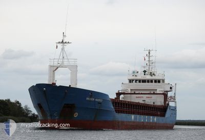
WILSON HARRIER
General Cargo
Current Trip
| Time Travelled | 8 h, 1 mins |
|---|---|
| Remaining Time | 3 days |
| Distance Travelled | 66.42 nm |
| Remaining Distance | 790.51 nm |
| AVG Speed | 8.2 Knots |
| MAX Speed | 11 Knots |
| AVG Wind | 5 knots |
| MAX Wind | 14.4 knots |
| MIN Temp | 5.5°C / 41.9°F |
| MAX Temp | 8.9°C / 48.02°F |
| Draught | 6 m |
| Position Received | 4 h, 40 m ago |
Current Position
| Longitude | 4.05824° |
|---|---|
| Latitude | 52.51890° |
| Status | Under way using engine |
| Speed | 10.8 Knots |
| Course | 274.3° |
| Area | North Sea |
| Station | T-AIS |
| Position Received | 4 h, 40 m ago |
Info
Information
The current position of WILSON HARRIER is in North Sea with coordinates 52.51890° / 4.05824° as reported on 2024-04-27 00:00 by AIS to our vessel tracker app. The vessel's current speed is 10.8 Knots and is heading at the port of PASAJES. The estimated time of arrival as calculated by MyShipTracking vessel tracking app is 2024-04-30 06:52 LT
The vessel WILSON HARRIER (IMO: 9064891, MMSI: 314463000) is a General Cargo that was built in 1993 ( 31 years old ). It's sailing under the flag of [BB] Barbados.
In this page you can find informations about the vessels current position, last detected port calls, and current voyage information. If the vessels is not in coverage by AIS you will find the latest position.
The current position of WILSON HARRIER is detected by our AIS receivers and we are not responsible for the reliability of the data. The last position was recorded while the vessel was in Coverage by the Ais receivers of our vessel tracking app.
The current draught of WILSON HARRIER as reported by AIS is 6 meters
Weather
| Temperature | 8.4°C / 47.12°F |
|---|---|
| Wind Speed | 13 knots |
| Direction | 89° E |
| Pressure | 1004.1 hPa |
| Humidity | 79.7 % |
| Cloud Coverage | 100 % |
Featured Company
Last Port Calls
| Port | Arrival | Departure | Time In Port |
|---|---|---|---|
| 2024-04-25 19:20 | 2024-04-26 20:40 | 1 d | |
| 2024-04-22 09:23 | 2024-04-23 21:49 | 1 d | |
| 2024-04-12 14:35 | 2024-04-13 14:41 | 1 d | |
| 2024-04-06 12:26 | 2024-04-10 17:43 | 4 d | |
| 2024-03-27 00:26 | 2024-03-27 18:57 | 18 h | |
| 2024-03-25 06:17 | 2024-03-25 06:36 | 18 m | |
| 2024-03-22 10:22 | 2024-03-25 05:32 | 2 d | |
| 2024-03-18 18:41 | 2024-03-19 17:22 | 22 h | |
| 2024-02-24 21:23 | 2024-02-27 13:59 | 2 d | |
| 2024-02-21 18:29 | 2024-02-24 14:41 | 2 d |
Last Trips
| Origin | Departure | Destination | Arrival | Distance | |
|---|---|---|---|---|---|
| 2024-04-23 23:49 | 2024-04-25 21:20 | 224.57 nm | |||
| 2024-04-13 16:41 | 2024-04-22 11:23 | 1971.56 nm | |||
| 2024-04-10 19:43 | 2024-04-12 16:35 | 434.04 nm | |||
| 2024-03-27 19:57 | 2024-04-06 14:26 | 2101.04 nm | |||
| 2024-03-25 07:36 | 2024-03-27 01:26 | 200.59 nm | |||
| 2024-03-25 06:32 | 2024-03-25 07:17 | 1.80 nm | |||
| 2024-03-19 18:22 | 2024-03-22 11:22 | 280.81 nm | |||
| 2024-02-27 13:59 | 2024-03-18 19:41 | 2548.64 nm | |||
| 2024-02-24 14:41 | 2024-02-24 21:23 | 75.84 nm | |||
| 2024-02-17 20:17 | 2024-02-21 18:29 | 1007.41 nm |
Events
| Time | Event | Details | Position / Dest | Info |
|---|---|---|---|---|
| 2024-04-27 00:08 | Status Changed | Default Under way using engine |
52.51915 / 4.01678
ESPAS
|
Speed: 10.8 kn Course: 274.3° |
| 2024-04-27 00:00 | OUT of Coverage |
52.51890 / 4.05824
North Sea
ESPAS
|
Speed: 10.8 kn Course: 274.3° |
|
| 2024-04-26 22:01 | START Moving | 0.34 nm, East of IJMUIDEN |
52.46588 / 4.59674
ESPAS
|
Speed: 3.1 kn Course: 271° |
| 2024-04-26 21:45 | ETA Changed | 2024/04/30 14:00 2024/04/30 15:00 |
52.46583 / 4.60011
ESPAS
|
Speed: Course: 271° |
| 2024-04-26 21:39 | STOP Moving | 0.47 nm, East of IJMUIDEN |
52.46585 / 4.60034
ESPAS
|
Speed: 0.2 kn Course: 272° |
| 2024-04-26 20:40 | PORT DEPARTURE |
|
52.42799 / 4.76700
ESPAS
|
Speed: 8.6 kn Course: 287° |
| 2024-04-26 20:16 | START Moving |
52.39919 / 4.82127
[NL] AMSTERDAM
|
Speed: 3.7 kn Course: 355° |
|
| 2024-04-26 20:15 | ETA Changed | 2024/04/30 15:00 |
52.39821 / 4.82146
[NL] AMSTERDAM
|
Speed: 1.1 kn Course: 355° |
| 2024-04-26 20:09 | Status Changed | Under way using engine Moored |
52.39848 / 4.82273
[NL] AMSTERDAM
|
Speed: 1 kn Course: 97° |
| 2024-04-26 19:56 | ETA Changed | 2024/04/30 15:00 |
52.39806 / 4.82341
[NL] AMSTERDAM
|
Speed: Course: 91° |