
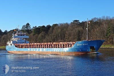
WILSON BILBAO
General Cargo
Current Trip
| Time Travelled | 23 h, 23 mins |
|---|---|
| Remaining Time | --- |
| Distance Travelled | 229.49 nm |
| Remaining Distance | --- |
| AVG Speed | 11 Knots |
| MAX Speed | 13 Knots |
| AVG Wind | 7.4 knots |
| MAX Wind | 11 knots |
| MIN Temp | 13°C / 55.4°F |
| MAX Temp | 18.5°C / 65.3°F |
| Draught | 4.8 m |
| Position Received | 4 h, 25 m ago |
Current Position
| Longitude | --- |
|---|---|
| Latitude | --- |
| Status | Under way using engine |
| Speed | 10.5 Knots |
| Course | 208.4° |
| Area | Aegean Sea |
| Station | T-AIS |
| Position Received | 4 h, 25 m ago |
Info
Information
The current position of WILSON BILBAO is in Aegean Sea with coordinates 39.45715° / 25.58409° as reported on 2025-12-06 18:20 by AIS to our vessel tracker app. The vessel's current speed is 10.5 Knots and is heading at the port of BELFAST. The estimated time of arrival as calculated by MyShipTracking vessel tracking app is 2025-12-19 18:00 LT
The vessel WILSON BILBAO (IMO: 9014705, MMSI: 314543000) is a General Cargo that was built in 1992 ( 33 years old ). It's sailing under the flag of [BB] Barbados.
In this page you can find informations about the vessels current position, last detected port calls, and current voyage information. If the vessels is not in coverage by AIS you will find the latest position.
The current position of WILSON BILBAO is detected by our AIS receivers and we are not responsible for the reliability of the data. The last position was recorded while the vessel was in Coverage by the Ais receivers of our vessel tracking app.
The current draught of WILSON BILBAO as reported by AIS is 4.8 meters
Weather
| Temperature | 16.2°C / 61.16°F |
|---|---|
| Wind Speed | 9 knots |
| Direction | 352° N |
| Pressure | 1008.1 hPa |
| Humidity | 72.2 % |
| Cloud Coverage | 100 % |
Featured Company
Last Port Calls
| Port | Arrival | Departure | Time In Port |
|---|---|---|---|
| 2025-12-01 11:04 | 2025-12-06 02:22 | 4 d | |
| 2025-11-27 00:05 | 2025-11-28 06:17 | 1 d | |
| 2025-11-17 13:16 | 2025-11-18 23:20 | 1 d | |
| 2025-11-14 12:01 | 2025-11-15 18:04 | 1 d | |
| 2025-11-10 00:10 | 2025-11-12 21:40 | 2 d | |
| 2025-10-25 04:31 | 2025-10-25 22:54 | 18 h | |
| 2025-10-21 17:00 | 2025-10-22 18:02 | 1 d | |
| 2025-10-15 02:01 | 2025-10-15 02:49 | 48 m | |
| 2025-10-12 16:44 | 2025-10-14 20:32 | 2 d | |
| 2025-10-12 11:32 | 2025-10-12 11:52 | 20 m |
Most Visited Ports (Last year)
| Port | Arrivals | |
|---|---|---|
| 4 | ||
| 3 | ||
| 3 | ||
| 3 | ||
| 3 | ||
| 3 |
Last Trips
| Origin | Departure | Destination | Arrival | Distance | |
|---|---|---|---|---|---|
| 2025-11-28 06:17 | 2025-12-01 11:04 | 250.52 nm | |||
| 2025-11-18 23:20 | 2025-11-27 00:05 | 1731.49 nm | |||
| 2025-11-15 18:04 | 2025-11-17 13:16 | 335.59 nm | |||
| 2025-11-12 21:40 | 2025-11-14 12:01 | 339.77 nm | |||
| 2025-10-25 22:54 | 2025-11-10 00:10 | 2936.43 nm | |||
| 2025-10-22 18:02 | 2025-10-25 04:31 | 64.95 nm | |||
| 2025-10-15 02:49 | 2025-10-21 17:00 | 1320.09 nm | |||
| 2025-10-14 20:32 | 2025-10-15 02:01 | 48.76 nm | |||
| 2025-10-12 11:52 | 2025-10-12 16:44 | 48.26 nm | |||
| 2025-10-10 13:17 | 2025-10-12 11:32 | 306.83 nm |
Events
| Time | Event | Details | Position / Dest | Info |
|---|---|---|---|---|
| 2025-12-06 18:21 | Status Changed | Default Under way using engine |
39.45284 / 25.58110
GBBEL
|
Speed: 10.5 kn Course: 208.4° |
| 2025-12-06 18:20 | Status Changed | Under way using engine Default |
39.45715 / 25.58409
GBBEL
|
Speed: 10.6 kn Course: 210° |
| 2025-12-06 18:20 | OUT of Coverage |
39.45715 / 25.58409
Aegean Sea
GBBEL
|
Speed: 10.5 kn Course: 208.4° |
|
| 2025-12-06 17:59 | Status Changed | Default Under way using engine |
39.50950 / 25.62141
GBBEL
|
Speed: 10.6 kn Course: 202.7° |
| 2025-12-06 17:08 | Detected in Sea | Greek part of the Aegean Sea |
39.64778 / 25.69383
Aegean Sea
GBBEL
|
Speed: 10.3 kn Course: 204.3° |
| 2025-12-06 17:08 | Status Changed | Under way using engine Default |
39.64778 / 25.69383
GBBEL
|
Speed: 10.2 kn Course: 211° |
| 2025-12-06 16:49 | IN Coverage |
39.64778 / 25.69383
Aegean Sea
GBBEL
|
Speed: 10.3 kn Course: 204.3° |
|
| 2025-12-06 14:09 | Status Changed | Default Under way using engine |
40.02000 / 26.11301
GBBEL
|
Speed: 12 kn Course: 261.6° |
| 2025-12-06 13:57 | Change Sea Area | Turkish part of the Aegean Sea Turkish part of the Sea of Marmara |
40.02496 / 26.16130
Aegean Sea
GBBEL
|
Speed: 12 kn Course: 261.6° |
| 2025-12-06 13:57 | OUT of Coverage |
40.02496 / 26.16130
Aegean Sea
GBBEL
|
Speed: 12 kn Course: 261.6° |