
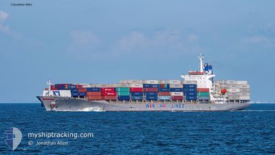
WAN HAI 312
Container Ship
Current Trip
| Time Travelled | 15 h, 2 mins |
|---|---|
| Remaining Time | --- |
| Distance Travelled | 264.04 nm |
| Remaining Distance | --- |
| AVG Speed | 18.5 Knots |
| MAX Speed | 19.7 Knots |
| AVG Wind | 17.4 knots |
| MAX Wind | 25.3 knots |
| MIN Temp | 14.6°C / 58.28°F |
| MAX Temp | 21.1°C / 69.98°F |
| Draught | 8.9 m |
| Position Received | 4 h, 53 m ago |
Current Position
| Longitude | --- |
|---|---|
| Latitude | --- |
| Status | Under way using engine |
| Speed | 19 Knots |
| Course | 131.3° |
| Area | Red Sea |
| Station | T-AIS |
| Position Received | 4 h, 53 m ago |
Info
Information
The current position of WAN HAI 312 is in Red Sea with coordinates 27.16549° / 34.42047° as reported on 2025-01-19 05:58 by AIS to our vessel tracker app. The vessel's current speed is 19 Knots and is heading at the port of PORT KLANG. The estimated time of arrival as calculated by MyShipTracking vessel tracking app is 2025-01-30 14:00 LT
The vessel WAN HAI 312 (IMO: 9248693, MMSI: 565032000) is a Container Ship that was built in 2006 ( 19 years old ). It's sailing under the flag of [SG] Singapore.
In this page you can find informations about the vessels current position, last detected port calls, and current voyage information. If the vessels is not in coverage by AIS you will find the latest position.
The current position of WAN HAI 312 is detected by our AIS receivers and we are not responsible for the reliability of the data. The last position was recorded while the vessel was in Coverage by the Ais receivers of our vessel tracking app.
The current draught of WAN HAI 312 as reported by AIS is 8.9 meters
Weather
| Temperature | 21.8°C / 71.24°F |
|---|---|
| Wind Speed | 16 knots |
| Direction | 337° NNW |
| Pressure | 1015.6 hPa |
| Humidity | 53.8 % |
| Cloud Coverage | 2 % |
Featured Company
Last Port Calls
| Port | Arrival | Departure | Time In Port |
|---|---|---|---|
| 2025-01-17 15:24 | 2025-01-18 21:50 | 1 d | |
| 2025-01-15 13:45 | 2025-01-16 02:23 | 12 h | |
| 2025-01-10 12:54 | 2025-01-11 00:17 | 11 h | |
| 2024-12-31 09:57 | 2024-12-31 21:57 | 12 h | |
| 2024-12-26 04:41 | 2024-12-26 20:56 | 16 h | |
| 2024-12-25 10:04 | 2024-12-25 17:37 | 7 h | |
| 2024-12-20 19:55 | 2024-12-21 02:12 | 6 h | |
| 2024-12-14 07:17 | 2024-12-15 05:01 | 21 h | |
| 2024-12-13 08:48 | 2024-12-13 21:33 | 12 h | |
| 2024-12-09 22:37 | 2024-12-10 11:49 | 13 h |
Last Trips
| Origin | Departure | Destination | Arrival | Distance | |
|---|---|---|---|---|---|
| 2025-01-16 02:23 | 2025-01-17 15:24 | 255.23 nm | |||
| 2025-01-11 00:17 | 2025-01-15 13:45 | 611.36 nm | |||
| 2024-12-31 21:57 | 2025-01-10 12:54 | 4264.89 nm | |||
| 2024-12-26 20:56 | 2024-12-31 09:57 | 1677.91 nm | |||
| 2024-12-25 17:37 | 2024-12-26 04:41 | 93.54 nm | |||
| 2024-12-21 02:12 | 2024-12-25 10:04 | 1059.77 nm | |||
| 2024-12-15 05:01 | 2024-12-20 19:55 | 974.92 nm | |||
| 2024-12-13 21:33 | 2024-12-14 07:17 | 98.89 nm | |||
| 2024-12-10 11:49 | 2024-12-13 08:48 | 341.48 nm | |||
| 2024-12-08 21:56 | 2024-12-09 22:37 | 258.32 nm |
Events
| Time | Event | Details | Position / Dest | Info |
|---|---|---|---|---|
| 2025-01-19 06:10 | Status Changed | Default Under way using engine |
27.12196 / 34.47520
MYPKG
|
Speed: 19 kn Course: 131.3° |
| 2025-01-19 05:58 | OUT of Coverage |
27.16549 / 34.42047
Red Sea
MYPKG
|
Speed: 19 kn Course: 131.3° |
|
| 2025-01-19 04:39 | Draught Changed | 8.9 10.6 |
27.46200 / 34.09188
MYPKG
|
Speed: 18.9 kn Course: 135.9° |
| 2025-01-19 04:39 | Destination Changed | MYPKG JOAQJ |
27.46200 / 34.09188
MYPKG
|
Speed: 18.9 kn Course: 135.9° |
| 2025-01-19 04:39 | ETA Changed | 2025/01/30 06:00 2025/01/15 14:30 |
27.46200 / 34.09188
MYPKG
|
Speed: 18.9 kn Course: 135.9° |
| 2025-01-19 04:37 | Change Sea Area | Egyptian part of the Red Sea Egyptian part of the Gulf of Suez |
27.46849 / 34.08491
Red Sea
|
Speed: 18.9 kn Course: 136.3° |
| 2025-01-19 04:27 | Status Changed | Under way using engine Default |
27.50808 / 34.04691
JOAQJ
|
Speed: 18.9 kn Course: 138° |
| 2025-01-19 04:25 | Status Changed | Default Under way using engine |
27.51875 / 34.03651
JOAQJ
|
Speed: 18.5 kn Course: 137.7° |
| 2025-01-19 04:18 | Status Changed | Under way using engine Default |
27.54389 / 34.01114
JOAQJ
|
Speed: 18.9 kn Course: 138° |
| 2025-01-19 04:18 | IN Coverage |
27.54306 / 34.01201
Gulf of Suez
|
Speed: 18.6 kn Course: 137.6° |