
W-SMASH
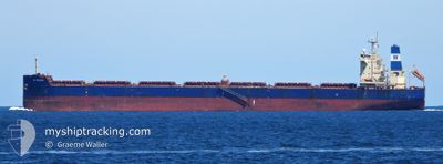
Bulk Carrier
Current Trip
| Trip Time | 4 days |
|---|---|
| Trip Distance | 255.91 nm |
| AVG Speed | 10.5 Knots |
| MAX Speed | 13.8 Knots |
| Draught | 13.5 m |
| AVG Wind | 9 knots |
| MAX Wind | 19 knots |
| MIN Temp | -2.6°C / 27.32°F |
| MAX Temp | 4.4°C / 39.92°F |
| Position Received | 2025-12-04 04:22 |
Current Position
| Longitude | --- |
|---|---|
| Latitude | --- |
| Status | Under way using engine |
| Speed | 10.9 Knots |
| Course | 281.1° |
| Area | North Pacific Ocean |
| Station | T-AIS |
| Position Received | 2025-12-04 04:22 |
Info
Information
The current position of W-SMASH is in North Pacific Ocean with coordinates 48.72870° / -127.10795° as reported on 2025-12-04 04:22 by AIS to our vessel tracker app. The vessel's current speed is 10.9 Knots and is currently inside the port of TIANJIN.
The vessel W-SMASH (IMO: 9625877, MMSI: 636016053) is a Bulk Carrier that was built in 2013 ( 13 years old ). It's sailing under the flag of [LR] Liberia.
In this page you can find informations about the vessels current position, last detected port calls, and current voyage information. If the vessels is not in coverage by AIS you will find the latest position.
The current position of W-SMASH is detected by our AIS receivers and we are not responsible for the reliability of the data. The last position was recorded while the vessel was in Coverage by the Ais receivers of our vessel tracking app.
The current draught of W-SMASH as reported by AIS is 13.5 meters
Weather
| Temperature | 4.9°C / 40.82°F |
|---|---|
| Wind Speed | 14 knots |
| Direction | 231° SW |
| Pressure | 1023.2 hPa |
| Humidity | 38.2 % |
| Cloud Coverage | --- |
Featured Company
Last Port Calls
| Port | Arrival | Departure | Time In Port |
|---|---|---|---|
| 2026-01-08 10:12 | |||
| 2025-12-29 20:48 | 2026-01-03 21:52 | 5 d | |
| 2025-11-30 22:02 | 2025-12-02 22:36 | 2 d | |
| 2025-11-25 13:00 | 2025-11-29 14:51 | 4 d | |
| 2025-11-07 07:34 | 2025-11-08 11:48 | 1 d | |
| 2025-11-05 02:45 | 2025-11-06 14:49 | 1 d |
Last Trips
| Origin | Departure | Destination | Arrival | Distance | |
|---|---|---|---|---|---|
| 2026-01-03 21:52 | 2026-01-08 10:12 | 255.91 nm | |||
| 2025-12-02 22:36 | 2025-12-29 20:48 | 5431.39 nm | |||
| 2025-11-29 14:51 | 2025-11-30 22:02 | 5.41 nm | |||
| 2025-11-08 11:48 | 2025-11-25 13:00 | 4630.95 nm | |||
| 2025-11-06 14:49 | 2025-11-07 07:34 | 156.94 nm | |||
| 2025-09-23 07:51 | 2025-11-05 02:45 | 5539.76 nm |
Events
| Time | Event | Details | Position / Dest | Info |
|---|---|---|---|---|
| 2026-01-08 02:13 | STOP Moving |
38.94729 / 117.76168
[CN] TIANJIN
|
Speed: Course: 289° |
|
| 2026-01-08 02:12 | PORT ARRIVAL |
|
38.94729 / 117.76168
[CN] TIANJIN
|
Speed: 0.9 kn Course: 285° |
| 2026-01-08 00:08 | START Moving | 16.98 nm, East of TIANJIN |
38.88294 / 118.08785
CN BYQ
|
Speed: 5.4 kn Course: 240° |
| 2026-01-05 10:01 | STOP Moving | 17.19 nm, East of TIANJIN |
38.88337 / 118.09283
CN BYQ
|
Speed: 0.1 kn Course: 270° |
| 2026-01-05 09:40 | START Moving | 17.19 nm, East of TIANJIN |
38.88353 / 118.09289
CN BYQ
|
Speed: 3.1 kn Course: 268° |
| 2026-01-05 03:07 | STOP Moving | 17.09 nm, East of TIANJIN |
38.88186 / 118.08968
CN BYQ
|
Speed: 0.3 kn Course: 18° |
| 2026-01-05 00:57 | START Moving | 19.81 nm, West of CAOFEIDIAN |
38.92107 / 118.17513
CN BYQ
|
Speed: 5.1 kn Course: 130° |
| 2026-01-04 08:29 | STOP Moving | 19.79 nm, West of CAOFEIDIAN |
38.92544 / 118.17396
CN BYQ
|
Speed: 0.3 kn Course: 348° |
| 2026-01-03 13:52 | PORT DEPARTURE |
|
40.29352 / 122.02224
CN BYQ
|
Speed: 10.4 kn Course: 277° |
| 2026-01-03 13:13 | START Moving |
40.25323 / 122.09139
[CN] BAYUQUAN
|
Speed: 3.4 kn Course: 359° |