
W-SMASH
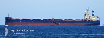
Bulk Carrier
Current Trip
| Time Travelled | 2 days |
|---|---|
| Remaining Time | --- |
| Distance Travelled | 424.92 nm |
| Remaining Distance | --- |
| AVG Speed | 10.1 Knots |
| MAX Speed | 14.2 Knots |
| AVG Wind | 6.6 knots |
| MAX Wind | 14.8 knots |
| MIN Temp | 22.6°C / 72.68°F |
| MAX Temp | 28.7°C / 83.66°F |
| Dybgang | 7.5 m |
| Position Modtaget | 27 d siden |
Current Position
| Longitude | 54.39308° |
|---|---|
| Latitude | -21.00834° |
| Status | Under way using engine |
| Fart | 12.2 Knots |
| Kurs | 234.1° |
| Område | Indian Ocean |
| Station | T-AIS |
| Position Modtaget | 27 d siden |
Info
Information
The current position of W-SMASH is in Indian Ocean with coordinates -21.00834° / 54.39308° as reported on 2024-03-30 19:09 by AIS to our vessel tracker app. The vessel's current speed is 12.2 Knots and is heading at the port of SANTOS. The estimated time of arrival as calculated by MyShipTracking vessel tracking app is 2024-04-19 04:00 LT
The vessel W-SMASH (IMO: 9625877, MMSI: 636016053) is a Bulk Carrier that was built in 2013 ( 11 år gamle ). It's sailing under the flag of [LR] Liberia.
In this page you can find informations about the vessels current position, last detected port calls, and current voyage information. If the vessels is not in coverage by AIS you will find the latest position.
The current position of W-SMASH is detected by our AIS receivers and we are not responsible for the reliability of the data. The last position was recorded while the vessel was in Coverage by the Ais receivers of our vessel tracking app.
The current draught of W-SMASH as reported by AIS is 7.5 meters
Weather
| Temperature | 25.7°C / 78.26°F |
|---|---|
| Wind Speed | 15 knots |
| Direction | 128° SE |
| Pressure | 1008.2 hPa |
| Humidity | 93.6 % |
| Cloud Coverage | 100 % |
Featured Company
Last Port Calls
| Port | Arrival | Departure | Time In Port |
|---|---|---|---|
| 2024-04-22 23:52 | 2024-04-25 14:52 | 2 d | |
| 2024-02-06 16:53 | 2024-02-08 01:01 | 1 d |
Most Visited Ports (Last year)
| Port | Arrivals | |
|---|---|---|
| 2 | ||
| 1 | ||
| 1 | ||
| 1 | ||
| 1 | ||
| 1 |
Last Trips
| Origin | Departure | Destination | Arrival | Distance | |
|---|---|---|---|---|---|
| 2024-02-08 03:01 | 2024-04-22 20:52 | 12643.51 nm | |||
| 2024-01-14 09:08 | 2024-02-06 18:53 | 6378.50 nm |
Events
| Tid | Hændelsen | Detaljer | Position / Dest | Info |
|---|---|---|---|---|
| 2024-04-26 08:04 | START Sejllads | 8.29 nm, North East of SOURE |
-.66905 / -48.39867
SANTOS
|
Fart: 7.8 kn Kurs: 18° |
| 2024-04-26 03:25 | STOP Sejllads | 7.97 nm, East of SOURE |
-.68333 / -48.39834
SANTOS
|
Fart: Kurs: -1° |
| 2024-04-25 23:59 | START Sejllads | 10.25 nm, North West of ICOARACI |
-1.14176 / -48.57068
SANTOS
|
Fart: 4.5 kn Kurs: 42° |
| 2024-04-25 17:46 | STOP Sejllads | 9.97 nm, North West of ICOARACI |
-1.14500 / -48.56667
SANTOS
|
Fart: Kurs: -1° |
| 2024-04-25 14:52 | START Sejllads | 2.03 nm, South West of VILA DO CONDE |
-1.55667 / -48.77833
SANTOS
|
Fart: 7 kn Kurs: -1° |
| 2024-04-25 14:52 | Afsejlet fra sidste havn |
|
-1.55667 / -48.77833
SANTOS
|
Fart: 2.2 kn Kurs: 20° |
| 2024-04-22 23:52 | STOP Sejllads |
-1.56833 / -48.78333
[BR] VILA DO CONDE
|
Fart: Kurs: -1° |
|
| 2024-04-22 23:52 | Skibe i havn |
|
-1.56833 / -48.78333
[BR] VILA DO CONDE
|
Fart: 1.2 kn Kurs: 58° |
| 2024-04-22 20:41 | START Sejllads | 12.11 nm, North of ICOARACI |
-1.09052 / -48.48091
SANTOS
|
Fart: 3.4 kn Kurs: 214° |
| 2024-04-22 16:49 | STOP Sejllads | 12.24 nm, North of ICOARACI |
-1.08833 / -48.48000
SANTOS
|
Fart: Kurs: -1° |