
VIANEN
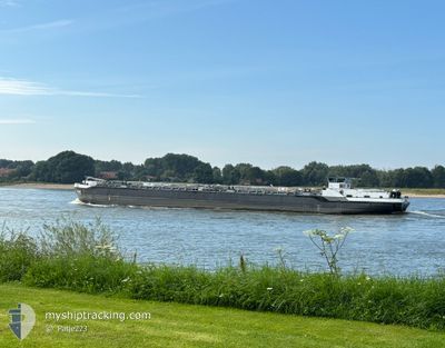
Tanker
Current Trip
| Time Travelled | 12 h, 3 mins |
|---|---|
| Remaining Time | --- |
| Distance Travelled | 56.16 nm |
| Remaining Distance | --- |
| AVG Speed | 7.3 Knots |
| MAX Speed | 8.3 Knots |
| AVG Wind | 11.1 knots |
| MAX Wind | 14 knots |
| MIN Temp | 8.5°C / 47.3°F |
| MAX Temp | 11.4°C / 52.52°F |
| Draught | 2.7 m |
| Position Received | 35 m ago |
Current Position
| Longitude | --- |
|---|---|
| Latitude | --- |
| Status | Under way using engine |
| Speed | |
| Course | --- |
| Area | North Sea |
| Station | T-AIS |
| Position Received | 35 m ago |
Info
Information
The current position of VIANEN is in North Sea with coordinates 51.64824° / 6.77421° as reported on 2025-12-19 16:41 by AIS to our vessel tracker app. The vessel's current speed is 0 Knots
The vessel VIANEN (MMSI: 244860573) is a Tanker It's sailing under the flag of [NL] Netherlands.
In this page you can find informations about the vessels current position, last detected port calls, and current voyage information. If the vessels is not in coverage by AIS you will find the latest position.
The current position of VIANEN is detected by our AIS receivers and we are not responsible for the reliability of the data. The last position was recorded while the vessel was in Coverage by the Ais receivers of our vessel tracking app.
The current draught of VIANEN as reported by AIS is 2.7 meters
Weather
| Temperature | 8.8°C / 47.84°F |
|---|---|
| Wind Speed | 5 knots |
| Direction | 251° WSW |
| Pressure | 1018.8 hPa |
| Humidity | 88.2 % |
| Cloud Coverage | 100 % |
Featured Company
Last Port Calls
| Port | Arrival | Departure | Time In Port |
|---|---|---|---|
| 2025-12-18 20:22 | 2025-12-19 06:13 | 9 h | |
| 2025-12-18 14:38 | 2025-12-18 16:22 | 1 h | |
| 2025-12-18 09:18 | 2025-12-18 12:50 | 3 h | |
| 2025-12-17 20:05 | 2025-12-18 08:10 | 12 h | |
| 2025-12-17 16:36 | 2025-12-17 16:46 | 9 m | |
| 2025-12-15 02:44 | 2025-12-15 12:37 | 9 h | |
| 2025-12-14 11:20 | |||
| 2025-12-14 11:12 | |||
| 2025-12-13 15:46 | 2025-12-14 10:13 | 18 h | |
| 2025-12-13 14:23 | 2025-12-13 15:22 | 59 m |
Last Trips
| Origin | Departure | Destination | Arrival | Distance | |
|---|---|---|---|---|---|
| 2025-12-18 16:22 | 2025-12-18 20:22 | 33.72 nm | |||
| 2025-12-18 12:50 | 2025-12-18 14:38 | 17.52 nm | |||
| 2025-12-18 08:10 | 2025-12-18 09:18 | 4.60 nm | |||
| 2025-12-17 16:46 | 2025-12-17 20:05 | 29.11 nm | |||
| 2025-12-15 12:37 | 2025-12-17 16:36 | 221.44 nm | |||
| 2025-12-14 11:12 | 2025-12-15 02:44 | 121.25 nm | |||
| 2025-12-14 10:13 | 2025-12-14 11:20 | 1.28 nm | |||
| 2025-12-13 15:22 | 2025-12-13 15:46 | 1.75 nm | |||
| 2025-12-12 20:05 | 2025-12-13 14:23 | 121.79 nm | |||
| 2025-12-12 07:12 | 2025-12-12 07:46 | 2.03 nm |
Events
| Time | Event | Details | Position / Dest | Info |
|---|---|---|---|---|
| 2025-12-19 16:41 | Status Changed | Under way using engine Default |
51.64824 / 6.77421
MARL HAFEN MARL
|
Speed: 2 kn Course: -1° |
| 2025-12-19 16:41 | STOP Moving | 6.43 nm, East of WESEL |
51.64824 / 6.77421
MARL HAFEN MARL
|
Speed: Course: 511° |
| 2025-12-19 16:15 | Status Changed | Default Under way using engine |
51.64834 / 6.77000
MARL HAFEN MARL
|
Speed: 5.4 kn Course: 77.3° |
| 2025-12-19 15:15 | START Moving | 1.97 nm, South East of WESEL |
51.62853 / 6.63812
MARL HAFEN MARL
|
Speed: 4.2 kn Course: 79° |
| 2025-12-19 14:38 | IN Coverage |
51.62867 / 6.61543
North Sea
|
Speed: 0.5 kn Course: 169.9° |
|
| 2025-12-19 12:41 | OUT of Coverage |
51.63075 / 6.61126
North Sea
|
Speed: Course: 309.7° |
|
| 2025-12-19 12:23 | STOP Moving | 1.36 nm, South of WESEL |
51.63055 / 6.61106
MARL HAFEN MARL
|
Speed: 0.3 kn Course: 511° |
| 2025-12-19 11:44 | Status Changed | Under way using engine Default |
51.65862 / 6.54240
MARL HAFEN MARL
|
Speed: 7 kn Course: 86° |
| 2025-12-19 11:36 | IN Coverage |
51.65847 / 6.56093
North Sea
|
Speed: 6.5 kn Course: 83.4° |
|
| 2025-12-19 09:12 | OUT of Coverage |
51.82627 / 6.24922
North Sea
|
Speed: 7 kn Course: 111.5° |