
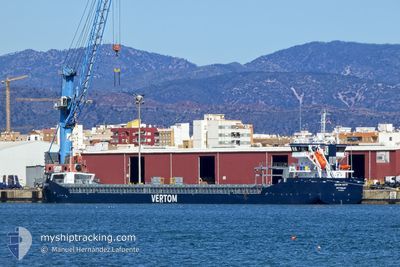
VERTOM PATTY
Cargo
Current Trip
| Trip Time | 10 days |
|---|---|
| Trip Distance | 1969.01 nm |
| AVG Speed | 8 Knots |
| MAX Speed | 10.6 Knots |
| Draught | 6.1 m |
| AVG Wind | 7.4 knots |
| MAX Wind | 21 knots |
| MIN Temp | 4.8°C / 40.64°F |
| MAX Temp | 17.9°C / 64.22°F |
| Position Received | 1 d ago |
Current Position
| Longitude | --- |
|---|---|
| Latitude | --- |
| Status | Under way using engine |
| Speed | 7.7 Knots |
| Course | 323.2° |
| Area | Black Sea |
| Station | T-AIS |
| Position Received | 1 d ago |
Info
Information
The current position of VERTOM PATTY is in Black Sea with coordinates 41.49911° / 29.07035° as reported on 2025-03-01 09:45 by AIS to our vessel tracker app. The vessel's current speed is 7.7 Knots and is currently inside the port of VARNA.
The vessel VERTOM PATTY (IMO: 9938729, MMSI: 246360000) is a Cargo It's sailing under the flag of [NL] Netherlands.
In this page you can find informations about the vessels current position, last detected port calls, and current voyage information. If the vessels is not in coverage by AIS you will find the latest position.
The current position of VERTOM PATTY is detected by our AIS receivers and we are not responsible for the reliability of the data. The last position was recorded while the vessel was in Coverage by the Ais receivers of our vessel tracking app.
The current draught of VERTOM PATTY as reported by AIS is 6.1 meters
Weather
| Temperature | 3.7°C / 38.66°F |
|---|---|
| Wind Speed | 8 knots |
| Direction | 352° N |
| Pressure | 1028 hPa |
| Humidity | 71.9 % |
| Cloud Coverage | 6 % |
Featured Company
Last Port Calls
| Port | Arrival | Departure | Time In Port |
|---|---|---|---|
| 2025-03-02 00:57 | |||
| 2025-02-19 17:52 | 2025-02-19 22:32 | 4 h | |
| 2025-02-09 07:55 | 2025-02-10 05:03 | 21 h | |
| 2025-02-07 10:49 | 2025-02-09 07:35 | 1 d | |
| 2025-01-27 09:04 | 2025-02-05 01:31 | 8 d | |
| 2025-01-20 07:34 | 2025-01-20 14:58 | 7 h | |
| 2025-01-06 23:45 | 2025-01-10 13:41 | 3 d |
Last Trips
| Origin | Departure | Destination | Arrival | Distance | |
|---|---|---|---|---|---|
| 2025-02-19 23:32 | 2025-03-02 02:57 | 1969.01 nm | |||
| 2025-02-10 06:03 | 2025-02-19 18:52 | 1913.74 nm | |||
| 2025-02-09 08:35 | 2025-02-09 08:55 | 0.73 nm | |||
| 2025-02-05 01:31 | 2025-02-07 11:49 | 599.50 nm | |||
| 2025-01-20 15:58 | 2025-01-27 09:04 | 1380.08 nm | |||
| 2025-01-10 16:41 | 2025-01-20 08:34 | 2031.19 nm | |||
| 2024-12-31 14:33 | 2025-01-07 02:45 | 729.73 nm |
Events
| Time | Event | Details | Position / Dest | Info |
|---|---|---|---|---|
| 2025-03-02 01:55 | STOP Moving |
43.19978 / 27.89073
[BG] VARNA
|
Speed: Course: 136° |
|
| 2025-03-02 00:57 | PORT ARRIVAL |
|
43.18458 / 27.91908
[BG] VARNA
|
Speed: 8.6 kn Course: 259° |
| 2025-03-01 09:50 | Status Changed | Default Under way using engine |
41.50711 / 29.06225
BGVAR
|
Speed: 7.7 kn Course: 323.2° |
| 2025-03-01 09:45 | OUT of Coverage |
41.49911 / 29.07035
Black Sea
BGVAR
|
Speed: 7.7 kn Course: 323.2° |
|
| 2025-03-01 07:19 | Change Sea Area | Turkish part of the Black Sea Turkish part of the Sea of Marmara |
41.23262 / 29.14240
Black Sea
BGVAR
|
Speed: 7.8 kn Course: 32.8° |
| 2025-03-01 03:35 | START Moving | 2.26 nm, East of ZEYTINBURNU |
40.97808 / 28.94267
BGVAR
|
Speed: 3.9 kn Course: 169° |
| 2025-03-01 03:29 | Status Changed | Under way using engine At anchor |
40.97897 / 28.93990
BGVAR
|
Speed: 0.2 kn Course: 54° |
| 2025-03-01 00:27 | Status Changed | At anchor Default |
40.97895 / 28.93924
BGVAR
|
Speed: 0.2 kn Course: 82° |
| 2025-03-01 00:24 | Status Changed | Default At anchor |
40.97904 / 28.93902
BGVAR
|
Speed: 0.2 kn Course: 82° |
| 2025-02-28 14:24 | STOP Moving | 2.17 nm, East of ZEYTINBURNU |
40.97893 / 28.94054
BGVAR
|
Speed: 0.3 kn Course: 10° |