
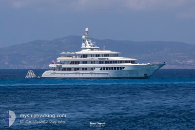
UTOPIA
Yacht
Current Trip
| Time Travelled | 21 h, 49 mins |
|---|---|
| Remaining Time | --- |
| Distance Travelled | 6.38 nm |
| Remaining Distance | --- |
| AVG Speed | 11.3 Knots |
| MAX Speed | 13 Knots |
| AVG Wind | 4.6 knots |
| MAX Wind | 8 knots |
| MIN Temp | 13.8°C / 56.84°F |
| MAX Temp | 19.5°C / 67.1°F |
| Draught | 3.6 m |
| Position Received | 2 m ago |
Current Position
| Longitude | 7.34650° |
|---|---|
| Latitude | 43.70167° |
| Status | At anchor |
| Speed | 0.3 Knots |
| Course | 125° |
| Area | Mediterranean Sea - Western Basin |
| Station | T-AIS |
| Position Received | 2 m ago |
Info
Information
The current position of UTOPIA is in Mediterranean Sea - Western Basin with coordinates 43.70167° / 7.34650° as reported on 2024-05-20 07:38 by AIS to our vessel tracker app. The vessel's current speed is 0.3 Knots and is heading at the port of BUCKLERS HARD. The estimated time of arrival as calculated by MyShipTracking vessel tracking app is 2024-05-19 19:00 LT
The vessel UTOPIA (IMO: 1007263, MMSI: 319326000) is a Yacht that was built in 2004 ( 20 years old ). It's sailing under the flag of [KY] Cayman Is.
In this page you can find informations about the vessels current position, last detected port calls, and current voyage information. If the vessels is not in coverage by AIS you will find the latest position.
The current position of UTOPIA is detected by our AIS receivers and we are not responsible for the reliability of the data. The last position was recorded while the vessel was in Coverage by the Ais receivers of our vessel tracking app.
The current draught of UTOPIA as reported by AIS is 3.6 meters
Weather
| Temperature | 18.3°C / 64.94°F |
|---|---|
| Wind Speed | 3 knots |
| Direction | 349° N |
| Pressure | 1009.9 hPa |
| Humidity | 55.4 % |
| Cloud Coverage | 100 % |
Featured Company
Last Port Calls
Last Trips
| Origin | Departure | Destination | Arrival | Distance | |
|---|---|---|---|---|---|
| 2024-05-11 09:41 | 2024-05-12 16:32 | 22.05 nm | |||
| 2024-04-19 14:18 | 2024-04-19 15:17 | 9.29 nm | |||
| 2024-04-18 11:13 | 2024-04-18 12:02 | 9.12 nm | |||
| 2024-04-08 10:54 | 2024-04-12 10:13 | 49.34 nm | |||
| 2024-04-03 08:23 | 2024-04-05 10:10 | 41.69 nm |
Events
| Time | Event | Details | Position / Dest | Info |
|---|---|---|---|---|
| 2024-05-19 15:47 | Status Changed | At anchor Under way using engine |
43.70157 / 7.34706
BEAULIEU SUR-MER
|
Speed: 1.6 kn Course: 116° |
| 2024-05-19 15:44 | STOP Moving | 0.64 nm, South East of BEAULIEU-SUR-MER |
43.70134 / 7.34905
BEAULIEU SUR-MER
|
Speed: 0.3 kn Course: 109° |
| 2024-05-19 15:23 | Change Sea Area | French part of the Mediterranean Sea - Western Basin Mon�gasque part of the Mediterranean Sea - Western Basin |
43.71567 / 7.41483
Mediterranean Sea - Western Basin
BEAULIEU SUR-MER
|
Speed: 13 kn Course: 237° |
| 2024-05-19 15:19 | Destination Changed | BEAULIEU SUR-MER MONACO |
43.72366 / 7.42922
BEAULIEU SUR-MER
|
Speed: 12.9 kn Course: 221° |
| 2024-05-19 15:19 | ETA Changed | 2024/05/19 18:00 2024/05/19 12:00 |
43.72366 / 7.42922
BEAULIEU SUR-MER
|
Speed: 12.9 kn Course: 221° |
| 2024-05-19 15:14 | START Moving | 0.89 nm, North East of MONACO |
43.73787 / 7.43811
MONACO
|
Speed: 6.6 kn Course: 190° |
| 2024-05-19 15:02 | Status Changed | Under way using engine At anchor |
43.74104 / 7.43876
MONACO
|
Speed: 0.1 kn Course: 100° |
| 2024-05-19 10:09 | Status Changed | At anchor Under way using engine |
43.74092 / 7.43930
MONACO
|
Speed: 0.7 kn Course: 177° |
| 2024-05-19 10:01 | STOP Moving | 1.02 nm, North East of MONACO |
43.73947 / 7.44034
MONACO
|
Speed: 0.3 kn Course: 140° |
| 2024-05-19 09:51 | PORT DEPARTURE |
|
43.73881 / 7.43607
MONACO
|
Speed: 6 kn Course: 48° |