
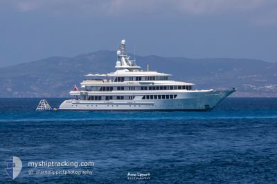
UTOPIA
Yacht
Current Trip
| Trip Time | 25 days |
|---|---|
| Trip Distance | 108.59 nm |
| AVG Speed | 9.1 Noeuds |
| MAX Speed | 14.4 Noeuds |
| Tirant d eau | 3.6 m |
| AVG Wind | 15.1 knots |
| MAX Wind | 20 knots |
| MIN Temp | 26.6°C / 79.88°F |
| MAX Temp | 28°C / 82.4°F |
| Position reçue | 1 m depuis |
Current Position
| Longitude | --- |
|---|---|
| Latitude | --- |
| Etat | Moored |
| Vitesse | |
| Parcours | 260° |
| Zone | Caribbean Sea |
| Station | T-AIS |
| Position reçue | 1 m depuis |
Info
Information
The current position of UTOPIA is in Caribbean Sea with coordinates 18.03983° / -63.09033° as reported on 2025-12-09 08:22 by AIS to our vessel tracker app. The vessel's current speed is 0 Noeuds and is currently inside the port of ST MAARTEN.
The vessel UTOPIA (IMO: 1007263, MMSI: 319326000) is a Yacht that was built in 2004 ( 21 Age ). It's sailing under the flag of [KY] Cayman Is.
In this page you can find informations about the vessels current position, last detected port calls, and current voyage information. If the vessels is not in coverage by AIS you will find the latest position.
The current position of UTOPIA is detected by our AIS receivers and we are not responsible for the reliability of the data. The last position was recorded while the vessel was in Coverage by the Ais receivers of our vessel tracking app.
The current draught of UTOPIA as reported by AIS is 3.6 meters
Weather
| Temperature | 26.6°C / 79.88°F |
|---|---|
| Wind Speed | 17 knots |
| Direction | 121° ESE |
| Pressure | 1014.3 hPa |
| Humidity | 75 % |
| Cloud Coverage | 25 % |
Featured Company
Last Port Calls
| Port | Arrival | Departure | Time In Port |
|---|---|---|---|
| 2025-12-08 17:18 | |||
| 2025-11-05 09:38 | 2025-11-13 10:27 | 8 d | |
| 2025-10-24 07:53 | 2025-10-24 17:03 | 9 h | |
| 2025-10-17 13:19 | 2025-10-21 09:18 | 3 d | |
| 2025-10-17 09:28 |
Last Trips
| Origin | Departure | Destination | Arrival | Distance | |
|---|---|---|---|---|---|
| 2025-11-13 10:27 | 2025-12-08 17:18 | 108.59 nm | |||
| 2025-10-24 17:03 | 2025-11-05 09:38 | 3362.81 nm | |||
| 2025-10-21 09:18 | 2025-10-24 07:53 | 704.51 nm | |||
| 2025-10-17 09:28 | 2025-10-17 13:19 | 38.57 nm |
Events
| Heure | Evenement | Détails | Position/ Destination | Info |
|---|---|---|---|---|
| 2025-12-08 23:58 | Etat Changé | Moored Under way using engine |
18.03985 / -63.09027
[SX] ST MAARTEN
|
Vitesse: Parcours: 260° |
| 2025-12-08 21:18 | Port d'arrivée |
|
18.04002 / -63.09074
[SX] ST MAARTEN
|
Vitesse: 0.7 kn Parcours: 329° |
| 2025-12-08 20:33 | Etat Changé | Under way using engine At anchor |
18.03297 / -63.10571
SEA TRIALS
|
Vitesse: 0.2 kn Parcours: 83° |
| 2025-12-08 19:36 | Etat Changé | At anchor Under way using engine |
18.03294 / -63.10654
SEA TRIALS
|
Vitesse: 2.6 kn Parcours: 67° |
| 2025-12-08 19:11 | Changement de destination | SEA TRIALS SIMPSON BAY |
18.03332 / -63.10398
SEA TRIALS
|
Vitesse: 0.2 kn Parcours: 121° |
| 2025-12-08 18:21 | Etat Changé | Under way using engine At anchor |
18.03343 / -63.10302
SIMPSON BAY
|
Vitesse: 0.5 kn Parcours: 59° |
| 2025-12-08 17:58 | Etat Changé | At anchor Under way using engine |
18.03333 / -63.10352
SIMPSON BAY
|
Vitesse: 1.9 kn Parcours: 96° |
| 2025-12-08 17:42 | Changement d'ETA | 2025/12/08 14:00 2025/12/07 14:00 |
18.03324 / -63.10329
SIMPSON BAY
|
Vitesse: 0.9 kn Parcours: 127° |
| 2025-12-08 17:42 | Etat Changé | Under way using engine At anchor |
18.03324 / -63.10329
SIMPSON BAY
|
Vitesse: 0.8 kn Parcours: 101° |
| 2025-12-08 13:46 | Arret | 0.72 nm, South West of ST MAARTEN |
18.03308 / -63.10390
SIMPSON BAY
|
Vitesse: 0.2 kn Parcours: 123° |