
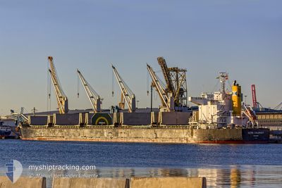
ULTRA COLONSAY
Bulk Carrier
Current Trip
| Trip Time | 68 days |
|---|---|
| Trip Distance | 4090.87 nm |
| AVG Speed | 10.3 Knots |
| MAX Speed | 14.7 Knots |
| Draught | 12 m |
| AVG Wind | 10.8 knots |
| MAX Wind | 37.7 knots |
| MIN Temp | 13°C / 55.4°F |
| MAX Temp | 29.2°C / 84.56°F |
| Position Received | 7 d ago |
Current Position
| Longitude | --- |
|---|---|
| Latitude | --- |
| Status | Under way using engine |
| Speed | 11.5 Knots |
| Course | 18.8° |
| Area | Philippine Sea |
| Station | T-AIS |
| Position Received | 7 d ago |
Info
Information
The current position of ULTRA COLONSAY is in Philippine Sea with coordinates 22.65682° / 121.64340° as reported on 2025-11-28 17:14 by AIS to our vessel tracker app. The vessel's current speed is 11.5 Knots and is currently inside the port of SHANGHAI.
The vessel ULTRA COLONSAY (IMO: 9448217, MMSI: 371011000) is a Bulk Carrier that was built in 2011 ( 14 years old ). It's sailing under the flag of [PA] Panama.
In this page you can find informations about the vessels current position, last detected port calls, and current voyage information. If the vessels is not in coverage by AIS you will find the latest position.
The current position of ULTRA COLONSAY is detected by our AIS receivers and we are not responsible for the reliability of the data. The last position was recorded while the vessel was in Coverage by the Ais receivers of our vessel tracking app.
The current draught of ULTRA COLONSAY as reported by AIS is 12 meters
Weather
| Temperature | 13.5°C / 56.3°F |
|---|---|
| Wind Speed | 3 knots |
| Direction | 197° SSW |
| Pressure | 1023.7 hPa |
| Humidity | 41.1 % |
| Cloud Coverage | --- |
Featured Company
Events
| Time | Event | Details | Position / Dest | Info |
|---|---|---|---|---|
| 2025-12-01 12:53 | PORT ARRIVAL |
|
31.36679 / 121.59712
[CN] SHANGHAI
|
Speed: 3.4 kn Course: 133° |
| 2025-12-01 05:37 | START Moving |
31.15481 / 122.64578
CJK P/STN
|
Speed: 4.1 kn Course: 235° |
|
| 2025-11-30 19:59 | STOP Moving |
31.15784 / 122.65176
CJK P/STN
|
Speed: 0.2 kn Course: 51° |
|
| 2025-11-28 17:28 | Status Changed | Default Under way using engine |
22.69667 / 121.65833
CJK P/STN
|
Speed: 11.5 kn Course: 18.8° |
| 2025-11-28 17:14 | OUT of Coverage |
22.65682 / 121.64340
Philippine Sea
CJK P/STN
|
Speed: 11.5 kn Course: 18.8° |
|
| 2025-11-28 17:09 | Status Changed | Under way using engine Default |
22.64274 / 121.63789
CJK P/STN
|
Speed: 11.2 kn Course: 20° |
| 2025-11-28 16:38 | Status Changed | Default Under way using engine |
22.55147 / 121.59813
CJK P/STN
|
Speed: 11.3 kn Course: 23.7° |
| 2025-11-28 16:35 | Status Changed | Under way using engine Default |
22.54239 / 121.59376
CJK P/STN
|
Speed: 11.2 kn Course: 22° |
| 2025-11-28 16:33 | Status Changed | Default Under way using engine |
22.53654 / 121.59106
CJK P/STN
|
Speed: 11 kn Course: 21.6° |
| 2025-11-28 16:13 | Status Changed | Under way using engine Default |
22.47884 / 121.56558
CJK P/STN
|
Speed: 11 kn Course: 24° |