
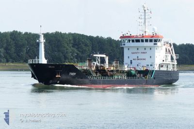
TROY
Oil/Chemical Tanker
Current Trip
| Time Travelled | 17 h, 46 mins |
|---|---|
| Remaining Time | 10 h, 13 mins |
| Distance Travelled | 182.95 nm |
| Remaining Distance | 115.11 nm |
| AVG Speed | 10 Knots |
| MAX Speed | 12.9 Knots |
| AVG Wind | 17.5 knots |
| MAX Wind | 21 knots |
| MIN Temp | 5.5°C / 41.9°F |
| MAX Temp | 11.1°C / 51.98°F |
| Draught | 4.9 m |
| Position Received | 2 m ago |
Current Position
| Longitude | --- |
|---|---|
| Latitude | --- |
| Status | Under way using engine |
| Speed | 8.6 Knots |
| Course | 254.9° |
| Area | English Channel |
| Station | T-AIS |
| Position Received | 2 m ago |
Info
Information
The current position of TROY is in English Channel with coordinates 50.56685° / 0.55019° as reported on 2024-12-15 09:16 by AIS to our vessel tracker app. The vessel's current speed is 8.6 Knots and is heading at the port of PORT JEROME. The estimated time of arrival as calculated by MyShipTracking vessel tracking app is 2024-12-15 20:31 LT
The vessel TROY (IMO: 9327205, MMSI: 253678000) is a Oil/Chemical Tanker that was built in 2005 ( 19 years old ). It's sailing under the flag of [LU] Luxembourg.
In this page you can find informations about the vessels current position, last detected port calls, and current voyage information. If the vessels is not in coverage by AIS you will find the latest position.
The current position of TROY is detected by our AIS receivers and we are not responsible for the reliability of the data. The last position was recorded while the vessel was in Coverage by the Ais receivers of our vessel tracking app.
The current draught of TROY as reported by AIS is 4.9 meters
Weather
| Temperature | 11.1°C / 51.98°F |
|---|---|
| Wind Speed | 17 knots |
| Direction | 276° W |
| Pressure | 1029.1 hPa |
| Humidity | 90.6 % |
| Cloud Coverage | 100 % |
Featured Company
Last Port Calls
| Port | Arrival | Departure | Time In Port |
|---|---|---|---|
| 2024-12-12 19:27 | 2024-12-14 16:32 | 1 d | |
| 2024-12-10 16:13 | 2024-12-11 16:21 | 1 d | |
| 2024-12-09 08:47 | 2024-12-10 05:47 | 21 h | |
| 2024-12-06 18:13 | 2024-12-07 10:48 | 16 h | |
| 2024-11-30 22:14 | 2024-12-01 09:50 | 11 h | |
| 2024-11-29 05:21 | 2024-11-30 08:38 | 1 d | |
| 2024-11-28 09:15 | 2024-11-29 04:01 | 18 h | |
| 2024-11-26 02:50 | 2024-11-26 22:33 | 19 h | |
| 2024-11-23 18:58 | 2024-11-24 18:36 | 23 h | |
| 2024-11-19 14:59 | 2024-11-21 04:34 | 1 d |
Most Visited Ports (Last year)
| Port | Arrivals | |
|---|---|---|
| 22 | ||
| 20 | ||
| 16 | ||
| 14 | ||
| 11 | ||
| 9 |
Last Trips
| Origin | Departure | Destination | Arrival | Distance | |
|---|---|---|---|---|---|
| 2024-12-11 16:21 | 2024-12-12 19:27 | 275.75 nm | |||
| 2024-12-10 05:47 | 2024-12-10 16:13 | 36.06 nm | |||
| 2024-12-07 10:48 | 2024-12-09 08:47 | 291.79 nm | |||
| 2024-12-01 09:50 | 2024-12-06 18:13 | 680.55 nm | |||
| 2024-11-30 08:38 | 2024-11-30 22:14 | 128.58 nm | |||
| 2024-11-29 04:01 | 2024-11-29 05:21 | 13.09 nm | |||
| 2024-11-26 22:33 | 2024-11-28 09:15 | 268.96 nm | |||
| 2024-11-24 18:36 | 2024-11-26 02:50 | 268.03 nm | |||
| 2024-11-21 04:34 | 2024-11-23 18:58 | 137.77 nm | |||
| 2024-11-16 20:38 | 2024-11-19 14:59 | 252.36 nm |
Events
| Time | Event | Details | Position / Dest | Info |
|---|---|---|---|---|
| 2024-12-15 08:59 | Status Changed | Under way using engine Default |
50.58099 / .60913
FRPJE
|
Speed: 8.8 kn Course: 236° |
| 2024-12-15 08:53 | Status Changed | Default Under way using engine |
50.58952 / .62932
FRPJE
|
Speed: 8.6 kn Course: 236.4° |
| 2024-12-15 08:44 | Status Changed | Under way using engine Default |
50.60108 / .65708
FRPJE
|
Speed: 8.7 kn Course: 236° |
| 2024-12-15 08:41 | IN Coverage |
50.60064 / .65603
English Channel
FRPJE
|
Speed: 8.6 kn Course: 236.4° |
|
| 2024-12-15 07:45 | Status Changed | Default Under way using engine |
50.68911 / .84691
FRPJE
|
Speed: 9.7 kn Course: 233.1° |
| 2024-12-15 07:37 | OUT of Coverage |
50.70186 / .87301
English Channel
FRPJE
|
Speed: 9.7 kn Course: 233.1° |
|
| 2024-12-15 04:53 | Change Sea Area | United Kingdom part of the English Channel United Kingdom part of the North Sea |
51.04833 / 1.50457
English Channel
FRPJE
|
Speed: 11.9 kn Course: 223.6° |
| 2024-12-14 23:22 | Detected in Sea | United Kingdom part of the North Sea |
51.72498 / 2.38623
North Sea
FRPJE
|
Speed: 9.1 kn Course: 223.8° |
| 2024-12-14 22:22 | Change Sea Area | Belgian part of the North Sea Dutch part of the North Sea |
51.84428 / 2.56834
North Sea
FRPJE
|
Speed: 10.5 kn Course: 224.1° |
| 2024-12-14 20:44 | Status Changed | Under way using engine Default |
52.02441 / 2.94271
FRPJE
|
Speed: 10.9 kn Course: 264° |