
TOROS M
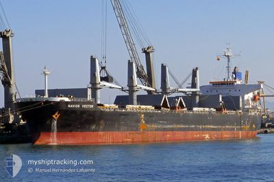
Bulk Carrier
Current Trip
SALEEF
| Time Travelled | 22 days |
|---|---|
| Remaining Time | --- |
| Distance Travelled | 4931.38 nm |
| Remaining Distance | --- |
| AVG Speed | 8.8 Knots |
| MAX Speed | 11.9 Knots |
| AVG Wind | 12.3 knots |
| MAX Wind | 24.8 knots |
| MIN Temp | 16.5°C / 61.7°F |
| MAX Temp | 25.9°C / 78.62°F |
| Draught | 12.3 m |
| Position Received | 2 d ago |
Current Position
| Longitude | 31.37786° |
|---|---|
| Latitude | -29.77513° |
| Status | Under way using engine |
| Speed | 10 Knots |
| Course | 69.9° |
| Area | Indian Ocean |
| Station | T-AIS |
| Position Received | 2 d ago |
Info
Information
The current position of TOROS M is in Indian Ocean with coordinates -29.77513° / 31.37786° as reported on 2024-05-03 17:27 by AIS to our vessel tracker app. The vessel's current speed is 10 Knots
The vessel TOROS M (IMO: 9241358, MMSI: 355851000) is a Bulk Carrier that was built in 2002 ( 22 years old ). It's sailing under the flag of [PA] Panama.
In this page you can find informations about the vessels current position, last detected port calls, and current voyage information. If the vessels is not in coverage by AIS you will find the latest position.
The current position of TOROS M is detected by our AIS receivers and we are not responsible for the reliability of the data. The last position was recorded while the vessel was in Coverage by the Ais receivers of our vessel tracking app.
The current draught of TOROS M as reported by AIS is 12.3 meters
Weather
| Temperature | 25.8°C / 78.44°F |
|---|---|
| Wind Speed | 4 knots |
| Direction | 177° S |
| Pressure | 1016.1 hPa |
| Humidity | 63.1 % |
| Cloud Coverage | --- |
Featured Company
Most Visited Ports (Last year)
| Port | Arrivals | |
|---|---|---|
| 2 | ||
| 1 | ||
| 1 | ||
| 1 | ||
| 1 | ||
| 1 |
Last Trips
| Origin | Departure | Destination | Arrival | Distance |
|---|
Events
| Time | Event | Details | Position / Dest | Info |
|---|---|---|---|---|
| 2024-05-03 17:31 | Status Changed | Default Under way using engine |
-29.77089 / 31.39026
SALEEF
|
Speed: 10 kn Course: 69.9° |
| 2024-05-03 17:27 | OUT of Coverage |
-29.77513 / 31.37786
Indian Ocean
SALEEF
|
Speed: 10 kn Course: 69.9° |
|
| 2024-05-03 17:13 | Status Changed | Under way using engine Default |
-29.78981 / 31.33609
SALEEF
|
Speed: 10.2 kn Course: 65° |
| 2024-05-03 17:07 | Status Changed | Default Under way using engine |
-29.79645 / 31.31767
SALEEF
|
Speed: 10.2 kn Course: 65° |
| 2024-05-03 17:00 | Status Changed | Under way using engine Default |
-29.80365 / 31.29816
SALEEF
|
Speed: 10.1 kn Course: 68° |
| 2024-05-03 16:55 | Status Changed | Default Under way using engine |
-29.80992 / 31.28172
SALEEF
|
Speed: 9.8 kn Course: 65.6° |
| 2024-05-03 16:46 | Status Changed | Under way using engine Default |
-29.81983 / 31.25608
SALEEF
|
Speed: 9.4 kn Course: 64° |
| 2024-05-03 16:30 | Status Changed | Default Under way using engine |
-29.83749 / 31.21366
SALEEF
|
Speed: 8.6 kn Course: 63.6° |
| 2024-05-03 16:23 | Status Changed | Under way using engine Default |
-29.84535 / 31.19545
SALEEF
|
Speed: 8.4 kn Course: 63° |
| 2024-05-03 16:11 | Status Changed | Default Under way using engine |
-29.85728 / 31.16865
SALEEF
|
Speed: 6.1 kn Course: 56.5° |