
TOLEDO
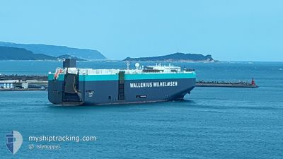
Vehicles Carrier
Current Trip
| Time Travelled | 15 h, 10 mins |
|---|---|
| Remaining Time | 3 days |
| Distance Travelled | 262.89 nm |
| Remaining Distance | 1448.17 nm |
| AVG Speed | 16.2 Knots |
| MAX Speed | 20 Knots |
| AVG Wind | 7.6 knots |
| MAX Wind | 18.7 knots |
| MIN Temp | 19.9°C / 67.82°F |
| MAX Temp | 23.1°C / 73.58°F |
| Draught | 9.5 m |
| Position Received | 1 m ago |
Current Position
| Longitude | --- |
|---|---|
| Latitude | --- |
| Status | Under way using engine |
| Speed | 19.8 Knots |
| Course | 125.4° |
| Area | Indian Ocean |
| Station | T-AIS |
| Position Received | 1 m ago |
Info
Information
The current position of TOLEDO is in Indian Ocean with coordinates -35.28130° / 116.06830° as reported on 2025-12-16 09:45 by AIS to our vessel tracker app. The vessel's current speed is 19.8 Knots and is heading at the port of MELBOURNE. The estimated time of arrival as calculated by MyShipTracking vessel tracking app is 2025-12-19 23:07 LT
The vessel TOLEDO (IMO: 9293624, MMSI: 248917000) is a Vehicles Carrier that was built in 2005 ( 20 years old ). It's sailing under the flag of [MT] Malta.
In this page you can find informations about the vessels current position, last detected port calls, and current voyage information. If the vessels is not in coverage by AIS you will find the latest position.
The current position of TOLEDO is detected by our AIS receivers and we are not responsible for the reliability of the data. The last position was recorded while the vessel was in Coverage by the Ais receivers of our vessel tracking app.
The current draught of TOLEDO as reported by AIS is 9.5 meters
Weather
| Temperature | 20°C / 68°F |
|---|---|
| Wind Speed | 17 knots |
| Direction | 257° WSW |
| Pressure | 1006.6 hPa |
| Humidity | 87.3 % |
| Cloud Coverage | --- |
Featured Company
Last Port Calls
| Port | Arrival | Departure | Time In Port |
|---|---|---|---|
| 2025-12-13 00:39 | 2025-12-16 02:37 | 3 d | |
| 2025-11-25 13:52 | 2025-11-26 08:03 | 18 h | |
| 2025-11-24 06:57 | 2025-11-24 12:07 | 5 h | |
| 2025-11-07 12:25 | 2025-11-07 22:31 | 10 h | |
| 2025-11-05 01:11 | 2025-11-06 00:16 | 23 h | |
| 2025-11-01 00:50 | 2025-11-03 14:07 | 2 d | |
| 2025-10-29 14:14 | 2025-10-30 18:05 | 1 d | |
| 2025-10-28 05:41 | 2025-10-28 14:19 | 8 h | |
| 2025-10-26 02:22 | 2025-10-26 12:32 | 10 h | |
| 2025-10-23 06:23 | 2025-10-25 10:17 | 2 d |
Most Visited Ports (Last year)
| Port | Arrivals | |
|---|---|---|
| 3 | ||
| 3 | ||
| 2 | ||
| 2 | ||
| 2 | ||
| 1 |
Last Trips
| Origin | Departure | Destination | Arrival | Distance | |
|---|---|---|---|---|---|
| 2025-11-26 08:03 | 2025-12-13 00:39 | 4596.71 nm | |||
| 2025-11-24 12:07 | 2025-11-25 13:52 | 277.98 nm | |||
| 2025-11-07 22:31 | 2025-11-24 06:57 | 6235.77 nm | |||
| 2025-11-06 00:16 | 2025-11-07 12:25 | 587.99 nm | |||
| 2025-11-03 14:07 | 2025-11-05 01:11 | 235.50 nm | |||
| 2025-10-30 18:05 | 2025-11-01 00:50 | 332.03 nm | |||
| 2025-10-28 14:19 | 2025-10-29 14:14 | 381.35 nm | |||
| 2025-10-26 12:32 | 2025-10-28 05:41 | 616.09 nm | |||
| 2025-10-25 10:17 | 2025-10-26 02:22 | 173.56 nm | |||
| 2025-10-22 17:19 | 2025-10-23 06:23 | 112.82 nm |
Events
| Time | Event | Details | Position / Dest | Info |
|---|---|---|---|---|
| 2025-12-16 09:03 | Status Changed | Under way using engine Default |
-35.14595 / 115.83475
AU MEL
|
Speed: 19.9 kn Course: 126° |
| 2025-12-16 09:00 | Status Changed | Default Under way using engine |
-35.13948 / 115.82383
AU MEL
|
Speed: 19.9 kn Course: 126.3° |
| 2025-12-16 08:48 | Status Changed | Under way using engine Default |
-35.09968 / 115.75647
AU MEL
|
Speed: 19.7 kn Course: 126° |
| 2025-12-16 08:41 | Status Changed | Default Under way using engine |
-35.07582 / 115.71634
AU MEL
|
Speed: 19.5 kn Course: 126.2° |
| 2025-12-16 08:35 | Status Changed | Under way using engine Default |
-35.05584 / 115.68307
AU MEL
|
Speed: 19.4 kn Course: 126° |
| 2025-12-16 08:24 | Status Changed | Default Under way using engine |
-35.02187 / 115.62615
AU MEL
|
Speed: 19.4 kn Course: 125.9° |
| 2025-12-16 08:07 | Status Changed | Under way using engine Default |
-34.96878 / 115.53684
AU MEL
|
Speed: 19.4 kn Course: 126° |
| 2025-12-16 08:01 | IN Coverage |
-34.96952 / 115.53807
Indian Ocean
AU MEL
|
Speed: 19.4 kn Course: 126.3° |
|
| 2025-12-16 06:25 | Status Changed | Default Under way using engine |
-34.65664 / 114.99093
AU MEL
|
Speed: 18.7 kn Course: 125.6° |
| 2025-12-16 06:23 | OUT of Coverage |
-34.64986 / 114.97944
Indian Ocean
AU MEL
|
Speed: 18.7 kn Course: 125.6° |