
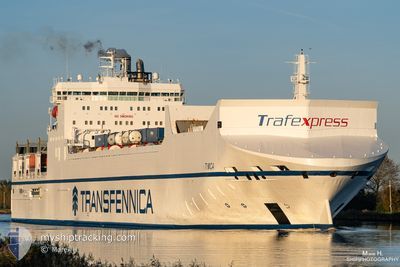
TIMCA
Ro-Ro Cargo
Current Trip
| Time Travelled | 22 h, 24 mins |
|---|---|
| Remaining Time | 1 day |
| Distance Travelled | 463.31 nm |
| Remaining Distance | 746.08 nm |
| AVG Speed | 20.5 Knots |
| MAX Speed | 21.9 Knots |
| AVG Wind | 15.1 knots |
| MAX Wind | 24 knots |
| MIN Temp | 4.2°C / 39.56°F |
| MAX Temp | 7.1°C / 44.78°F |
| Draught | 7.1 m |
| Position Received | 1 m ago |
Current Position
| Longitude | --- |
|---|---|
| Latitude | --- |
| Status | Under way using engine |
| Speed | 21.4 Knots |
| Course | 237.8° |
| Area | Baltic Sea |
| Station | T-AIS |
| Position Received | 1 m ago |
Info
Information
The current position of TIMCA is in Baltic Sea with coordinates 55.46269° / 14.64952° as reported on 2025-12-17 21:32 by AIS to our vessel tracker app. The vessel's current speed is 21.4 Knots and is heading at the port of VLISSINGEN. The estimated time of arrival as calculated by MyShipTracking vessel tracking app is 2025-12-19 09:24 LT
The vessel TIMCA (IMO: 9307358, MMSI: 246521000) is a Ro-Ro Cargo that was built in 2006 ( 19 years old ). It's sailing under the flag of [NL] Netherlands.
In this page you can find informations about the vessels current position, last detected port calls, and current voyage information. If the vessels is not in coverage by AIS you will find the latest position.
The current position of TIMCA is detected by our AIS receivers and we are not responsible for the reliability of the data. The last position was recorded while the vessel was in Coverage by the Ais receivers of our vessel tracking app.
The current draught of TIMCA as reported by AIS is 7.1 meters
Weather
| Temperature | 6.9°C / 44.42°F |
|---|---|
| Wind Speed | 10 knots |
| Direction | 233° SW |
| Pressure | 1016.7 hPa |
| Humidity | 82.4 % |
| Cloud Coverage | 100 % |
Featured Company
Last Port Calls
| Port | Arrival | Departure | Time In Port |
|---|---|---|---|
| 2025-12-16 11:19 | 2025-12-17 01:09 | 13 h | |
| 2025-12-15 15:17 | 2025-12-16 01:08 | 9 h | |
| 2025-12-12 10:10 | 2025-12-13 02:05 | 15 h | |
| 2025-12-09 01:57 | 2025-12-11 19:16 | 2 d | |
| 2025-12-04 06:20 | 2025-12-04 15:01 | 8 h | |
| 2025-12-03 05:56 | 2025-12-03 14:55 | 8 h | |
| 2025-11-30 21:40 | 2025-12-02 19:28 | 1 d | |
| 2025-11-30 09:12 | 2025-11-30 13:19 | 4 h | |
| 2025-11-27 04:03 | 2025-11-27 11:12 | 7 h | |
| 2025-11-26 02:27 | 2025-11-27 00:40 | 22 h |
Last Trips
| Origin | Departure | Destination | Arrival | Distance | |
|---|---|---|---|---|---|
| 2025-12-16 01:08 | 2025-12-16 11:19 | 185.63 nm | |||
| 2025-12-13 02:05 | 2025-12-15 15:17 | 970.09 nm | |||
| 2025-12-11 19:16 | 2025-12-12 10:10 | 163.89 nm | |||
| 2025-12-04 15:01 | 2025-12-09 01:57 | 1408.20 nm | |||
| 2025-12-03 14:55 | 2025-12-04 06:20 | 189.27 nm | |||
| 2025-12-02 19:28 | 2025-12-03 05:56 | 139.65 nm | |||
| 2025-11-30 13:19 | 2025-11-30 21:40 | 147.03 nm | |||
| 2025-11-27 11:12 | 2025-11-30 09:12 | 1163.83 nm | |||
| 2025-11-27 00:40 | 2025-11-27 04:03 | 51.31 nm | |||
| 2025-11-26 00:33 | 2025-11-26 02:27 | 31.84 nm |
Events
| Time | Event | Details | Position / Dest | Info |
|---|---|---|---|---|
| 2025-12-17 21:23 | Change Sea Area | Swedish part of the Baltic Sea Danish part of the Kattegat |
55.49069 / 14.72990
Baltic Sea
NLVLI
|
Speed: 21 kn Course: 242.6° |
| 2025-12-17 20:31 | Change Sea Area | Danish part of the Kattegat Swedish part of the Baltic Sea |
55.64216 / 15.19812
Kattegat
NLVLI
|
Speed: 21 kn Course: 239.2° |
| 2025-12-17 15:47 | Status Changed | Under way using engine Default |
56.75637 / 17.19483
NLVLI
|
Speed: 21.5 kn Course: 201° |
| 2025-12-17 15:26 | Status Changed | Default Under way using engine |
56.87199 / 17.27597
NLVLI
|
Speed: 21.5 kn Course: 201.1° |
| 2025-12-17 15:22 | Status Changed | Under way using engine Default |
56.89511 / 17.29212
NLVLI
|
Speed: 21.5 kn Course: 202° |
| 2025-12-17 15:18 | Status Changed | Default Under way using engine |
56.91614 / 17.30694
NLVLI
|
Speed: 21.5 kn Course: 201° |
| 2025-12-17 14:17 | Status Changed | Under way using engine Default |
57.25680 / 17.54089
NLVLI
|
Speed: 21.6 kn Course: 201° |
| 2025-12-17 14:14 | Status Changed | Default Under way using engine |
57.27403 / 17.55366
NLVLI
|
Speed: 21.7 kn Course: 201.5° |
| 2025-12-17 14:02 | Status Changed | Under way using engine Default |
57.34035 / 17.60297
NLVLI
|
Speed: 21.5 kn Course: 202° |
| 2025-12-17 13:54 | Status Changed | Default Under way using engine |
57.38380 / 17.63516
NLVLI
|
Speed: 21.1 kn Course: 200.9° |